Category:Guinea-Bissau and Senegal 1973-1974 (Coutinho Collection)
| African Studies Centre Leiden
|
|||
|---|---|---|---|
 |
|||
| Native name | Stichting Afrika-Studiecentrum | ||
| Parent institution | Leiden University | ||
| Location | |||
| Coordinates | | ||
| Established | 1947 | ||
| Authority file | |||
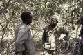
This category contains photographs donated to Wikimedia Commons in 2016 by Roel Coutinho (on Dutch wikipedia), MD. These photographs were made by him in the course of his medical work in the liberated areas of Guinea-Bissau and in Senegal in 1973 and 1974 during the final years of the war of independence against the colonising power Portugal. The metadata for this collection were collected and organised by Michele Portatadino, MA African Studies, Leiden University. The photographs were digitized by GMS Digitaliseert in Alblasserdam. Hans Muller finalised the upload to Wikimedia Commons using the GLAMwiki Toolset. The project was led by Jos Damen and sponsored by the African Studies Centre, Leiden University.
Literature:
- Roel Coutinho, Jos Damen (foreword): De vrijheidsstrijd van Guinee-Bissau door de ogen van een jonge dokter, Roel Countinho (translated title: The struggle for independence in Guinea-Bissau, seen through the eyes of a young doctor, Roel Coutinho), Afrika-Studiecentrum Leiden (African Studies Centre Leiden), 2022. 81 pages. ISSN: 1876-018x, ISBN 978-90-5448-195-9. In Dutch. Open access online version
Example photos and usage:
- Usage of these images on Wikimedia projects, main namespace (articles) only.
Notes[edit]

- Campada: Campada, Guinea-Bissau, on the Senegalese border, 35 km east of Sao Domingos, between Sedengal and Ingoré on the road Bissau (Guinea-Bissau)-Ziguinchor (Senegal)). Coordinates 12.38860 N -15.88175 E.
- Candjambary: obsolete (?) spelling for Canjambari (Candjambari), Guinea-Bissau, 20 km east of the town of Farim near the river Rio Cacheu and 20 km from the border with Senegal. Coordinates 12.49087 N -15.01191 E. To the south runs the Rio de Canjambari.
- FAL: Frente Armada de Libertação, a paramilitary force of armed civilians, inspired by the Angolan FNLA (Frente Nacional de Libertação de Angola, National Liberation Front of Angola)
- Hermangono: small village in Guinea-Bissau, at a one day walking distance from the Senegalese border. Exact location?
- Manten: Mantem, Guinea-Bissau, on the river Rio Mansoa 30 km south-east of Bissora and 65 km north of Porto Gole (Porto Goli) Coordinates 12.10671 N -15.11391 E.
- PAIGC: Partido Africano da Independência da Guiné e Cabo Verde (African Party for the Independence of Guinea and Cape Verde), resistance movement and political party
- People's shop: armazéns do povo (people's stores), collective shops organised by the PAIGC government - see Guinea-Bissau War of Independence.
- Sara: Sara, Guinea-Bissau 35 km south-east of Bissora and 70 km north of Porto Gole (Porto Goli). Coordinates 12.15000 N -15.06667 E.
- Sui, Senegal?
- Ziguinchor: town in Senegal, 10 km north of the border with Guinea-Bissau
Subcategories
This category has the following 8 subcategories, out of 8 total.
P
Pages in category "Guinea-Bissau and Senegal 1973-1974 (Coutinho Collection)"
The following 2 pages are in this category, out of 2 total.
Media in category "Guinea-Bissau and Senegal 1973-1974 (Coutinho Collection)"
The following 3 files are in this category, out of 3 total.
-
 ASC Leiden - Coutinho Collection - 6 29 - School for adults in Guinea-Bissau - 1974.tiff 4,753 × 3,205; 14.55 MB
-

-