Category:Gussage St Michael
Jump to navigation
Jump to search
English: Gussage Saint Michael is a small village in North Dorset, in the south of England. As of the 2001 census, the village has a population of 219. Gussage St Michael is tucked off the main A354 as it runs through the Cranborne Chase, ten miles from Blandford Forum and fourteen miles from Salisbury. The village has no local shops, with the nearest store being in Cranborne, some six miles away. The nearest public house is the "Drovers Inn", a mile down a country lane in the sister village of Gussage All Saints.
village in Dorset, United Kingdom  Eglwys Sant Mihangel, Gussage St Michael | |||||
| Upload media | |||||
| Instance of | |||||
|---|---|---|---|---|---|
| Location | Dorset, South West England, England | ||||
 | |||||
Subcategories
This category has the following 2 subcategories, out of 2 total.
C
S
Media in category "Gussage St Michael"
The following 85 files are in this category, out of 85 total.
-
 A354 at Thickthorn Cross - geograph.org.uk - 5724656.jpg 640 × 428; 112 KB
-
 A354 east of Thickthorn Cross - geograph.org.uk - 3423437.jpg 535 × 640; 116 KB
-
 Ackling Dyke (Roman Road) - geograph.org.uk - 208473.jpg 640 × 481; 154 KB
-
 Ackling Dyke - geograph.org.uk - 2071026.jpg 640 × 477; 395 KB
-
 Ackling Dyke - geograph.org.uk - 208470.jpg 640 × 481; 134 KB
-

-
 Ancient Settlement on Gussage Hill - geograph.org.uk - 284222.jpg 640 × 480; 89 KB
-

-
 Converted chapel in Gussage St Michael - geograph.org.uk - 276744.jpg 640 × 480; 120 KB
-
 Dilapidated farm implements - geograph.org.uk - 276717.jpg 640 × 480; 111 KB
-
 Down Farm, buildings - geograph.org.uk - 1449106.jpg 640 × 480; 84 KB
-
 Down Farm, excavated barrow - geograph.org.uk - 1449025.jpg 640 × 480; 66 KB
-
 Down Farm, hayfield - geograph.org.uk - 1449112.jpg 640 × 480; 71 KB
-
 Down Farm, museum shed - geograph.org.uk - 1449008.jpg 640 × 480; 64 KB
-
 Down Farm, reconstructed kiln - geograph.org.uk - 1449029.jpg 640 × 480; 108 KB
-
 Down Farm, shaft - geograph.org.uk - 1449255.jpg 640 × 480; 97 KB
-
 Down Farm, shaft - geograph.org.uk - 1449263.jpg 640 × 480; 110 KB
-
 Drive to Ryall's Lodge - geograph.org.uk - 1141760.jpg 640 × 481; 205 KB
-
 Flat landscape from Thickthorn Down - geograph.org.uk - 3994595.jpg 1,536 × 1,025; 868 KB
-
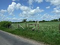
 Footpath stile, Gussage St Michael - geograph.org.uk - 4921067.jpg 2,048 × 1,536; 748 KB
-

-

-
 Gussage Hill, corn field - geograph.org.uk - 1433836.jpg 640 × 480; 110 KB
-
 Gussage Hill, earthworks - geograph.org.uk - 1433717.jpg 640 × 480; 95 KB
-
 Gussage Hill, old settlement - geograph.org.uk - 1433804.jpg 640 × 480; 85 KB
-
 Gussage Hill, tumulus - geograph.org.uk - 1433679.jpg 640 × 480; 88 KB
-
 Abandoned caravan near Down Farm - geograph.org.uk - 24103.jpg 640 × 480; 157 KB
-
 Gussage St Michael, barn - geograph.org.uk - 1433648.jpg 640 × 480; 110 KB
-
 Gussage St Michael, bridleway - geograph.org.uk - 1433488.jpg 640 × 480; 120 KB
-
 Gussage St Michael, bridleway - geograph.org.uk - 1433494.jpg 640 × 480; 105 KB
-
 Gussage St Michael, bridleway - geograph.org.uk - 1433925.jpg 640 × 480; 123 KB
-
 Gussage St Michael, byway - geograph.org.uk - 1433482.jpg 640 × 480; 110 KB
-
 Gussage St Michael, cob wall - geograph.org.uk - 1433457.jpg 640 × 480; 90 KB
-
 Gussage St Michael, engineers - geograph.org.uk - 1433432.jpg 640 × 480; 96 KB
-
 Gussage St Michael, farm buildings - geograph.org.uk - 1433473.jpg 640 × 480; 78 KB
-
 Gussage St Michael, farmland - geograph.org.uk - 1433633.jpg 640 × 480; 97 KB
-
 Gussage St Michael, former church - geograph.org.uk - 1434288.jpg 640 × 480; 88 KB
-
 Gussage St Michael, gate - geograph.org.uk - 1434031.jpg 640 × 480; 95 KB
-
 Gussage St Michael, lane - geograph.org.uk - 1433967.jpg 640 × 480; 119 KB
-
 Gussage St Michael, lane - geograph.org.uk - 1434281.jpg 640 × 480; 81 KB
-
 Gussage St Michael, Manor Road - geograph.org.uk - 1433413.jpg 640 × 480; 106 KB
-
 Gussage St Michael, Roman road - geograph.org.uk - 2712481.jpg 1,024 × 768; 298 KB
-
 Gussage St Michael, Sovell Down - geograph.org.uk - 1433407.jpg 640 × 480; 88 KB
-
 Gussage St Michael, stubble - geograph.org.uk - 1434007.jpg 640 × 480; 96 KB
-
 Gussage St Michael, stubble - geograph.org.uk - 1434283.jpg 640 × 480; 78 KB
-

-

-
 Harley Down, harvested field - geograph.org.uk - 1433896.jpg 640 × 480; 80 KB
-
 Harley Down, harvested field - geograph.org.uk - 1433902.jpg 640 × 480; 75 KB
-
 Harley Down, Roman road - geograph.org.uk - 1433880.jpg 640 × 480; 154 KB
-
 Houses, Cashmoor - geograph.org.uk - 5299636.jpg 640 × 480; 109 KB
-
 In the footsteps of the Centurions - geograph.org.uk - 1433862.jpg 640 × 480; 143 KB
-
-

-
 Lone tree near the track for Manor Farm - geograph.org.uk - 3994588.jpg 1,536 × 922; 721 KB
-
 Lonely little sunflower, Wyke Down - geograph.org.uk - 2027178.jpg 640 × 480; 70 KB
-
 Long Barrow, Thickthorn Down - geograph.org.uk - 2404848.jpg 800 × 600; 127 KB
-
 Long Barrow, Thickthorn Down - geograph.org.uk - 2404858.jpg 800 × 600; 120 KB
-

-

-
 Manor Farm, Gussage St. Michael - geograph.org.uk - 5299626.jpg 640 × 428; 118 KB
-
 Memorial near Harley Down, Dorset - geograph.org.uk - 1045397.jpg 480 × 640; 175 KB
-
 Monkton Up Wimborne, harvesting - geograph.org.uk - 1440277.jpg 640 × 480; 63 KB
-
 Monkton Up Wimborne, sheep - geograph.org.uk - 1440260.jpg 640 × 480; 54 KB
-

-
 Pink clover near Gussage Hill - geograph.org.uk - 1432734.jpg 640 × 482; 140 KB
-
 Private road to Manor Farm - geograph.org.uk - 5299631.jpg 640 × 480; 202 KB
-

-
 Road junction, Gussage St Michael - geograph.org.uk - 2027196.jpg 640 × 480; 58 KB
-
 Rosebay Willowherb, Gussage St Michael - geograph.org.uk - 1432852.jpg 640 × 480; 160 KB
-
 Rough grazing near Canada Farm - geograph.org.uk - 1432489.jpg 640 × 481; 121 KB
-
 Scrapyard, Gussage St Michael - geograph.org.uk - 1141792.jpg 640 × 480; 191 KB
-
-
 Stile and Gate, Thickthorn Down - geograph.org.uk - 2404825.jpg 800 × 600; 118 KB
-

-
 Triangulation Pillar, Gussage Hill - geograph.org.uk - 1432722.jpg 640 × 481; 105 KB
-
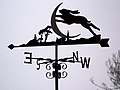 Weather vane at Ryall's Lodge - geograph.org.uk - 1141750.jpg 640 × 482; 91 KB
-
 Wyke Down, chalk pit - geograph.org.uk - 1440291.jpg 640 × 480; 68 KB
-
 Wyke Down, Down Farm - geograph.org.uk - 1449006.jpg 640 × 480; 63 KB
-
 Wyke Down, freshly shorn sheep - geograph.org.uk - 1432116.jpg 640 × 480; 108 KB
-
 Wyke Down, permissive footpath - geograph.org.uk - 1440297.jpg 480 × 640; 49 KB
-
 Wyke Down, pumping station - geograph.org.uk - 1440284.jpg 640 × 480; 63 KB
-
 Archaeologically aware cows^ - geograph.org.uk - 276727.jpg 640 × 480; 93 KB
-

-
 North Farm north from the north - geograph.org.uk - 276728.jpg 640 × 480; 90 KB


_-_geograph.org.uk_-_208473.jpg)


