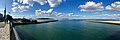
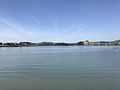
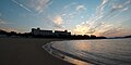
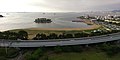
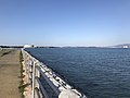
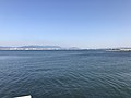
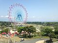
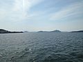
Category:Hakata Bay
Vai alla navigazione
Vai alla ricerca
English: Category for Hakata Bay, in the northwestern part of Fukuoka, on the Japanese island of Kyushu
فارسی: خلیج هاکاتا
Suomi: Hakatanlahti
Français : Baie de Hakata
Italiano: Baia di Hakata
Polski: Hakata-wan
bay in Northwest Kyūshū | |||||
| Carica un file multimediale | |||||
| Istanza di | |||||
|---|---|---|---|---|---|
| Prende il nome da |
| ||||
| Luogo | Fukuoka, prefettura di Fukuoka, Giappone | ||||
| Connesso con | |||||
| Consiste di | |||||
| Immissario | |||||
 | |||||
Sottocategorie
Questa categoria contiene le 19 sottocategorie indicate di seguito, su un totale di 19.
C
- Central Passage (2 F)
E
- East Passage (2 F)
F
I
- Imazu Higata (27 F)
K
- Kashii Kamome Bridge (13 F)
M
- Marizon (34 F)
N
P
- Pegmatite dikes of Nagatare (12 F)
S
T
U
- Uminonakamichi Bridge (4 F)
W
File nella categoria "Hakata Bay"
Questa categoria contiene 165 file, indicati di seguito, su un totale di 165.
-
 -i---i- (31457438901).jpg 10 762 × 3 620; 8,14 MB
-
 Aitakabashi Bridge from Kashiihama North Park 2.jpg 3 986 × 2 990; 2,5 MB
-
 Aitakabashi Bridge from Kashiihama North Park 3.jpg 4 032 × 3 024; 3,04 MB
-
 Aitakabashi Bridge from Kashiihama North Park.jpg 4 016 × 3 012; 2,42 MB
-
 Aratsu Fukuoka-City 20220725.jpg 4 000 × 2 000; 2,55 MB
-
 Areial photograpy of Muromi river mouth.jpg 4 000 × 3 000; 4,64 MB
-
 Beach of Hakata Bay near Najima Castle.JPG 3 264 × 2 448; 1,71 MB
-

-
 Bridge of Route 1 Kashi Line of Fukuoka Expressway near Hakozaki Shrine.JPG 3 264 × 2 448; 2,33 MB
-
 California Barbecue Beach from train of Chikuhi Line.jpg 4 000 × 3 000; 2,05 MB
-
 Cape Sunosaki from Imazubashi Bridge 2.JPG 3 204 × 2 403; 2,15 MB
-
 Cape Sunosaki from Imazubashi Bridge.JPG 3 264 × 2 448; 2,04 MB
-
 Cherry blossoms near Aeon Mall Kashiihama 2.jpg 3 971 × 2 978; 5,14 MB
-
 Cherry blossoms near Aeon Mall Kashiihama.jpg 3 999 × 2 999; 4,37 MB
-
 Chikuhiline-hakatabay-20051226.jpg 1 600 × 1 200; 697 KB
-
 Fukuhama Beach Fukuhama 1-chōme Chūō-ku Fukuoka 20221227.jpg 4 000 × 1 680; 1,6 MB
-
 Fukuhama Beach Hakata Bay Fukuhama-1-chōme Chūō-ku Fukuoka City 20221028.jpg 4 000 × 2 000; 2,26 MB
-
 Fukuhama-Beach Ugushima-Island 20220725.jpg 4 000 × 2 000; 2,26 MB
-
 Fukuoka Expressway Circle Route near Fukuoka Dome 2.jpg 4 032 × 3 024; 2,07 MB
-
 Fukuoka Expressway Circle Route near Fukuoka Dome.JPG 3 264 × 2 448; 1,35 MB
-
 Fukuoka Island City from Kasumigaoka, Higashi, Fukuoka 2.jpg 4 032 × 3 024; 2,16 MB
-
 Fukuoka Prefectural Road No.542 and Gebagahama Beach.jpg 3 264 × 2 448; 2,72 MB
-
 Fukuoka Tower and Muromigawa River 2.jpg 4 032 × 3 024; 2,6 MB
-
 FukuokaWaterfront.jpg 1 500 × 1 027; 455 KB
-
 Hakata Bay and Fukuoka Expressway Circle Route near Fukuoka Dome.jpg 3 989 × 2 992; 2,73 MB
-
 Hakata Bay and Fukuoka Expressway Kashii Route from Hakozakihama Beach 2.JPG 3 264 × 2 448; 2,33 MB
-
 Hakata Bay and Fukuoka Expressway Kashii Route from Hakozakihama Beach.JPG 3 264 × 2 448; 2,37 MB
-
 Hakata Bay and Shikanoshima Island from Nagisabashi Bridge.jpg 4 032 × 3 024; 2,16 MB
-
 Hakata Bay from Cape Tsugamisaki (east).JPG 3 196 × 2 397; 1,91 MB
-
 Hakata Bay from Cape Tsugamisaki (southeast) 2.JPG 3 163 × 2 372; 1,77 MB
-
 Hakata Bay from Cape Tsugamisaki (southeast) 3.JPG 3 213 × 2 410; 1,85 MB
-
 Hakata Bay from Cape Tsugamisaki (southeast).JPG 3 178 × 2 383; 1,93 MB
-
 Hakata Bay from Fukuoka Tower 2.jpg 3 985 × 2 989; 2,26 MB
-
 Hakata Bay from Nagisabashi Bridge 2.jpg 3 990 × 2 993; 2,74 MB
-
 Hakata Bay from Nagisabashi Bridge.jpg 4 032 × 3 024; 2,09 MB
-
 Hakata Bay from train of Chikuhi Line 2.jpg 4 003 × 3 002; 2,76 MB
-
 Hakata Bay from train of Chikuhi Line 3.jpg 4 015 × 3 011; 2,95 MB
-
 Hakata Bay from train of Chikuhi Line 4.jpg 3 981 × 2 986; 2,85 MB
-
 Hakata Bay from train of Chikuhi Line.jpg 3 944 × 2 958; 3,03 MB
-
 Hakata Bay from Yokohama, Nishi, Fukuoka 2.JPG 3 264 × 2 448; 2,32 MB
-
 Hakata Bay from Yokohama, Nishi, Fukuoka.JPG 3 230 × 2 423; 2,6 MB
-
 Hakata Bay up200606242035.jpg 1 280 × 1 024; 818 KB
-
 Hakata Bay up200606242110.jpg 1 280 × 1 024; 572 KB
-
 Hakata Bay view north from Fukuhama Chūō-ku Fukuoka City 20221005.jpg 4 000 × 2 000; 1,63 MB
-
 Hakata Fishing Port and Kamome Square 2021-10.jpg 5 480 × 3 653; 12,82 MB
-
 Hakozaki Fishing Port 20160517-1.JPG 3 264 × 2 448; 2,3 MB
-
 Hakozaki Fishing Port 20160517-2.JPG 3 264 × 2 448; 2,09 MB
-
 Hakozaki Fishing Port 20170518-1.jpg 4 032 × 3 024; 2,89 MB
-
 Hakozaki Fishing Port 20170518-2.jpg 3 981 × 2 986; 2,94 MB
-
 Hakozaki Fishing Port 20170518-3.jpg 4 032 × 3 024; 2,66 MB
-
 Hamasaki-Imazu Fishing Port and Cape Sunosaki from Imazubashi Bridge 2.JPG 3 220 × 2 415; 2,15 MB
-
 Hamasaki-Imazu Fishing Port and Cape Sunosaki from Imazubashi Bridge.JPG 3 232 × 2 424; 2,26 MB
-
 Hamasaki-Imazu Fishing Port in Imazu, Nishi, Fukuoka 2.JPG 3 264 × 2 448; 2,23 MB
-
 Hamasaki-Imazu Fishing Port in Imazu, Nishi, Fukuoka 3.JPG 3 221 × 2 416; 2,33 MB
-
 Hamasaki-Imazu Fishing Port in Imazu, Nishi, Fukuoka.JPG 3 264 × 2 448; 2,15 MB
-
 Iki Shrine 1st Torii Imazu Bay Ikinomatsubara-1-chōme Nishi-ku Fukuoka City 20221027.jpg 4 000 × 3 000; 4,5 MB
-
 Ikinomatsubara Beach Ikinomatsubara-1-chōme Nishi-ku Fukuoka City 20221107.jpg 4 000 × 2 000; 2,71 MB
-
 Imazu Bay from Washio-Atago Shrine.JPG 3 264 × 2 448; 1,89 MB
-
 Imazu Bay near Ninomiya Shrine 1.jpg 3 982 × 2 987; 2,78 MB
-
 Imazu Bay near Ninomiya Shrine 2.jpg 3 989 × 2 992; 2,86 MB
-
 Imazu Bay near Ninomiya Shrine 3.jpg 4 017 × 3 013; 2,5 MB
-
 Imazu Bay near Ninomiya Shrine 4.jpg 4 013 × 3 010; 2,3 MB
-
 Imazu Bay near Ninomiya Shrine 5.jpg 3 913 × 2 935; 2,43 MB
-
 Imazu Bay near Ninomiya Shrine 6.jpg 4 006 × 3 005; 2,37 MB
-
 Imazu Bay near Ninomiya Shrine 7.jpg 4 032 × 3 024; 2,93 MB
-
 Imazu Bay near Ninomiya Shrine 8.jpg 4 006 × 3 005; 2,93 MB
-
 Imazu Bay near Ninomiya Shrine 9.jpg 4 003 × 3 003; 2,4 MB
-
 Imazu Bay view from west Odo Park Nishi-ku Fukuoka City 20221010.jpg 4 000 × 2 000; 1,73 MB
-
 JR Beetle2 2009.jpg 2 000 × 1 333; 1,76 MB
-
 Kamome Square 2021-10.jpg 5 568 × 3 712; 9,35 MB
-
 Karatomari Fishing Port 20160501-1.JPG 3 226 × 2 420; 2,3 MB
-
 Karatomari Fishing Port 20160501-2.JPG 3 264 × 2 448; 1,93 MB
-
 Karatomari Fishing Port 20160501-3.JPG 3 264 × 2 448; 1,96 MB
-
 Karatomari Fishing Port 20160501-4.JPG 3 236 × 2 427; 1,94 MB
-
 Karatomari Fishing Port 20160501-5.JPG 3 264 × 2 448; 1,91 MB
-
 Karatomari Fishing Port 20160501-6.JPG 3 264 × 2 448; 2 MB
-
 Karatomari Fishing Port and Shimmon Gate of Sansho Shrine in Miyanoura, Nishi, Fukuoka.JPG 3 264 × 2 448; 2,83 MB
-
 Karatomari Fishing Port in front of Sansho Shrine.JPG 3 264 × 2 448; 2,11 MB
-
 Kashiigawa River from Shin-Kashiihashi Bridge (west) 2.jpg 3 968 × 2 976; 3,16 MB
-
 Kashiigawa River from Shin-Kashiihashi Bridge (west).JPG 3 264 × 2 448; 2,18 MB
-
 Kashiikaen Amusement Park from Aitakabashi Bridge.jpg 3 967 × 2 975; 2,66 MB
-
 KashiiKamomeOh-hashiBridge.jpg 1 600 × 1 200; 913 KB
-
 Main Observation Area 13 Nishikōen Chūō-ku Fukuoka City 20220912.jpg 4 000 × 2 000; 2,33 MB
-
 Meinohama Area from Fukuoka Tower.jpg 3 989 × 2 992; 2,68 MB
-
 Mount Bishamonyama from train of Chikuhi Line 2.jpg 4 017 × 3 012; 1,88 MB
-
 Mount Bishamonyama from train of Chikuhi Line 3.jpg 4 016 × 3 012; 1,78 MB
-
 Mount Bishamonyama from train of Chikuhi Line 4.jpg 3 985 × 2 988; 2,18 MB
-
 Mount Bishamonyama from train of Chikuhi Line 5.jpg 4 022 × 3 016; 2,16 MB
-
 Mount Bishamonyama from train of Chikuhi Line 6.jpg 4 022 × 3 016; 1,86 MB
-
 Mount Bishamonyama from train of Chikuhi Line.jpg 4 010 × 3 006; 1,69 MB
-
 Mouth of Muromigawa River 2.jpg 4 032 × 3 024; 2,46 MB
-
 Mouth of Muromigawa River and Fukuoka Tower from Washio-Atago Shrine 2.JPG 3 264 × 2 448; 2,11 MB
-
 Mouth of Muromigawa River and Fukuoka Tower from Washio-Atago Shrine.JPG 3 256 × 2 442; 1,97 MB
-
 Mouth of Muromigawa River from Washio-Atago Shrine.JPG 3 264 × 2 448; 2,08 MB
-
 Mouth of Muromigawa River.jpg 4 032 × 3 024; 2,4 MB
-
 Mouth of Tataragawa River 20131210.JPG 3 264 × 2 448; 2,38 MB
-
 Mouth of Tataragawa River 20150620.JPG 3 264 × 2 448; 1,6 MB
-
 Mouth of Tataragawa River from Najima Coast.JPG 3 264 × 2 448; 1,93 MB
-
 Najima Seaplane Station 1945-06-06.jpg 5 916 × 6 604; 28,16 MB
-
 Namazugawabashi Bridge from train of Chikuhi Line.jpg 3 981 × 2 986; 2,32 MB
-
 New wind-lens turbine (2012 version).JPG 684 × 912; 299 KB
-
 North view from Washio-Atago Shrine 2.JPG 3 243 × 2 432; 2,16 MB
-
 North view from Washio-Atago Shrine.JPG 3 264 × 2 448; 2,1 MB
-

-
 Platform of Saitozaki Station 3.jpg 3 986 × 2 989; 2,79 MB
-
 Stone lantern of Ninomiya Shrine.jpg 3 991 × 2 993; 3,18 MB
-

-

-
 Torii of Hakozaki Shrine near Hakata Bay 2.jpg 2 448 × 3 264; 2,07 MB
-
 Torii of Hakozaki Shrine on seaside of Hakata Bay.JPG 3 239 × 2 430; 2,43 MB
-
 Torii of Iki Shrine and Ikinomatsubara Beach.JPG 3 264 × 2 448; 2,64 MB
-
 Torii of Mishima Shrine in Hakata Bay.JPG 3 264 × 2 448; 2,04 MB
-

-

-
 View from central observation square of Nishi Park (north) 2.JPG 3 264 × 2 448; 1,59 MB
-
 View from pier of Saitozaki Port (south).jpg 4 006 × 3 004; 2,55 MB
-
 View from site of Najima Castle (west).JPG 3 264 × 2 448; 2,4 MB
-
 View from top of Mount Tachibanayama (southwest) 2.jpg 3 943 × 2 958; 2,34 MB
-
 View from top of Mount Tachibanayama (west) 1.jpg 4 032 × 3 024; 2,9 MB
-
 View in Umino Nakamichi Seaside Park 20150504-1.JPG 3 264 × 2 448; 2,55 MB
-
 View near Imazu Pump Station 1.jpg 4 032 × 3 024; 2,62 MB
-
 View near Imazu Pump Station 2.jpg 4 009 × 3 007; 3,67 MB
-
 View near Imazu Pump Station 3.jpg 4 032 × 3 024; 4,24 MB
-
 View near Saitozaki Port (east) 2.jpg 4 011 × 3 008; 2,73 MB
-
 View near Saitozaki Port (east) 3.jpg 4 011 × 3 008; 2,84 MB
-
 View near Saitozaki Port (east) 4.jpg 3 985 × 2 989; 2,71 MB
-
 View near Saitozaki Port (east) 5.jpg 4 031 × 3 023; 2,8 MB
-
 View near Saitozaki Port (east).jpg 3 997 × 2 998; 2,83 MB
-
 View near Saitozaki Port (northeast) 2.jpg 4 009 × 3 007; 2,99 MB
-
 View near Saitozaki Port (northeast).jpg 4 032 × 3 024; 2,96 MB
-
 View near Saitozaki Port (southeast) 2.jpg 3 995 × 2 996; 2,6 MB
-
 View near Saitozaki Port (southeast).jpg 3 991 × 2 993; 2,57 MB
-
 View of breakwater and Hakata Bay from Atagohama Seaside (West).JPG 3 264 × 2 448; 2,16 MB
-
 View of Fukuoka City from Ito Campus of Kyushu University 1.JPG 3 264 × 2 448; 2,71 MB
-
 View of Fukuoka City from Ito Campus of Kyushu University 2.JPG 3 264 × 2 448; 2,57 MB
-
 View of Hakata Bay and breakwater from Atagohama Seaside (East).JPG 3 264 × 2 448; 2,26 MB
-
 View of Hakata Bay and ferris wheel of Umino Nakamichi Seaside Park 1.JPG 3 264 × 2 448; 2,82 MB
-
 View of Hakata Bay and ferris wheel of Umino Nakamichi Seaside Park 2.JPG 3 264 × 2 448; 2,87 MB
-
 View of Hakata Bay and Imajuku area from Ferry "Flower-Noko” bounding for Noko Port.JPG 3 264 × 2 448; 2,28 MB
-
 View of Hakata Bay and Imazu Peninsula from Ferry "Flower-Noko” bounding for Noko Port 1.JPG 3 264 × 2 448; 2,34 MB
-
 View of Hakata Bay and mouth of Kashiigawa River from Kataosabashi Bridge.JPG 3 264 × 2 448; 2,1 MB
-
 View of Hakata Bay from Atagohama Seaside (North).JPG 3 264 × 2 448; 2,22 MB
-
 View of Hakata Bay from platform of Saitozaki Station.jpg 3 987 × 2 990; 2,68 MB
-
 View of Imazu Bay and Nokonoshima Island from train of Chikuhi Line 2.jpg 3 978 × 2 983; 2,52 MB
-
 View of Imazu Bay and Nokonoshima Island from train of Chikuhi Line 3.jpg 4 032 × 3 024; 3,06 MB
-
 View of Imazu Bay and Nokonoshima Island from train of Chikuhi Line.jpg 3 971 × 2 978; 2,72 MB
-
 View of Imazu Bay from train of Chikuhi Line 2.jpg 3 999 × 3 000; 2,18 MB
-
 View of Imazu Bay from train of Chikuhi Line 3.jpg 4 032 × 3 024; 2,31 MB
-
 View of Imazu Bay from train of Chikuhi Line.jpg 3 978 × 2 983; 2,39 MB
-
 View of Karatomari Fishing Port from Sansho Shrine 2.JPG 3 232 × 2 424; 2,31 MB
-
 View of Karatomari Fishing Port from Sansho Shrine.JPG 3 264 × 2 448; 2,12 MB
-
 View of Meinohama area and Hakata Bay from Atagohama Seaside (Southwest).JPG 3 264 × 2 448; 1,98 MB
-
 View of Meinohama area from Ferry "Flower-Noko” bounding for Noko Port 2.JPG 3 264 × 2 448; 2,42 MB
-
 View of RKB mast on Wajiro Mudflat from overpass of Wajiro Station (JR).jpg 3 190 × 2 392; 2,03 MB
-
 View of torii of Hakozaki Shrine on seaside of Hakata Bay 2.jpg 4 020 × 3 015; 3,75 MB
-
 View of torii of Hakozaki Shrine on seaside of Hakata Bay across Japan National Route 3.JPG 3 264 × 2 448; 2,65 MB
-
 View of torii of Hakozaki Shrine on seaside of Hakata Bay.JPG 3 264 × 2 448; 2,83 MB
-
 Wajiro Area from Aitakabashi Bridge 1.jpg 4 032 × 3 024; 2,59 MB
-
 Wajiro Area from Aitakabashi Bridge 2.jpg 4 008 × 3 006; 2,66 MB
-
 Wajiro Area from Aitakabashi Bridge 3.jpg 4 032 × 3 024; 2,05 MB
-
 博多湾1.jpg 1 536 × 1 024; 136 KB
-
 博多湾2.jpg 1 536 × 948; 199 KB
-
 博多湾3.jpg 1 482 × 899; 194 KB
-
 博多湾4.jpg 1 536 × 940; 161 KB
-
 福岡高速道路天神北付近から見た博多湾.JPG 1 582 × 1 180; 664 KB


.JPG)
_2.JPG)
_3.JPG)
.JPG)


_2.jpg)
.JPG)


.JPG)


_passes_by_Fukuoka_city_as_the_ship_departs_Hakata_Harbor.jpg)
_2.JPG)
.jpg)
.JPG)
_2.jpg)
_1.jpg)


_2.jpg)
_3.jpg)
_4.jpg)
_5.jpg)
.jpg)
_2.jpg)
.jpg)
_2.jpg)
.jpg)
.JPG)


.JPG)


.JPG)


.JPG)

.jpg)


.jpg)