Category:Halkirk (civil parish)
Jump to navigation
Jump to search
Scottish parish in Highland, Scotland, UK | |||||
| Upload media | |||||
| Instance of | |||||
|---|---|---|---|---|---|
| Named after | |||||
| Location | |||||
| Population |
| ||||
| Area |
| ||||
 | |||||
Subcategories
This category has the following 21 subcategories, out of 21 total.
A
C
- Loch Calder (10 F)
- Carn-nam-Muc Farmstead (5 F)
D
- Dalnawillan Graveyard (5 F)
- Dalnawillan Lodge (8 F)
- Dorrery (40 F)
- Loch Dubh, Altnabreac (4 F)
E
- Loch Eileanach, Halkirk (2 F)
G
- Loch Gaineimh, Halkirk (1 F)
H
L
- Loch Caluim (5 F)
- Lochdhu Lodge (19 F)
M
- Loch a' Mhuilinn, Altnabreac (5 F)
- Mybster (48 F)
S
- Loch Sand (2 F)
- Spittal, Highland (4 F)
- Strathmore Lodge (4 F)
T
- Lochan Thulachan (1 F)
W
Media in category "Halkirk (civil parish)"
The following 200 files are in this category, out of 1,102 total.
(previous page) (next page)-
 'Forest-to-bog Project' - geograph.org.uk - 4696417.jpg 2,878 × 4,249; 3.71 MB
-
 135 miles from Inverness - geograph.org.uk - 5562083.jpg 640 × 480; 244 KB
-
 A boggy depression in The Flow - geograph.org.uk - 4696088.jpg 640 × 480; 147 KB
-

-
 A dinghy moored on Loch a' Mhuilinn - geograph.org.uk - 5740577.jpg 640 × 480; 154 KB
-

-

-
 A misty morning view over Glutt Loch - geograph.org.uk - 5797239.jpg 640 × 480; 115 KB
-
 A rainbow over Loch Dhu Forest - geograph.org.uk - 5562076.jpg 640 × 480; 190 KB
-

-
 A ride in the Flow forestry - geograph.org.uk - 5288065.jpg 640 × 480; 200 KB
-
 A ride in the forestry near Lochdhu - geograph.org.uk - 5288428.jpg 640 × 480; 211 KB
-

-
 A small clearing beside the forest track - geograph.org.uk - 4436176.jpg 640 × 480; 228 KB
-

-

-
 A view across the Flows from Backlass Farm - geograph.org.uk - 5989762.jpg 1,024 × 769; 360 KB
-
 A view over Loch Gaineimh - geograph.org.uk - 5563575.jpg 640 × 480; 139 KB
-
 A view over the extended estate of Backlass Farm - geograph.org.uk - 5982763.jpg 1,024 × 769; 523 KB
-
 A view southwards - geograph.org.uk - 5738270.jpg 640 × 480; 158 KB
-

-

-
 A wide expanse of Flow country bog - geograph.org.uk - 5561798.jpg 1,024 × 768; 329 KB
-
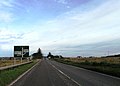
 A870, Westerdale - geograph.org.uk - 2169483.jpg 640 × 359; 66 KB
-
 A9 across Achkeepster Moss - geograph.org.uk - 2020667.jpg 800 × 531; 148 KB
-
 A9 crossroads - geograph.org.uk - 4678071.jpg 640 × 458; 43 KB
-
 A9 on Spittal Hill - geograph.org.uk - 4749749.jpg 800 × 450; 162 KB
-
 A9 on Spittal Hill - geograph.org.uk - 4749753.jpg 800 × 450; 147 KB
-
 A9 southbound - geograph.org.uk - 4678093.jpg 640 × 469; 47 KB
-
 A9 towards Thurso - geograph.org.uk - 5080016.jpg 640 × 480; 56 KB
-
 A9 towards Thurso - geograph.org.uk - 5080053.jpg 640 × 480; 50 KB
-
 A9 towards Thurso - geograph.org.uk - 5080124.jpg 640 × 480; 51 KB
-
 A9 towards Thurso - geograph.org.uk - 5080136.jpg 640 × 480; 55 KB
-
 A9 towards Thurso - geograph.org.uk - 5080459.jpg 640 × 480; 54 KB
-
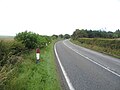
 A9, Achalone - geograph.org.uk - 5080405.jpg 640 × 480; 49 KB
-
 A9, Achkeepster - geograph.org.uk - 5080021.jpg 640 × 480; 51 KB
-
 A9, Causeymire - geograph.org.uk - 5080003.jpg 640 × 480; 48 KB
-
 A9, Clashgal - geograph.org.uk - 5080426.jpg 640 × 480; 67 KB
-
 A9, Georgemas - geograph.org.uk - 5080464.jpg 640 × 480; 66 KB
-
 A9, Moss of Knockglass - geograph.org.uk - 5080009.jpg 640 × 480; 47 KB
-
 A9, Mybster - geograph.org.uk - 5080039.jpg 640 × 480; 53 KB
-
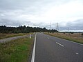
 A9, North Achalone - geograph.org.uk - 5080411.jpg 640 × 480; 55 KB
-
 A9, Spittal - geograph.org.uk - 5107162.jpg 640 × 428; 48 KB
-
 Abandoned Henhouse - geograph.org.uk - 2386163.jpg 3,648 × 2,736; 2.19 MB
-
 Access steps - geograph.org.uk - 2264851.jpg 3,648 × 2,736; 2.2 MB
-
 Access to Altnabreac station - geograph.org.uk - 5562057.jpg 640 × 480; 269 KB
-
 Achaeter Farm - geograph.org.uk - 1917498.jpg 4,416 × 3,312; 1.22 MB
-
 Achagie north of Scotscalder - geograph.org.uk - 2957874.jpg 1,200 × 900; 263 KB
-
 Achanarras Car Park - geograph.org.uk - 2446731.jpg 1,600 × 1,074; 818 KB
-
 Achanarras Shelter - geograph.org.uk - 2446807.jpg 1,600 × 1,074; 570 KB
-
 Acharynie Cemetery - geograph.org.uk - 2447045.jpg 1,600 × 1,074; 834 KB
-
 Acharynie Cemetery - geograph.org.uk - 4228501.jpg 1,440 × 960; 1.16 MB
-
 Achbilster - geograph.org.uk - 2169486.jpg 640 × 359; 83 KB
-
 Achkeeper electricity sub station - geograph.org.uk - 5080027.jpg 640 × 480; 50 KB
-
 Achkeepster - geograph.org.uk - 4749987.jpg 800 × 450; 139 KB
-
 Achkeepster Cottage - geograph.org.uk - 2446678.jpg 1,600 × 1,074; 400 KB
-
 Achkeepster Moss - geograph.org.uk - 3422652.jpg 4,416 × 3,312; 714 KB
-
 Achkeepster Moss - geograph.org.uk - 5080025.jpg 640 × 480; 57 KB
-
 Achlibster - geograph.org.uk - 2957959.jpg 1,200 × 900; 279 KB
-
 Achscoriclate - geograph.org.uk - 5987280.jpg 1,024 × 769; 377 KB
-
 Achscoriclate - geograph.org.uk - 5989998.jpg 1,024 × 769; 420 KB
-
 Achscoriclate and Loch More - geograph.org.uk - 5990009.jpg 1,024 × 576; 238 KB
-
 Achscrabster Quarry - geograph.org.uk - 1917579.jpg 4,416 × 3,312; 1.69 MB
-
 Across the moor to some of the wind turbines - geograph.org.uk - 6219817.jpg 4,000 × 3,000; 2.63 MB
-
 Across the Moor........ - geograph.org.uk - 2446834.jpg 1,600 × 846; 201 KB
-
 Afternoon arrival from the south at Georgemas Junction - geograph.org.uk - 4760442.jpg 1,800 × 1,012; 1.24 MB
-
 Agricultural building, Mybster - geograph.org.uk - 5080035.jpg 640 × 480; 67 KB
-
 Allt a' Mhuilinn - geograph.org.uk - 4619656.jpg 800 × 450; 349 KB
-
 Allt Aikergill - geograph.org.uk - 3511627.jpg 4,416 × 3,312; 752 KB
-
 Allt an Buidhe - geograph.org.uk - 926418.jpg 640 × 480; 88 KB
-
 Allt Athain Shalaich, Braehour Forest - geograph.org.uk - 913073.jpg 640 × 480; 113 KB
-
 Allt Dubh near Westerdale by Thurso - geograph.org.uk - 5686900.jpg 3,128 × 2,346; 1.91 MB
-
 Allt Glas-choire - geograph.org.uk - 4619627.jpg 800 × 450; 296 KB
-
 Allt Loch na Cloiche - geograph.org.uk - 4696325.jpg 640 × 480; 224 KB
-
 Allt Lochain Ealaich Mhoir - geograph.org.uk - 5974075.jpg 1,152 × 864; 822 KB
-
 Allt Meadhoin - geograph.org.uk - 918229.jpg 640 × 480; 82 KB
-
 Allt na h-Imriche - geograph.org.uk - 4050600.jpg 4,416 × 3,312; 1.24 MB
-
 Allt nam Beist flows towards Loch More - geograph.org.uk - 5990005.jpg 1,024 × 769; 374 KB
-
 Allt Nam Bo Odhar - geograph.org.uk - 5738417.jpg 640 × 480; 164 KB
-
 Allt nam Breac - geograph.org.uk - 4696433.jpg 640 × 480; 146 KB
-
 Alltan Dubh - geograph.org.uk - 1338465.jpg 640 × 480; 70 KB
-
 Altnabreac - buildings - geograph.org.uk - 2382530.jpg 1,600 × 1,200; 858 KB
-
 Altnabreac - the parting of the ways^ - geograph.org.uk - 2382518.jpg 1,600 × 1,200; 788 KB
-
 Altnabreac DC twinned with Washington DC - geograph.org.uk - 4436793.jpg 640 × 480; 265 KB
-
 Altnabreac railway station, Highland - geograph.org.uk - 5405712.jpg 1,600 × 1,200; 628 KB
-
 Altnabreac Station - geograph.org.uk - 4433193.jpg 640 × 480; 180 KB
-
 Altnabreac station - geograph.org.uk - 5160593.jpg 1,800 × 1,013; 2.09 MB
-

-
 Altnabreac Station in the north Highlands - geograph.org.uk - 4314313.jpg 2,464 × 1,632; 2.38 MB
-
 Altnabreac station waiting shelter - geograph.org.uk - 4437679.jpg 640 × 480; 252 KB
-
 Altnabreac station water tower - geograph.org.uk - 4437691.jpg 480 × 640; 281 KB
-
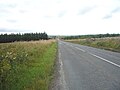
 Altnabreac to Loch More road - geograph.org.uk - 4620975.jpg 800 × 450; 319 KB
-
 Altnabreac, 1701 to Inverness - geograph.org.uk - 4621025.jpg 800 × 533; 448 KB
-
 Anchor chain at Georgemas Junction - geograph.org.uk - 2432104.jpg 800 × 601; 183 KB
-
 Anglers' Hut - geograph.org.uk - 2447490.jpg 1,600 × 943; 259 KB
-

-
 Approach to Altnabreac station - geograph.org.uk - 5740633.jpg 640 × 480; 256 KB
-
 Approaching Dalganachan - geograph.org.uk - 5795899.jpg 640 × 480; 174 KB
-
 Approaching Halkirk - geograph.org.uk - 5084118.jpg 640 × 480; 69 KB
-
 Approaching Loch Caise - geograph.org.uk - 5562510.jpg 640 × 480; 119 KB
-
 Approaching Loch Dubh - geograph.org.uk - 4434824.jpg 640 × 480; 168 KB
-
 Approaching Lochdhu - geograph.org.uk - 5740586.jpg 640 × 480; 168 KB
-

-
 Approaching the deer fence by Cnoc Seasaimh - geograph.org.uk - 5561806.jpg 1,024 × 768; 396 KB
-

-
 Arrival at Altnabreac - geograph.org.uk - 5738213.jpg 640 × 480; 207 KB
-
 At Georgemas Junction - geograph.org.uk - 4454730.jpg 640 × 480; 163 KB
-

-

-
 B870 in Big Sky Country - geograph.org.uk - 4932210.jpg 1,800 × 1,012; 1.69 MB
-
 B874 towards Halkirk - geograph.org.uk - 5084107.jpg 640 × 480; 55 KB
-
 B874 towards Halkirk - geograph.org.uk - 5084113.jpg 640 × 480; 59 KB
-
 B874, Halkirk - geograph.org.uk - 5084132.jpg 640 × 480; 62 KB
-
 B874, Skinnet - geograph.org.uk - 5084102.jpg 640 × 480; 71 KB
-
 Backlass Farm - geograph.org.uk - 5987261.jpg 1,024 × 769; 373 KB
-
 Backlass Farm - geograph.org.uk - 5989980.jpg 768 × 1,023; 578 KB
-
 Backlass Farm in its Flows Country setting - geograph.org.uk - 5989766.jpg 1,024 × 576; 259 KB
-
 Backlass Farmhouse and a view over the Flows - geograph.org.uk - 5989968.jpg 1,024 × 769; 477 KB
-

-
 Badnaheen Cottage - geograph.org.uk - 5561808.jpg 1,024 × 768; 531 KB
-
 Bailey Bridge, Burn of Olgrinbeg - geograph.org.uk - 913093.jpg 640 × 480; 95 KB
-
 Balavreed - geograph.org.uk - 1249822.jpg 640 × 480; 94 KB
-
 Ballone Farm - geograph.org.uk - 2446705.jpg 1,600 × 1,074; 509 KB
-
 Barley, Achavarn - geograph.org.uk - 1992307.jpg 640 × 359; 48 KB
-

-
 Ben Dorrery - geograph.org.uk - 4368400.jpg 2,560 × 1,920; 2.43 MB
-
 Bend in the A9, Clashgal - geograph.org.uk - 5080452.jpg 640 × 480; 57 KB
-
 Bend in the track in the Sithean forest - geograph.org.uk - 5288437.jpg 640 × 480; 269 KB
-
 Bend in the track towards Skyline Loch - geograph.org.uk - 4692651.jpg 640 × 480; 161 KB
-
 Beside Loch a' Mhuilinn - geograph.org.uk - 5739870.jpg 640 × 480; 165 KB
-
 Beside Loch a' Mhuilinn - geograph.org.uk - 5739978.jpg 640 × 480; 150 KB
-
 Beside Loch a' Mhuilinn - geograph.org.uk - 5797229.jpg 640 × 480; 196 KB
-
 Beside Loch Dubh - geograph.org.uk - 5738242.jpg 640 × 480; 177 KB
-
 Beside the A9, Mybster - geograph.org.uk - 4749978.jpg 800 × 450; 190 KB
-
 Beside the deer fence - geograph.org.uk - 5738267.jpg 640 × 480; 178 KB
-
 Beside the deer fence - geograph.org.uk - 5738269.jpg 640 × 480; 208 KB
-
 Between Glutt Water and Gobernuisgeach - geograph.org.uk - 3825298.jpg 6,432 × 4,288; 5.03 MB
-
 Big Sky Country in Caithness - geograph.org.uk - 2265366.jpg 1,000 × 657; 105 KB
-
 Bivouacking beside The Glutt Loch - geograph.org.uk - 5862078.jpg 1,024 × 768; 563 KB
-
 Blackpark near Halkirk - geograph.org.uk - 1931381.jpg 4,416 × 3,312; 793 KB
-
 Blanket Bog - geograph.org.uk - 2483262.jpg 4,416 × 3,312; 1.35 MB
-
 Blanket Bog - geograph.org.uk - 913173.jpg 640 × 480; 91 KB
-
 Blanket Bog - geograph.org.uk - 917171.jpg 640 × 480; 76 KB
-
 Blanket Bog in the Blar nam Faoileag - geograph.org.uk - 918257.jpg 640 × 480; 63 KB
-

-
-

-

-
 Blanket Bog in the Loch Caluim Flows - geograph.org.uk - 883328.jpg 640 × 480; 75 KB
-
 Blanket Bog near Braehour Forest - geograph.org.uk - 913214.jpg 640 × 480; 88 KB
-
 Blanket Bog near Braehour Forest - geograph.org.uk - 913227.jpg 640 × 480; 73 KB
-
 Blanket Bog near Braehour Forest - geograph.org.uk - 913256.jpg 640 × 480; 81 KB
-
 Blanket Bog on the Blar nam Faoileag - geograph.org.uk - 917166.jpg 640 × 480; 48 KB
-

-
 Bog, The Glutt - geograph.org.uk - 4618342.jpg 800 × 450; 310 KB
-
 Boggy grazing beside drain - geograph.org.uk - 5088187.jpg 640 × 480; 71 KB
-
 Boggy Moorland West of Lochan Ealach Mor - geograph.org.uk - 5974056.jpg 1,152 × 864; 890 KB
-
 Boom, Round Knowe - geograph.org.uk - 4618653.jpg 800 × 450; 263 KB
-
 Borrow pit, Dail Righe - geograph.org.uk - 4619621.jpg 800 × 450; 315 KB
-
 Braehour Forest - geograph.org.uk - 913141.jpg 640 × 480; 74 KB
-
 Braehour Forest - geograph.org.uk - 913239.jpg 640 × 480; 78 KB
-
 Braehour Forest - geograph.org.uk - 913247.jpg 640 × 480; 67 KB
-
 Braehour Forest - geograph.org.uk - 913275.jpg 640 × 480; 104 KB
-
 Braemore - Glutt road - geograph.org.uk - 4618277.jpg 800 × 450; 281 KB
-
 Braemore to Glutt road - geograph.org.uk - 4615849.jpg 800 × 450; 295 KB
-
 Bridge across the River Thurso - geograph.org.uk - 2420953.jpg 2,516 × 1,835; 538 KB
-
 Bridge near to Altnabreac Station - geograph.org.uk - 1106741.jpg 640 × 360; 79 KB
-
 Bridge over Glutt Water - geograph.org.uk - 1111534.jpg 640 × 360; 69 KB
-
 Bridge over River Thurso where it enters Loch More - geograph.org.uk - 4412667.jpg 3,413 × 2,438; 1.82 MB
-
 Bridge over Rumsdale Water - geograph.org.uk - 1111584.jpg 640 × 360; 65 KB
-
 Bridge over Sleach Water, Altnabreac - geograph.org.uk - 4434454.jpg 640 × 480; 157 KB
-
 Bridge ^ fish ladder - geograph.org.uk - 3036790.jpg 600 × 450; 166 KB
-
 Bridge, Altnabreac - geograph.org.uk - 4620932.jpg 800 × 450; 299 KB
-
 Bridge, Loch More - geograph.org.uk - 2170912.jpg 640 × 359; 81 KB
-
 Broch, Tulach Mor - geograph.org.uk - 2420923.jpg 2,560 × 1,920; 2.15 MB
-
 Brooding afternoon by Dalnawillan Lodge - geograph.org.uk - 2264890.jpg 1,000 × 599; 122 KB
-
 Buolinach Farm - geograph.org.uk - 2446760.jpg 1,600 × 1,074; 401 KB
-
 Burn of Halkirk - geograph.org.uk - 5084223.jpg 640 × 480; 95 KB
-
 Burn of Olgrinbeg - geograph.org.uk - 2969058.jpg 4,000 × 3,000; 3.15 MB
-
 Burn of Olgrinbeg - geograph.org.uk - 913084.jpg 640 × 480; 94 KB
-
 Burn of Olgrinbeg - geograph.org.uk - 913130.jpg 640 × 480; 96 KB
-

-
 By Glutt Loch - geograph.org.uk - 5795866.jpg 640 × 480; 196 KB
-
 Caithness 'hedge' near Achanarras Farm near Thurso - geograph.org.uk - 5929883.jpg 5,184 × 3,888; 7.55 MB
-
 Caithness Flagstones Ltd. - geograph.org.uk - 4749767.jpg 800 × 450; 200 KB
-
 Caithness Peatland - geograph.org.uk - 926456.jpg 640 × 480; 47 KB
-

-
 Caithness wind farm - geograph.org.uk - 1106616.jpg 640 × 480; 22 KB
-
 Caol Loch Boathouse - geograph.org.uk - 931007.jpg 640 × 480; 62 KB
-
 Cattle at Georgemas - geograph.org.uk - 2386512.jpg 2,023 × 1,276; 508 KB
-
 Cattle grazing off the B874 - geograph.org.uk - 5084111.jpg 640 × 480; 57 KB
-
 Cattle grazing, Achalone - geograph.org.uk - 5080139.jpg 640 × 480; 68 KB
-
 Cattle grid - geograph.org.uk - 2169489.jpg 640 × 359; 95 KB
-
 Causewaymire Windfarm - geograph.org.uk - 3512328.jpg 640 × 480; 58 KB
-
 Causeymire wind farm - geograph.org.uk - 4749989.jpg 800 × 450; 118 KB
-
 Causeymire wind farm - geograph.org.uk - 4751358.jpg 800 × 450; 118 KB
-
 Causeymire wind farm - geograph.org.uk - 4751371.jpg 800 × 450; 131 KB
-
 Causeymire wind farm - geograph.org.uk - 4751400.jpg 800 × 450; 159 KB
-
 Causeymire Wind Farm - geograph.org.uk - 5080010.jpg 640 × 480; 45 KB
-
 Causeymire Wind Farm - geograph.org.uk - 5477847.jpg 1,024 × 684; 66 KB


&filefrom=Causeymire+Wind+Farm+from+A9+-+geograph.org.uk+-+4678797.jpg#mw-category-media)