Category:Haltepunkt Kreenried
Jump to navigation
Jump to search
| Object location | | View all coordinates using: OpenStreetMap |
|---|

 | |||||
| Upload media | |||||
| Instance of |
| ||||
|---|---|---|---|---|---|
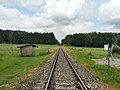
| Location | Eichstegen, Landkreis Ravensburg, Tübingen Government Region, Baden-Württemberg, Germany | ||||
| Connecting line | |||||
| Adjacent station | |||||
 | |||||
Media in category "Haltepunkt Kreenried"
The following 4 files are in this category, out of 4 total.
-
 Haltepunkt Kreenried I.jpg 3,984 × 2,988; 7.52 MB
-
 Haltepunkt Kreenried II.jpg 3,984 × 2,988; 5.67 MB
-
 Haltepunkt Kreenried III.jpg 3,984 × 2,988; 4.55 MB
-
 Haltepunkt Kreenried IV.jpg 3,984 × 2,988; 6.58 MB


