Category:Hartcliffe (ward)
Jump to navigation
Jump to search
suburb and former electoral ward of Bristol, in the United Kingdom | |||||
| Upload media | |||||
| Instance of |
| ||||
|---|---|---|---|---|---|
| Location | City of Bristol, South West England, England | ||||
 | |||||
Subcategories
This category has the following 2 subcategories, out of 2 total.
I
- Imperial Park, Bristol (4 F)
L
- Lakeshore, Bristol (11 F)
Media in category "Hartcliffe (ward)"
The following 32 files are in this category, out of 32 total.
-
 A quiet spot for the Pigeonhouse - geograph.org.uk - 6378996.jpg 3,296 × 2,472; 3.49 MB
-
 Bristol hartcliffe.png 702 × 780; 149 KB
-
 Container, Willmott Park, Hartcliffe - geograph.org.uk - 3750670.jpg 1,920 × 1,133; 457 KB
-
 Cycle path near Imperial Park - geograph.org.uk - 3749098.jpg 1,920 × 1,327; 567 KB
-
 Flats at Hartcliffe - geograph.org.uk - 1325553.jpg 640 × 499; 179 KB
-
 Green on Fair Furlong - geograph.org.uk - 3750532.jpg 1,920 × 1,409; 639 KB
-
 Hareclive Youth Centre - geograph.org.uk - 3751098.jpg 1,920 × 1,269; 309 KB
-
 Hartcliffe 2.jpg 5,357 × 3,468; 13.3 MB
-
 Hartcliffe Bristol UK ward map.svg 1,138 × 1,266; 709 KB
-
 Hartcliffe from the air - geograph.org.uk - 4783679.jpg 3,264 × 2,448; 4 MB
-
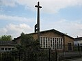 St Andrew, Hartcliffe - geograph.org.uk - 1249716.jpg 640 × 480; 53 KB
-
 Hartcliffmethodistchurch.jpg 640 × 480; 77 KB
-
 Hengrove Way - geograph.org.uk - 5818100.jpg 1,024 × 768; 102 KB
-
 Lakeshore development - geograph.org.uk - 6170801.jpg 3,296 × 2,472; 3.52 MB
-
 Lakeshore in green - geograph.org.uk - 6170816.jpg 3,296 × 2,472; 3.61 MB
-
 Lakeshore's new Copper Building - geograph.org.uk - 6170808.jpg 3,296 × 2,472; 3.46 MB
-
 Morrisons, Hartcliffe - geograph.org.uk - 3751110.jpg 1,920 × 1,076; 270 KB
-
 Open space, Hartcliffe - geograph.org.uk - 3750538.jpg 1,920 × 1,440; 528 KB
-
 Roundabout, Hedley Park, Bristol - geograph.org.uk - 2237082.jpg 3,662 × 2,747; 2.87 MB
-
 Row of Houses, Whitland Road, Bristol - geograph.org.uk - 5616024.jpg 5,184 × 3,456; 5.45 MB
-
 Side of The Range, Imperial Retail Park - geograph.org.uk - 3714735.jpg 1,901 × 1,409; 354 KB
-
 The Harriers, Bishport Avenue, Hartcliffe - geograph.org.uk - 3750535.jpg 1,920 × 1,094; 310 KB
-
 The Pigeonhouse is doubly grated - geograph.org.uk - 6378998.jpg 2,472 × 3,296; 3.34 MB
-
 The southern outskirts of Bristol - geograph.org.uk - 4783655.jpg 3,264 × 2,448; 3.4 MB
-
 To Crox Bottom - geograph.org.uk - 4004303.jpg 1,704 × 2,304; 1.62 MB
-
 Tower blocks at Hartcliffe - geograph.org.uk - 4298005.jpg 3,264 × 2,448; 2.79 MB
-
 Trees by Hareclive Road - geograph.org.uk - 3751130.jpg 1,920 × 1,440; 783 KB
-
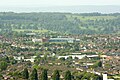 View over Bristol (3) - geograph.org.uk - 1344151.jpg 640 × 427; 162 KB
-
 View over Hartcliffe from the slopes of East Dundry - geograph.org.uk - 2252758.jpg 4,224 × 2,376; 4.83 MB
-
 Whitchurch Lane - geograph.org.uk - 6379000.jpg 3,296 × 2,472; 3.45 MB
-
 Willmott Park, Hartcliffe - geograph.org.uk - 3750547.jpg 1,920 × 1,294; 756 KB
-
 Withywoodcitylimits.jpg 640 × 426; 136 KB


_-_geograph.org.uk_-_1344151.jpg)


