Category:Hartshead
Jump to navigation
Jump to search
village in West Yorkshire, UK  | |||||
| Upload media | |||||
| Instance of | |||||
|---|---|---|---|---|---|
| Location | Kirklees, West Yorkshire, Yorkshire and the Humber, England | ||||
 | |||||
English: Hartshead is a village in the county of West Yorkshire, England, west of Dewsbury and near Hartshead Moor.
Subcategories
This category has the following 2 subcategories, out of 2 total.
G
- Gray Ox, Hartshead (6 F)
P
- Church of St Peter, Hartshead (48 F)
Media in category "Hartshead"
The following 56 files are in this category, out of 56 total.
-
 84 Boundary stone, Hartshead side - geograph.org.uk - 2998990.jpg 2,000 × 1,500; 836 KB
-
 Boundary Stone, Freakfield Road, Hartshead.jpg 2,000 × 1,715; 4.42 MB
-
 Bullace Trees Lane - Church Road - geograph.org.uk - 3581025.jpg 480 × 640; 115 KB
-

-
 Church Lane, Hartshead - geograph.org.uk - 221926.jpg 640 × 454; 62 KB
-
 Cross Hill Lane, Hartshead, Yorkshire - geograph.org.uk - 125883.jpg 640 × 480; 195 KB
-

-

-

-

-
 Fall Lane, Hartshead, Yorkshire - geograph.org.uk - 125894.jpg 640 × 477; 107 KB
-
 Farmer at work, Hartshead, Yorkshire - geograph.org.uk - 125249.jpg 640 × 480; 121 KB
-

-
 Field of stubble, Church Lane, Hartshead - geograph.org.uk - 221920.jpg 640 × 474; 101 KB
-
 Field off Church Lane, Hartshead - geograph.org.uk - 558590.jpg 640 × 473; 100 KB
-

-

-

-

-

-

-
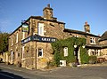
 Gray Ox, Hartshead (15541281679).jpg 3,008 × 2,808; 5.88 MB
-
 Hartshead - geograph.org.uk - 54941.jpg 640 × 480; 72 KB
-

-
 Hartshead from Freakfield Lane - geograph.org.uk - 69894.jpg 640 × 480; 109 KB
-

-
 Hartshead Lane, Harsthead - geograph.org.uk - 169587.jpg 480 × 640; 107 KB
-
 Hartshead Post Office - Fall Lane - geograph.org.uk - 3580825.jpg 640 × 480; 57 KB
-
 Hartshead Tithe Barn - geograph.org.uk - 2267676.jpg 640 × 480; 136 KB
-
 Hartshead Village from Roberttown Lane.jpg 2,304 × 1,728; 688 KB
-
-
 House on Hartshead Lane, Hartshead - geograph.org.uk - 3958037.jpg 1,600 × 1,064; 566 KB
-
 Inscribed stone on the south side of Twirl Hill Road, Hartshead (geograph 7006241).jpg 2,048 × 1,536; 709 KB
-
 Lady Well, Ladywell Lane, Hartshead - geograph.org.uk - 558607.jpg 640 × 480; 133 KB
-
 Ladywell Lane, Hartshead - geograph.org.uk - 558594.jpg 640 × 474; 99 KB
-

-
 Near Hartshead Green - geograph.org.uk - 2526463.jpg 3,042 × 2,028; 1.71 MB
-

-
 Peep Green Lane, Hartshead - geograph.org.uk - 611093.jpg 451 × 640; 140 KB
-
 Ploughed field, Church Lane, Hartshead - geograph.org.uk - 227736.jpg 640 × 475; 132 KB
-
 Prospect Road - Fall Lane - geograph.org.uk - 3580946.jpg 640 × 480; 69 KB
-
 Prospect Road - Windy Bank Lane - geograph.org.uk - 3580966.jpg 640 × 480; 64 KB
-
 Rutted track, Hartshead, Yorkshire - geograph.org.uk - 125874.jpg 640 × 472; 158 KB
-

-
 St Peter's Church, Hartshead - geograph.org.uk - 1305647.jpg 640 × 480; 96 KB
-
 Stile (4111535557).jpg 1,352 × 2,028; 3.96 MB
-
 Stocks, Hartshead.jpg 1,200 × 762; 517 KB
-

-
 Sundial (4107061592).jpg 2,384 × 1,920; 4.54 MB
-
-

-
-
-

-
 Weavers Cottage, Hartshead, Yorkshire - geograph.org.uk - 125917.jpg 640 × 480; 106 KB
-


.jpg)


.jpg)


.jpg)


.jpg)


