Category:Hasfield
Jump to navigation
Jump to search
village in United Kingdom  | |||||
| Upload media | |||||
| Instance of | |||||
|---|---|---|---|---|---|
| Location | Tewkesbury, Gloucestershire, South West England, England | ||||
 | |||||
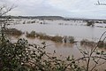
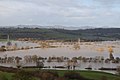
English: Hasfield is a civil parish in Gloucestershire and lies 6 miles south-west of Tewkesbury and 7 miles north of Gloucester. It is situated on the west bank of the Severn River with much of its land residing below the 50-foot contour and as such subject to regular flooding. Hasfield is represented by the county councillor for Severn Vale division and the two borough councillors for Highnam with Haw Bridge ward on Tewkesbury Borough Council.
Subcategories
This category has the following 4 subcategories, out of 4 total.
H
- Hasfield Court (6 F)
- Hasfield Great House (2 F)
- Hasfield Roll of Honour (1 F)
S
Media in category "Hasfield"
The following 121 files are in this category, out of 121 total.
-
 A view to Barrow Hill - geograph.org.uk - 987238.jpg 640 × 480; 191 KB
-
 Admiring the wildlife^ - geograph.org.uk - 5727330.jpg 4,896 × 3,264; 6.2 MB
-
 Amberley House, Hasfield - geograph.org.uk - 4977383.jpg 1,600 × 1,065; 535 KB
-
 Amberley House, Hasfield - geograph.org.uk - 4977497.jpg 1,600 × 1,065; 573 KB
-
 Amberley House, Hasfield - geograph.org.uk - 987187.jpg 640 × 480; 153 KB
-
 Ashleworth Ham - geograph.org.uk - 5727326.jpg 4,896 × 3,264; 6.38 MB
-
 Ashleworth Meadows - geograph.org.uk - 2370953.jpg 4,272 × 2,848; 4.66 MB
-
 Ashleworth Meadows - geograph.org.uk - 2371146.jpg 4,272 × 2,376; 7.78 MB
-
 Ashleworth Meadows - geograph.org.uk - 2371170.jpg 4,272 × 2,848; 5.47 MB
-
 Ashleworth meadows - geograph.org.uk - 5159117.jpg 1,600 × 901; 693 KB
-
 Banks of the Severn at Wainlode - geograph.org.uk - 2599110.jpg 1,798 × 1,161; 243 KB
-
 Coach-house, Hasfield Court - geograph.org.uk - 3095980.jpg 4,320 × 3,240; 2.95 MB
-
 Corse Grove - geograph.org.uk - 1501424.jpg 640 × 480; 220 KB
-
 Corse Grove - geograph.org.uk - 986123.jpg 640 × 480; 146 KB
-
 Country road at Corse Wood Hill - geograph.org.uk - 5327139.jpg 1,024 × 768; 225 KB
-

-

-
 Crossroads, Hasfield - geograph.org.uk - 3095976.jpg 4,320 × 3,240; 3.02 MB
-
 Dairy pasture, Hasfield - geograph.org.uk - 987202.jpg 640 × 480; 192 KB
-
 Draper's Lane - geograph.org.uk - 4198462.jpg 800 × 451; 294 KB
-
 Draper's Lane 1 - geograph.org.uk - 2143486.jpg 800 × 600; 418 KB
-
 Draper's Lane 2 - geograph.org.uk - 2143492.jpg 800 × 600; 466 KB
-
 Edward VII Postbox, Hasfield - geograph.org.uk - 4977513.jpg 1,065 × 1,600; 750 KB
-
 Entering Hasfield from the east - geograph.org.uk - 987233.jpg 640 × 480; 158 KB
-
 Entrance to a field on Hasfield Ham - geograph.org.uk - 1505125.jpg 640 × 426; 101 KB
-
 Entrance to Hasfield Court (geograph 7502775).jpg 1,024 × 754; 224 KB
-
 Farmyard set aside - geograph.org.uk - 1260296.jpg 640 × 480; 84 KB
-
 Field drain - geograph.org.uk - 2372954.jpg 3,000 × 2,000; 5.12 MB
-
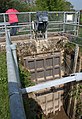
 Flood Gauge at Hasfield - geograph.org.uk - 4977511.jpg 1,600 × 1,065; 952 KB
-
 Flooded field, Hasfield - geograph.org.uk - 3039443.jpg 1,600 × 1,200; 470 KB
-
 Flooded Severn below Wainlode - geograph.org.uk - 3836352.jpg 1,024 × 680; 157 KB
-
 Flooded Severn Ham - geograph.org.uk - 3837669.jpg 1,024 × 680; 154 KB
-
 Footpath to Wickridge Street - geograph.org.uk - 4198469.jpg 800 × 451; 205 KB
-
 Gated entrance to footpath - geograph.org.uk - 986085.jpg 640 × 430; 119 KB
-
 Grass triangle - geograph.org.uk - 4198460.jpg 800 × 451; 195 KB
-
 Grazing land , Wickridge Street - geograph.org.uk - 940530.jpg 640 × 480; 199 KB
-
 Great House Farm near Hasfield - geograph.org.uk - 4977366.jpg 1,600 × 1,033; 690 KB
-
 Great House Road off Ham Road - geograph.org.uk - 4977364.jpg 1,600 × 1,065; 829 KB
-
 Green triangle road junction - geograph.org.uk - 5327134.jpg 1,024 × 768; 267 KB
-
 Ham Lane - geograph.org.uk - 2277951.jpg 640 × 480; 231 KB
-
 Ham Road at Great House Road - geograph.org.uk - 4977359.jpg 1,600 × 1,084; 666 KB
-
 Ham Road near Colways Farm - geograph.org.uk - 4977727.jpg 1,600 × 1,073; 536 KB
-
-
 Hasfield - Amberley House and Corse Grove 1705981 1861ebf3.jpg 640 × 381; 85 KB
-
 Hasfield - NE view from Barrow Hill 1705867 f9de0885.jpg 640 × 403; 88 KB
-
 Hasfield - SE from near Corse Grove 1705965 461c5bac.jpg 640 × 397; 79 KB
-
 Hasfield - Southward from Barrow Hill 1705878 df87bf1f.jpg 640 × 398; 84 KB
-
 Hasfield - Westward from above Hasfield 1724382 2f52731f.jpg 640 × 420; 183 KB
-
 Hasfield 1 - SE from Hasfield Court 1714283 d6baa2db.jpg 640 × 374; 81 KB
-
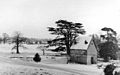 Hasfield 2 - Snow scene, Hasfield Court 1714275 67f6530c.jpg 640 × 401; 112 KB
-
 Hasfield Court and village, Glos - geograph.org.uk - 1260280.jpg 640 × 480; 93 KB
-
 Hasfield Ham - geograph.org.uk - 1307225.jpg 640 × 426; 70 KB
-
 Hasfield Ham - geograph.org.uk - 2277953.jpg 640 × 480; 235 KB
-
 Hasfield Ham - geograph.org.uk - 2537764.jpg 800 × 600; 380 KB
-
 Hasfield Road - geograph.org.uk - 1501499.jpg 640 × 480; 229 KB
-
 Hill Farm - geograph.org.uk - 987221.jpg 640 × 458; 152 KB
-
 Houses below Corse Wood Hill - geograph.org.uk - 5327146.jpg 1,024 × 768; 254 KB
-
 Large old house, Hasfield - geograph.org.uk - 3095981.jpg 4,320 × 3,240; 2.71 MB
-
 Looking south towards Hasfield - geograph.org.uk - 1501432.jpg 640 × 480; 229 KB
-

-
 Maize crop and dairy pasture, Hasfield - geograph.org.uk - 987228.jpg 640 × 480; 239 KB
-
 Minor roads meet near Corse Wood Hill - geograph.org.uk - 986096.jpg 640 × 480; 145 KB
-
 New crops near Colways Farm, Hasfield - geograph.org.uk - 3039413.jpg 1,600 × 1,200; 616 KB
-
 Old Farm, Hasfield - geograph.org.uk - 2120035.jpg 640 × 480; 244 KB
-
 Old Rectory Hasfield.jpg 3,374 × 2,537; 3.3 MB
-
 Old Rectory, Hasfield - geograph.org.uk - 987181.jpg 640 × 480; 278 KB
-
 Pastoral West Gloucestershire - geograph.org.uk - 4198465.jpg 800 × 450; 187 KB
-
 Pasture and wood on Corse Wood Hill - geograph.org.uk - 4198455.jpg 800 × 451; 193 KB
-
 Pasture on Corse Wood Hill - geograph.org.uk - 1501477.jpg 640 × 480; 223 KB
-
 Path across Ashleworth meadows - geograph.org.uk - 5159119.jpg 1,600 × 901; 718 KB
-
 Patience on the Severn - geograph.org.uk - 2371195.jpg 4,272 × 2,848; 6.72 MB
-
 River Severn at Wainlode - geograph.org.uk - 3264438.jpg 1,600 × 1,181; 390 KB
-
 Riverside track - geograph.org.uk - 2372810.jpg 4,272 × 2,848; 5.26 MB
-
 Riverside track - geograph.org.uk - 2372816.jpg 4,272 × 2,848; 6.17 MB
-
 Road and drainage ditch, Hasfield, near Tirley - geograph.org.uk - 3039379.jpg 1,600 × 1,200; 748 KB
-
 Road Junction at Hasfield - geograph.org.uk - 4977380.jpg 1,600 × 1,079; 714 KB
-
 Road junction at Hasfield - geograph.org.uk - 4977503.jpg 1,600 × 1,065; 752 KB
-
 Road junction near Hasfield - geograph.org.uk - 1307220.jpg 640 × 426; 85 KB
-
 Road junction, Hasfield - geograph.org.uk - 3095973.jpg 4,320 × 3,240; 2.92 MB
-
 Road past Hill Farm, near Hasfield - geograph.org.uk - 1307213.jpg 640 × 426; 77 KB
-
 Road to Colways Farm - geograph.org.uk - 2153319.jpg 800 × 600; 386 KB
-
 Rough grass on Hasfield Ham - geograph.org.uk - 1307200.jpg 640 × 426; 67 KB
-
 Rough grazing land - geograph.org.uk - 4740837.jpg 1,600 × 901; 768 KB
-
 Rough track on Hasfield Ham - geograph.org.uk - 2537770.jpg 800 × 600; 393 KB
-
 Sailing down the river - geograph.org.uk - 4059856.jpg 800 × 451; 215 KB
-
 Sluice gates by the River Severn - geograph.org.uk - 2371218.jpg 2,690 × 3,914; 6.47 MB
-

-
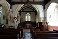
 St Mary the Virgin, Hasfield - geograph.org.uk - 4977412.jpg 1,600 × 1,065; 708 KB
-
 St Mary the Virgin, Hasfield - geograph.org.uk - 4977417.jpg 1,600 × 1,065; 666 KB
-
 St Mary the Virgin, Hasfield - geograph.org.uk - 4977421.jpg 1,600 × 1,065; 387 KB
-
 St Mary the Virgin, Hasfield - geograph.org.uk - 4977424.jpg 1,065 × 1,600; 413 KB
-
 St Mary the Virgin, Hasfield - geograph.org.uk - 4977426.jpg 1,600 × 1,065; 444 KB
-
 St Mary the Virgin, Hasfield - geograph.org.uk - 4977433.jpg 1,073 × 1,600; 396 KB
-
 St Mary the Virgin, Hasfield - geograph.org.uk - 4977434.jpg 1,135 × 1,600; 463 KB
-
 St Mary the Virgin, Hasfield - geograph.org.uk - 4977436.jpg 1,600 × 1,065; 400 KB
-
 St Mary the Virgin, Hasfield - geograph.org.uk - 4977438.jpg 1,600 × 1,065; 428 KB
-
 St Mary the Virgin, Hasfield - geograph.org.uk - 4977443.jpg 941 × 1,600; 597 KB
-
 St Mary the Virgin, Hasfield - geograph.org.uk - 4977447.jpg 1,195 × 1,600; 732 KB
-
 St Mary the Virgin, Hasfield - geograph.org.uk - 4977483.jpg 1,192 × 1,600; 706 KB
-
 St Mary the Virgin, Hasfield - geograph.org.uk - 4977487.jpg 924 × 1,600; 525 KB
-
 St Mary the Virgin, Hasfield - geograph.org.uk - 4977490.jpg 1,065 × 1,600; 515 KB
-
 St Mary the Virgin, Hasfield - geograph.org.uk - 4977492.jpg 1,600 × 1,065; 671 KB
-
 Staits Farm - geograph.org.uk - 1501483.jpg 640 × 480; 234 KB
-
 Strange tree on Barrow Hill - geograph.org.uk - 1705836.jpg 1,024 × 668; 220 KB
-
 Sunlight on flooded Ashleworth Meadows - geograph.org.uk - 3837623.jpg 1,024 × 680; 107 KB
-
 Swollen River Severn - geograph.org.uk - 3385721.jpg 1,024 × 680; 95 KB
-
 The lane to Hasfield Ham - geograph.org.uk - 3095856.jpg 4,320 × 3,240; 3.06 MB
-
 The Old Rectory, Hasfield - geograph.org.uk - 631762.jpg 640 × 426; 82 KB
-
 The Rectory, Hasfield - geograph.org.uk - 4977408.jpg 1,600 × 1,065; 640 KB
-
 The Red Lion approaching high tide - geograph.org.uk - 2372794.jpg 4,272 × 2,848; 4.75 MB
-
 Track to Colways Farm, Hasfield - geograph.org.uk - 3039390.jpg 1,600 × 1,200; 494 KB
-
 Track to Colways Farm, Hasfield - geograph.org.uk - 3095970.jpg 4,320 × 3,240; 2.94 MB
-
 Turning for Great House Lane - geograph.org.uk - 2015723.jpg 640 × 480; 69 KB
-
 Victorian Postbox at Hasfield - geograph.org.uk - 4977396.jpg 1,600 × 1,065; 864 KB
-
 Victorian Postbox at Hasfield - geograph.org.uk - 4977399.jpg 1,065 × 1,600; 653 KB
-
 View of Barrow Hill - geograph.org.uk - 1307207.jpg 640 × 426; 72 KB
-
 View the flooded River Severn - geograph.org.uk - 3836345.jpg 1,024 × 680; 93 KB
-
 View to Barrow Hill - geograph.org.uk - 5327141.jpg 1,024 × 768; 230 KB
-
 View to Barrow Hill - geograph.org.uk - 987219.jpg 640 × 480; 76 KB
-
 View to Corse Hill - geograph.org.uk - 2120032.jpg 640 × 480; 250 KB
-
 VR postbox, Hasfield - geograph.org.uk - 987186.jpg 451 × 640; 160 KB


.jpg)


