Category:Haughton Le Skerne
Jump to navigation
Jump to search
suburb of Darlington, County Durham, United Kingdom  | |||||
| Upload media | |||||
| Instance of | |||||
|---|---|---|---|---|---|
| Location | Darlington, County Durham, North East England, England | ||||
 | |||||
English: Haughton-le-Skerne is a suburb of Darlington in the ceremonial county of County Durham, England. It is situated in the north east of Darlington. The suburb lies to the west of the River Skerne.
Subcategories
This category has the following 2 subcategories, out of 2 total.
Media in category "Haughton Le Skerne"
The following 32 files are in this category, out of 32 total.
-
 Barmpton Lane - geograph.org.uk - 3227805.jpg 640 × 480; 65 KB
-
 Barn , Barmpton Grange Farm. - geograph.org.uk - 150923.jpg 640 × 479; 107 KB
-
 Beacon Hill , Sadberge. - geograph.org.uk - 150922.jpg 640 × 479; 84 KB
-
 Beech Road in Darlington - geograph.org.uk - 2739178.jpg 3,648 × 2,736; 2.73 MB
-
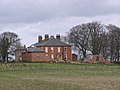 Burdon Hall. - geograph.org.uk - 150915.jpg 640 × 479; 94 KB
-
 Cycle Path , Crossing the A66 Ring Road. - geograph.org.uk - 157331.jpg 640 × 479; 135 KB
-
 Darlington Hotel, Houghton-Le-Skerne - geograph.org.uk - 4127533.jpg 1,600 × 1,200; 263 KB
-
 Entering Great Burden on the A1150 - geograph.org.uk - 3227809.jpg 640 × 480; 67 KB
-
 Houghton Road - geograph.org.uk - 4128715.jpg 2,560 × 1,920; 2.82 MB
-
 Houses on Rivergarth - geograph.org.uk - 3227804.jpg 640 × 480; 58 KB
-
 Maidendale , Nature Reserve - geograph.org.uk - 195592.jpg 640 × 261; 52 KB
-
 Morrisons, Morton Park, Darlington - geograph.org.uk - 75412.jpg 640 × 480; 91 KB
-
 River Skerne from Houghton Bridge - geograph.org.uk - 4127512.jpg 1,689 × 2,241; 1.88 MB
-
 St Andrew's Church - geograph.org.uk - 4128714.jpg 1,600 × 1,200; 401 KB
-
 Stockton Road, Darlington - geograph.org.uk - 2728607.jpg 640 × 480; 86 KB
-

-
 The River Skerne - geograph.org.uk - 3227806.jpg 640 × 480; 108 KB
-
 The River Skerne, Haughton le Skerne - geograph.org.uk - 2127914.jpg 1,280 × 960; 708 KB
-

-
 Commemorative Plaque , Sadberge Green. - geograph.org.uk - 192541.jpg 640 × 478; 153 KB
-
 Cummins Engine Co.Ltd , Salters Lane - geograph.org.uk - 327232.jpg 640 × 181; 29 KB
-
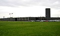 Cummins Factory, Yarm Rd. Darlington - geograph.org.uk - 123167.jpg 640 × 390; 44 KB
-
 Eastbourne Cemetery Chapel , Darlington - geograph.org.uk - 137585.jpg 640 × 479; 102 KB
-
 Elly Hill House Farm. - geograph.org.uk - 150912.jpg 640 × 479; 103 KB
-
 Footpath Alongside the A67 - geograph.org.uk - 502681.jpg 480 × 640; 87 KB
-
 Maidendale Farm - geograph.org.uk - 195589.jpg 640 × 479; 119 KB
-
 Phone Mast , Ely Hill. - geograph.org.uk - 150913.jpg 640 × 479; 64 KB
-
 Pond at Bumper Hall - geograph.org.uk - 404015.jpg 640 × 427; 121 KB
-
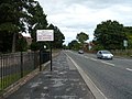
 Sadberge - geograph.org.uk - 75476.jpg 640 × 480; 83 KB
-
 Sadberge Hall. - geograph.org.uk - 168196.jpg 640 × 275; 63 KB
-
 South Burdon Farm. - geograph.org.uk - 157558.jpg 640 × 479; 89 KB
-
 The Wheatsheaf Pub - geograph.org.uk - 123117.jpg 640 × 459; 74 KB


