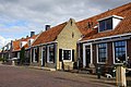
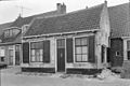
Category:Havenkade 33, Elburg
Jump to navigation
Jump to search
| Object location | | View all coordinates using: OpenStreetMap |
|---|
 | |||||
| Upload media | |||||
| Instance of |
| ||||
|---|---|---|---|---|---|
| Location | Elburg, Gelderland, Netherlands | ||||
| Street address |
| ||||
| Located on street |
| ||||
| Heritage designation |
| ||||
 | |||||
|
This is a category about rijksmonument number 14748
|
| Address |
|
Media in category "Havenkade 33, Elburg"
The following 4 files are in this category, out of 4 total.
-
 DSC08843 - ELBURG (38332208222).jpg 2,000 × 1,333; 737 KB
-
 Gevel - Elburg - 20069006 - RCE.jpg 1,200 × 960; 282 KB
-
 Gevel - Elburg - 20069007 - RCE.jpg 1,200 × 804; 202 KB
-
 RM14748 Havenkade 33.JPG 4,320 × 3,240; 2.13 MB
.jpg)

