Category:Hendy
Jump to navigation
Jump to search
village in United Kingdom  | |||||
| Upload media | |||||
| Instance of | |||||
|---|---|---|---|---|---|
| Location |
| ||||
 | |||||
Cymraeg: Pentref yn Sir Gaerfyrddin yw Yr Hendy neu Hendy. Saif yn agos i'r ffîn a bwrdeisdref sirol Abertawe, ger Afon Llwchwr. Gyferbyn a'r Hendy, ar lan arall afon Llwchwr, mae tref Pontarddulais. Saif lle mae'r briffordd A4138 yn croesi'r draffordd M4.
English: Hendy is a village in Carmarthenshire, Wales, situated on the border between Carmarthenshire and Swansea. Hendy lies just across the River Loughor from the town of Pontarddulais and forms part of the continuous built up area centred around Pontarddulais. Most of the village sits between the M4 Motorway junction 48 and the A48 road (Fforest Road) north of the motorway.
Media in category "Hendy"
The following 21 files are in this category, out of 21 total.
-
 Country lane - geograph.org.uk - 573577.jpg 640 × 480; 113 KB
-
 Defunct wind pump - geograph.org.uk - 244999.jpg 640 × 480; 45 KB
-
-
 Farmland, looking towards Fforest - geograph.org.uk - 573566.jpg 640 × 480; 90 KB
-
 Fields and Trig Point - geograph.org.uk - 573591.jpg 640 × 480; 76 KB
-
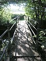 Footbridge over the Gwili - geograph.org.uk - 517470.jpg 480 × 640; 108 KB
-

-
 Railway bridge over Llwchwr estuary (geograph 7236026).jpg 3,301 × 2,476; 3.61 MB
-
 Serious GOML sign - geograph.org.uk - 517592.jpg 640 × 480; 81 KB
-
 Under the M4 - geograph.org.uk - 291903.jpg 480 × 640; 61 KB
-

-
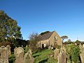 Yr Hen Gapel, Yr Hendy - geograph.org.uk - 3705257.jpg 690 × 518; 149 KB
-
 Footbridge over M4 at Hendy - geograph.org.uk - 71121.jpg 640 × 479; 100 KB
-
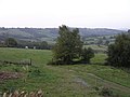 Loughor valley, north of Fforest - geograph.org.uk - 244992.jpg 640 × 480; 53 KB
-
 Pipeline descends to the Loughor - geograph.org.uk - 177701.jpg 640 × 480; 103 KB
-
 Remnant of an old abandoned road - geograph.org.uk - 517493.jpg 640 × 480; 96 KB
-
 Remnant of an old road - geograph.org.uk - 517485.jpg 640 × 480; 121 KB
-
 Road junction at Hendy - geograph.org.uk - 661037.jpg 640 × 480; 78 KB
-
 Small bridge over the Gwili river - geograph.org.uk - 517522.jpg 640 × 480; 115 KB
-
 Small ford across the Gwili river - geograph.org.uk - 517458.jpg 640 × 480; 115 KB
-
 St David's Church, Hendy - geograph.org.uk - 177123.jpg 640 × 480; 108 KB


.jpg)


