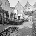
Category:Herengracht 7, Leiden
Jump to navigation
Jump to search
| Object location | | View all coordinates using: OpenStreetMap |
|---|
 | |||||
| Upload media | |||||
| Instance of |
| ||||
|---|---|---|---|---|---|
| Location | Leiden, South Holland, Netherlands | ||||
| Heritage designation | |||||
 | |||||
|
This is a category about rijksmonument number 24736
|
| Address |
|
Media in category "Herengracht 7, Leiden"
The following 5 files are in this category, out of 5 total.
-
 Gevels - Leiden - 20136005 - RCE.jpg 803 × 1,200; 188 KB
-
 Leiden - Herengracht 7.JPG 2,736 × 3,648; 4.58 MB
-
 Overzicht - Leiden - 20136000 - RCE.jpg 1,200 × 809; 198 KB
-
 Overzicht achtergevels - Leiden - 20136007 - RCE.jpg 1,200 × 1,197; 392 KB
-
 Overzicht voorgevels - Leiden - 20136006 - RCE.jpg 1,198 × 1,200; 387 KB


