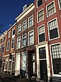
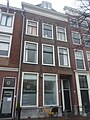
Category:Herengracht 8 en 8A, Leiden
Jump to navigation
Jump to search
| Object location | | View all coordinates using: OpenStreetMap |
|---|
 | |||||
| Upload media | |||||
| Instance of |
| ||||
|---|---|---|---|---|---|
| Location | Leiden, South Holland, Netherlands | ||||
| Heritage designation |
| ||||
 | |||||
| Address |
|
|
This is a category about rijksmonument number 24759
|
Media in category "Herengracht 8 en 8A, Leiden"
The following 6 files are in this category, out of 6 total.
-
 Gevels - Leiden - 20136008 - RCE.jpg 802 × 1,200; 185 KB
-
 Herengracht 8 en 8A Leiden April 2017.jpg 3,024 × 4,032; 3.23 MB
-
 Herengracht 8 en 8A Leiden August 2016.jpg 3,024 × 4,032; 2.87 MB
-
 Herengracht 8 en 8A Leiden November 2016.jpg 3,024 × 4,032; 2.3 MB
-
 Leiden - Herengracht 8 en 8A.jpg 2,736 × 3,648; 4.34 MB
-


