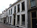
Category:Herenstraat 7, Utrecht
Jump to navigation
Jump to search
| Object location | | View all coordinates using: OpenStreetMap |
|---|
 | |||||
| Upload media | |||||
| Instance of |
| ||||
|---|---|---|---|---|---|
| Location | Utrecht, Netherlands | ||||
| Street address |
| ||||
| Heritage designation |
| ||||
 | |||||
|
This is a category about rijksmonument number 36126
|
| Address |
|
Media in category "Herenstraat 7, Utrecht"
The following 4 files are in this category, out of 4 total.
-
 Bis, voorgevels - Utrecht - 20235699 - RCE.jpg 802 × 1,200; 143 KB
-
 Herenstraat.7.Utrecht.jpg 4,000 × 3,000; 6.04 MB
-
 Voorgevel - Utrecht - 20235698 - RCE.jpg 802 × 1,200; 160 KB
-
 Voorgevels - Utrecht - 20235696 - RCE.jpg 806 × 1,200; 148 KB


