Category:High Catton
Jump to navigation
Jump to search
English: High Catton is a village in the East Riding of Yorkshire, England. It is situated approximately 6 miles (9.7 km) north west of the market town of Pocklington and about 1 mile (1.6 km) south of the village of Stamford Bridge. It lies 1 mile (1.6 km) to the east of the River Derwent.
village in East Riding of Yorkshire, UK  | |||||
| Upload media | |||||
| Instance of | |||||
|---|---|---|---|---|---|
| Location | Catton, East Riding of Yorkshire, Yorkshire and the Humber, England | ||||
 | |||||
Media in category "High Catton"
The following 38 files are in this category, out of 38 total.
-
 "Must Be Seen" - geograph.org.uk - 262282.jpg 640 × 480; 103 KB
-
 Between Wilberfoss and Fangfoss - geograph.org.uk - 211201.jpg 640 × 479; 46 KB
-
 Catton Park - geograph.org.uk - 399272.jpg 640 × 478; 173 KB
-
 Fairfield Farm - geograph.org.uk - 285119.jpg 640 × 479; 38 KB
-
 Fairfield Farm - geograph.org.uk - 399248.jpg 640 × 478; 139 KB
-
 Farmland near High Catton - geograph.org.uk - 285101.jpg 640 × 479; 24 KB
-
 Farmland near High Catton - geograph.org.uk - 745995.jpg 640 × 478; 136 KB
-
 Field boundary near High Catton - geograph.org.uk - 285109.jpg 640 × 479; 21 KB
-
 Field dip - High Catton - geograph.org.uk - 285092.jpg 640 × 479; 35 KB
-
 Hawthorn hedgerow - geograph.org.uk - 399259.jpg 640 × 478; 198 KB
-

-

-
 High Catton - geograph.org.uk - 285087.jpg 640 × 479; 37 KB
-
 High Catton 1.jpg 640 × 478; 141 KB
-
 High Catton to Wilberfoss Footpath - geograph.org.uk - 436456.jpg 640 × 469; 92 KB
-
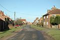 High Catton village street.jpg 640 × 426; 66 KB
-
 Howl Gate - geograph.org.uk - 745987.jpg 640 × 478; 134 KB
-
 Looking towards White House Farm.jpg 640 × 478; 155 KB
-
 Motocross Circuit - geograph.org.uk - 262382.jpg 640 × 480; 104 KB
-
 Near High Catton - geograph.org.uk - 285097.jpg 479 × 640; 55 KB
-
 On the High Catton to Wilberfoss Footpath - geograph.org.uk - 436450.jpg 640 × 480; 122 KB
-
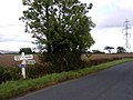
 On the road to Stamford Bridge - geograph.org.uk - 60006.jpg 640 × 480; 94 KB
-
 Primrose Hill - geograph.org.uk - 436439.jpg 640 × 436; 55 KB
-
 Road Junction - geograph.org.uk - 60012.jpg 640 × 466; 94 KB
-
 Road junction near the Cattons - geograph.org.uk - 109050.jpg 640 × 425; 118 KB
-
 Rural View - geograph.org.uk - 60010.jpg 640 × 480; 105 KB
-

-
 The Road From Stamford Bridge - geograph.org.uk - 260048.jpg 640 × 480; 100 KB
-
 The Road From Stamford Bridge - geograph.org.uk - 260062.jpg 640 × 480; 103 KB
-
 The Road To Stamford Bridge - geograph.org.uk - 262286.jpg 640 × 480; 102 KB
-
 The Road To Stamford Bridge - geograph.org.uk - 262380.jpg 640 × 480; 105 KB
-
 The road to Stamford Bridge - geograph.org.uk - 399251.jpg 640 × 478; 145 KB
-

-
 Towards Catton Park Farm - geograph.org.uk - 399266.jpg 640 × 478; 91 KB
-
 Towards Field House Farm - geograph.org.uk - 399263.jpg 640 × 478; 106 KB
-
 Under transmission lines - geograph.org.uk - 399246.jpg 640 × 478; 184 KB
-
 White House Farm - geograph.org.uk - 285105.jpg 640 × 479; 34 KB
-
 Wilberfoss to High Catton Footpath.jpg 640 × 480; 101 KB


