Category:Hiking trails in Japan
Jump to navigation
Jump to search
Countries of Asia: People's Republic of China · Georgia‡ · India · Indonesia‡ · Japan · Pakistan · Philippines · Russia‡ · Thailand · United Arab Emirates · Vietnam
Limited recognition: Taiwan – Other territories: Hong Kong
‡: partly located in Asia
Limited recognition: Taiwan – Other territories: Hong Kong
‡: partly located in Asia
Wikimedia category | |||||
| Upload media | |||||
| Instance of | |||||
|---|---|---|---|---|---|
| Category combines topics | |||||
 | |||||
Subcategories
This category has the following 4 subcategories, out of 4 total.
Media in category "Hiking trails in Japan"
The following 38 files are in this category, out of 38 total.
-
 Awagara-goe Pass on the border between Shiga and Fukui Prefectures.jpg 3,072 × 2,048; 4.04 MB
-
 Boardwalk and Tarodairagoya.JPG 5,184 × 3,456; 10.23 MB
-
 Experience the Volcano Hiking Trail.jpg 5,568 × 3,712; 11.42 MB
-
 Hike to Mount Mikuni, Mount Shoutou and Mount Jinba (15079521819).jpg 2,976 × 3,968; 5.2 MB
-
 Hiking trail of Sengan-en.jpg 3,281 × 2,293; 2.56 MB
-
 Ishione 06.11.5.JPG 1,600 × 1,200; 2 MB
-
 Izusanryosen Trail (Heda Pass).jpg 6,000 × 4,000; 13.24 MB
-
 Kamakura hiking trail.jpg 3,264 × 2,448; 3.23 MB
-
 Mikuni Pass amountainpath north.jpg 4,608 × 3,456; 3.8 MB
-
 Mount Myojin (Hiking trail).JPG 5,184 × 3,456; 10.03 MB
-
 Mount Taro (Hida Mountains).JPG 3,200 × 2,560; 4.55 MB
-
 Mt. Furano - panoramio.jpg 1,600 × 1,200; 693 KB
-
 Mt.Butcho 03.jpg 3,888 × 2,592; 4.37 MB
-
 Mt.Kitayokodake S-N.JPG 2,816 × 2,112; 4.19 MB
-
 Mt.Yufudake 09.jpg 3,888 × 2,592; 2.84 MB
-
 Oike crater01.JPG 4,608 × 3,072; 3.97 MB
-
 Okugame path.jpg 2,592 × 1,936; 2.57 MB
-
 Okuhamana Nature Trail (Mount Tonmaku).jpg 6,000 × 4,000; 14.43 MB
-
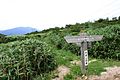
 Sign along the Kyūshū Shizen Hodō trail.jpg 984 × 738; 1.17 MB
-
 Tanzawa 21.jpg 1,063 × 746; 347 KB
-
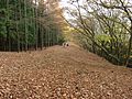
 Tatodairagoya.JPG 5,184 × 3,456; 8.55 MB
-
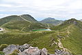
 The mountaintop of Mt. Naeba.jpg 4,534 × 3,003; 5.57 MB
-
 Trail for viewpoint of Tenkunosato s2.JPG 5,184 × 3,456; 9.64 MB
-
 Trail for viewpoint of Tenkunosato.JPG 5,184 × 3,456; 10.91 MB
-
 Trail of Mount Shirouma and Alpine plants.JPG 5,184 × 3,456; 13.04 MB
-
 Trail of Mt. Naccho 01.jpg 4,320 × 3,240; 2.4 MB
-
 Trail of Mt. Naccho 02.jpg 4,320 × 3,240; 2.43 MB
-
 Trail of Mt. Naccho 03.jpg 4,320 × 3,240; 2.33 MB
-
 Trail of Mt. Naccho 04.jpg 4,320 × 3,240; 2.39 MB
-
 不動山 - panoramio.jpg 400 × 300; 90 KB
-
 北八ヶ岳「坪庭」 - panoramio (3).jpg 2,816 × 2,112; 2.72 MB
-
 妙見倉まであと100m - panoramio - helohelon.jpg 4,288 × 2,848; 3.13 MB
-
 妙見倉まであと100m - panoramio.jpg 2,848 × 4,288; 4.09 MB
-
 御大師山・四国八十八ヶ所巡り - panoramio - mikeneko.jpg 600 × 800; 631 KB
-
 御大師山・四国八十八ヶ所巡り - panoramio.jpg 600 × 800; 650 KB
-
 根室フットパス.jpg 1,600 × 1,200; 328 KB
-
 樽前山火口原.JPG 1,936 × 1,288; 1.37 MB
-
 神福山アクセス路.png 1,280 × 960; 3.12 MB


.jpg)


.jpg)


.JPG)
.JPG)


.jpg)


.jpg)


