Category:Hilfield
Jump to navigation
Jump to search
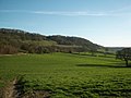
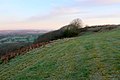
English: Hilfield is a hamlet in west Dorset, England, situated under the scarp face of the Dorset Downs seven miles south of Sherborne. The village has a population of 52 , mostly residents of the Friary of Saint Francis.
village and civil parish in Dorset, United Kingdom  | |||||
| Upload media | |||||
| Instance of | |||||
|---|---|---|---|---|---|
| Location | Dorset, South West England, England | ||||
 | |||||
Subcategories
This category has only the following subcategory.
H
Media in category "Hilfield"
The following 47 files are in this category, out of 47 total.
-
 Barns at Church Farm Hilfield - geograph.org.uk - 1120467.jpg 640 × 433; 94 KB
-
 Bell and cat at the Friary of St Francis - geograph.org.uk - 5650936.jpg 427 × 640; 120 KB
-
 Bluebells in the woods - geograph.org.uk - 1290999.jpg 640 × 483; 169 KB
-

-

-
-
 Countryside near Chetnole - geograph.org.uk - 1120469.jpg 640 × 428; 83 KB
-
 Countryside near Hermitage - geograph.org.uk - 1318741.jpg 640 × 480; 71 KB
-
 Countryside near Hermitage - geograph.org.uk - 1318743.jpg 640 × 480; 67 KB
-
 Countryside near Hermitage - geograph.org.uk - 1318862.jpg 640 × 480; 91 KB
-
 Countryside near Hilfield - geograph.org.uk - 1120468.jpg 640 × 428; 67 KB
-
 Farmland near Newlands Farm - geograph.org.uk - 5712219.jpg 640 × 427; 45 KB
-
 Gore Hill - geograph.org.uk - 1120457.jpg 640 × 428; 112 KB
-
 Gore Hill, footpath marker - geograph.org.uk - 4723882.jpg 768 × 1,024; 228 KB
-
 Hedgerow near Stone's Farm - geograph.org.uk - 1318739.jpg 640 × 480; 98 KB
-
 Hermitage, gated woodland track and bridleway - geograph.org.uk - 2349083.jpg 1,280 × 960; 616 KB
-
 Hilfield Hill - geograph.org.uk - 2996641.jpg 900 × 596; 437 KB
-
 Hilfield Hill - geograph.org.uk - 4465456.jpg 800 × 600; 242 KB
-
 Hilfield Hill - geograph.org.uk - 4465462.jpg 800 × 533; 245 KB
-
 Hilfield Hill Local Nature Reserve - geograph.org.uk - 1913236.jpg 800 × 600; 153 KB
-
 Hilfield Hill, track - geograph.org.uk - 1913242.jpg 640 × 480; 108 KB
-
 Hilfield Lane - geograph.org.uk - 5416999.jpg 640 × 480; 146 KB
-
 Hilfield Manor - geograph.org.uk - 489774.jpg 640 × 480; 162 KB
-
 Hilfield, a green view - geograph.org.uk - 1876334.jpg 640 × 480; 73 KB
-

-
 Hilfield, pasture land in evening light - geograph.org.uk - 2349075.jpg 1,280 × 960; 266 KB
-

-
 Hilfield, postbox and noticeboard - geograph.org.uk - 1876353.jpg 640 × 480; 97 KB
-
 Hilfield, postbox № DT2 5 - geograph.org.uk - 1876347.jpg 480 × 640; 120 KB
-
 Hilfield, Stone’s Farm junction - geograph.org.uk - 1876339.jpg 640 × 480; 84 KB
-
 Hillfield Hill nature reserve - geograph.org.uk - 5021538.jpg 640 × 439; 77 KB
-
 Hillfield Hill, view - geograph.org.uk - 1913138.jpg 800 × 600; 176 KB
-
 House Martin Construction Site - geograph.org.uk - 1318742.jpg 640 × 442; 125 KB
-
 Information Board at Hermit's Wood - geograph.org.uk - 5650940.jpg 427 × 640; 55 KB
-
 Minor road near Hilfield - geograph.org.uk - 2476028.jpg 640 × 481; 81 KB
-
 Muck Wagon - geograph.org.uk - 1318737.jpg 640 × 458; 75 KB
-
 Pond Farm - geograph.org.uk - 5650927.jpg 640 × 427; 44 KB
-
 Ramshorn Hill - geograph.org.uk - 4465452.jpg 800 × 600; 293 KB
-
-
 Road towards Hilfield church - geograph.org.uk - 5417176.jpg 640 × 480; 141 KB
-
 Sunny Dorset Lane - geograph.org.uk - 1120470.jpg 640 × 430; 91 KB
-
 Telegraph Hill - geograph.org.uk - 1120127.jpg 640 × 428; 59 KB
-
 Woodland path near Hilfield - geograph.org.uk - 2476000.jpg 640 × 480; 117 KB
-
 Farmland near Hilfield - geograph.org.uk - 490418.jpg 640 × 480; 115 KB
-
 Lower Farm - geograph.org.uk - 489775.jpg 640 × 480; 131 KB
-

-
 The Friary of St Francis, Hilfield - geograph.org.uk - 407865.jpg 640 × 480; 103 KB


,_Hilfield_-_geograph.org.uk_-_2476015.jpg)
,_Hilfield_-_geograph.org.uk_-_2476020.jpg)


