Category:Historical images of Galilee
Jump to navigation
Jump to search
Subcategories
This category has the following 18 subcategories, out of 18 total.
A
C
- Historical images of Capernaum (32 F)
E
- Historical images of Eilon (85 F)
H
- Historical images of Birya (67 F)
- Historical images of Metula (205 F)
- Historical images of Shefa-'Amr (54 F)
K
N
S
Media in category "Historical images of Galilee"
The following 110 files are in this category, out of 110 total.
-
 'Teygart (i.e., Tegart) Wall' wire fence on North frontier LOC matpc.19289.jpg 3,176 × 2,262; 1.12 MB
-

-
 Abellin Old Church.jpg 759 × 1,185; 480 KB
-
 Acre Bay. 1938.jpg 600 × 441; 50 KB
-

-
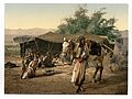
 Bedouins and their tents Holy Land.jpg 1,096 × 856; 156 KB
-
 Bedouins and their tents, Holy Land-LCCN2002725068.jpg 3,782 × 2,822; 2.92 MB
-

-
-
 Bedouin tents and occupants Holy Land.jpg 1,083 × 852; 192 KB
-
 Bedouin tents and occupants, Holy Land-LCCN2002725069.jpg 3,730 × 2,808; 3.59 MB
-

-
 The River Jordan Holy Land.jpg 1,096 × 859; 156 KB
-
 The River Jordan, Holy Land-LCCN2002725029.jpg 3,782 × 2,834; 2.98 MB
-
 Camí en direcció a la frontera.jpeg 1,556 × 720; 112 KB
-
 Cana 1912.jpg 672 × 553; 214 KB
-
 Dan 1912.jpg 672 × 554; 245 KB
-
 Ein HaMifratz. 1938.jpg 398 × 600; 37 KB
-
 FadilSabaMountofBeatitudes.jpg 1,012 × 512; 514 KB
-
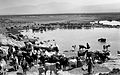
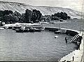
 Ferry between Samakh and Tiberias. 1919.jpg 600 × 560; 49 KB
-

-
 Galilee (997008136106905171).jpg 1,330 × 1,305; 560 KB
-
 Galilee (997008136107105171).jpg 1,330 × 1,330; 1.54 MB
-
 Galilee (997008136107205171).jpg 1,297 × 1,265; 1.66 MB
-
-
 Galilee. 1898-1946. Matson. matpc.08977.jpg 4,910 × 2,972; 7.89 MB
-

-

-

-
 GENERAL VIEW OF THE BEIT SHEAN VALLEY NEAR BEIT ALFA. נוף של עמק בית שאן.D20-076.jpg 3,072 × 2,048; 851 KB
-
 GENERAL VIEW OF THE BEIT SHEAN VALLEY NEAR BEIT ALFA. נוף של עמק בית שאן.D835-069.jpg 3,048 × 2,065; 1.37 MB
-
 Glil.jpg 706 × 699; 366 KB
-
 Hanita1938.JPG 1,024 × 440; 264 KB
-
 Haula swamps 1923.jpg 5,906 × 4,134; 15.86 MB
-
 Hittin-Khalidi-1934.JPG 1,745 × 1,079; 332 KB
-
 Horns of HattinFadil.jpg 1,012 × 652; 563 KB
-
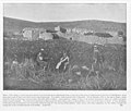
 Horse riding at the Upper Galilee. 1900-1910 (id.22714853).jpg 1,849 × 1,644; 607 KB
-

-
 IDF exercises (997008137399805171.jpg 1,289 × 1,297; 1.56 MB
-
 IDF exercises (997008137399905171.jpg 1,322 × 1,314; 1.71 MB
-
 IDF exercises (997008137400005171.jpg 1,297 × 1,322; 1.9 MB
-
 IDF exercises (997008137400105171.jpg 1,273 × 1,289; 1.59 MB
-
 IDF exercises (997008137400205171.jpg 1,322 × 1,322; 2.09 MB
-
 IDF exercises (997008137400305171.jpg 1,338 × 1,314; 1.91 MB
-
 IDF exercises (997008137400405171.jpg 1,281 × 1,257; 1.8 MB
-
 IDF exercises (997008137400505171.jpg 1,273 × 1,297; 1.78 MB
-
 IDF exercises (997008137400605171.jpg 1,305 × 1,338; 1.93 MB
-

-
 Jewish Pilgrims Celebrating in Meiron c. 1920.jpg 3,498 × 1,898; 3.53 MB
-
 JEWISH SHEPHERD IN THE GALILEE. רועה צאן עיזים עיברי, בגליל.D269-067.jpg 3,072 × 2,048; 815 KB
-
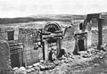 Kafr Bir'im synagogue ruins.jpg 716 × 496; 84 KB
-
 Lake Huleh & Mt. Hermon from the Safad road 1940 1946.jpg 5,306 × 3,750; 4.41 MB
-

-

-
 Maats Ein Gev Pier.jpg 2,399 × 1,765; 790 KB
-
 Magdala um 1900.jpg 3,421 × 2,469; 1.24 MB
-
 Margaliot.jpg 800 × 522; 288 KB
-
 Migdal 2 sea of galilee 1903.jpg 655 × 435; 86 KB
-
 Migdal sea of galil 1910.jpg 1,502 × 2,016; 435 KB
-
 Migdal sea of galilee 1903.jpg 672 × 573; 178 KB
-

-
 Mount TaborFs7.jpg 1,040 × 650; 224 KB
-
 Nain 1903.jpg 656 × 582; 195 KB
-
 Nain. 89.Holy land photographed. Daniel B. Shepp. 1894.jpg 5,404 × 4,609; 5.03 MB
-
 PikiWiki Israel 16812 Cities in Israel.jpg 717 × 479; 56 KB
-
 PikiWiki Israel 46795 Drying HaHula Lake.jpg 1,269 × 1,664; 625 KB
-
 PikiWiki Israel 46796 Drying HaHula Lake.jpg 1,317 × 1,865; 693 KB
-
 PikiWiki Israel 4799 Meron.jpg 1,102 × 717; 330 KB
-
 PikiWiki Israel 4804 Meron.jpg 1,093 × 716; 225 KB
-
 PikiWiki Israel 4917 Geography of Israel.jpg 977 × 617; 299 KB
-
 PikiWiki Israel 5884 tel hai in palestine.jpg 1,097 × 765; 153 KB
-
 PikiWiki Israel 5885 kibutz kinneret in palestine.jpg 1,097 × 783; 172 KB
-
 PikiWiki Israel 5887 kibuts ein harod in the 30.jpg 1,061 × 801; 127 KB
-
 PikiWiki Israel 5888 rosh pina in the 30.jpg 1,070 × 738; 159 KB
-
 PikiWiki Israel 6168 Rosh- pina in the 1930th.jpg 1,114 × 752; 164 KB
-
 PikiWiki Israel 8741 Pioneers in Kibbutz Ein Harod.jpg 408 × 270; 30 KB
-
 Pilgrims on the way to Meiron c. 1920.jpg 3,481 × 2,142; 4.48 MB
-
 Roman bridge over the Dan River 1912-2.jpg 459 × 388; 116 KB
-
 Roman bridge over the Dan River 1912.jpg 656 × 555; 240 KB
-
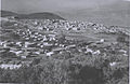
 V10p634001 Safed.jpg 518 × 366; 99 KB
-
 Sasa.jpg 720 × 708; 382 KB
-
 Sea of Galilee from Semakh Road. Matsom. matpc.03303. 1938.jpg 5,400 × 3,767; 10.09 MB
-

-
 THE BEIT NETOFA VALLEY IN LOWER GALILEE. עמק בית נטופה בגליל התחתון.D834-102.jpg 3,066 × 2,052; 1.44 MB
-
 The grave of Rabbi Shimon bar Yochai1 (before 1899) (cropped).jpg 1,495 × 1,035; 1.76 MB
-
 The grave of Rabbi Shimon bar Yochai1 (before 1899).jpg 1,520 × 1,080; 1.55 MB
-

-

-
 The Site of Ancient Bethsaida.jpg 798 × 768; 179 KB
-

-
 Yavneel early 20s.jpg 1,386 × 899; 167 KB
-
 בדרך להר חרמון צילום- ליאו קאהן 1912 - i וגנרi btm821.jpeg 582 × 453; 135 KB
-
 בנית גדר הצפון לאורך גבול הלבנון-JNF022307.jpeg 600 × 504; 40 KB
-
 הקמת גדר הצפון.jpg 643 × 499; 57 KB
-
 הרי נצרת - הגדר של יער המלך גורג'-JNF034935.jpeg 409 × 600; 53 KB
-
 הרי נצרת - יער המלך גורג', דירוג-JNF034978.jpeg 600 × 409; 56 KB
-
 הרי נצרת - יער המלך גורג'-JNF034976.jpeg 600 × 409; 75 KB
-
 הרי נצרת - יער המלך גורג'-JNF034977.jpeg 600 × 409; 80 KB
-
 הרי נצרת מקום שם ינטע היער ע"ש המלך ג'ורג'-JNF044665.jpeg 600 × 429; 51 KB
-
 הרי נצרת מקום שם ינטע היער ע"ש המלך ג'ורג'.-JNF044668.jpeg 600 × 425; 64 KB
-

-

-

-
 חצור - מראה נוף בגליל על כביש הגבול.-JNF028050.jpeg 600 × 413; 58 KB
-

-
 חריש בגליל תחת שמירה-JNF003464.jpeg 600 × 398; 53 KB
-
 חריש בגליל-JNF003465.jpeg 600 × 398; 59 KB
-
 כפר לרגלי הר חרמון צילום- ליאו קאהן 1912 - i וגנרi btm819.jpeg 571 × 453; 138 KB
-
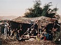
 מעון קייצי של בדואים ברקע החרמון צילום ליאו קאהן 1912 btm133.jpeg 425 × 340; 79 KB
-
 שיירת גמלים בדרך להר חרמון צילום- ליאו קאהן 1912 - i וגנרi btm823.jpeg 561 × 453; 130 KB
_Wall%27_wire_fence_on_North_frontier_LOC_matpc.19289.jpg)


_-_Village_Priest_in_Kfar_Yassif.jpg)
.jpg)
.jpg)
.jpg)
._Mallaha_source_N.W._of_Huleh_Lake,_Mt._Hermon_in_distance._matpc.20800.jpg)


.jpg)
,_Lake_Huleh_%26_Mt._Hermon_from_the_Safad_road_LOC_matpc.14490.jpg)


-LCCN2002725056.jpg)


-PHAL-1615893.png)

-PHAL-1615887.png)


_(cropped).jpg)
.jpg)