Category:History of indigenous peoples of the Great Lakes Region
Jump to navigation
Jump to search
| NO WIKIDATA ID FOUND! Search for History of indigenous peoples of the Great Lakes Region on Wikidata | |
| Upload media |
English: History of the Great Lakes tribes in what is now known as the United States and Canada.
Subcategories
This category has the following 21 subcategories, out of 21 total.
B
E
F
H
I
- Indian Land Grants (12 F)
M
N
- Nanfan Treaty (1701) (3 F)
O
P
S
T
- Treaty of St. Louis (1804) (1 F)
W
Media in category "History of indigenous peoples of the Great Lakes Region"
The following 18 files are in this category, out of 18 total.
-
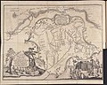
 1744 bellin map Carte des lacs du Canada.jpg 5,827 × 3,642; 7.82 MB
-
 1755 Bellin Map of the Great Lakes - Geographicus - GreatLakes-bellin-1755.jpg 4,000 × 3,215; 3.49 MB
-
 1825 Prairie du Chien Line.jpg 1,275 × 1,650; 495 KB
-
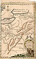 A Map of the Western parts of the Colony of Virginia, 1754.jpg 952 × 1,544; 1.78 MB
-
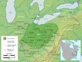
 Anishinaabe-Anishinini Distribution Map.svg 1,022 × 993; 89 KB
-
-

-
 Hopewell Exchange Network HRoe 2010.jpg 808 × 1,000; 582 KB
-

-
 Mascouten01.png 1,366 × 1,140; 2.31 MB
-
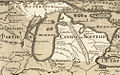 Michigan 1718.jpg 1,006 × 625; 374 KB
-
 Ohio Country de.png 1,217 × 920; 1.42 MB
-
 Ohio Country en.png 1,217 × 920; 1.41 MB
-
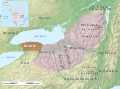
 Pt Peninsula and Saugeen complexes map HRoe 2010.jpg 600 × 500; 267 KB
-

-
 Thomas Hutchins Map of Henry Bouquet's 1764 Expedition.jpg 9,706 × 7,739; 20.11 MB
-

-
 Wenro Territory ca1630 map-en.svg 2,300 × 1,700; 9.76 MB


.jpg)

_(14755982396).jpg)


_(14782566514).jpg)
