Category:History of the canton of Graubünden
Jump to navigation
Jump to search
Cantons of Switzerland: Aargau (AG) · Appenzell Ausserrhoden (AR) · Appenzell Innerrhoden (AI) · Basel-Stadt (BS) · Basel-Landschaft (BL) · Bern (BE) · Fribourg (FR) · Geneva (GE) · Glarus (GL) · Graubünden (GR) · Jura (JU) · Luzern (LU) · Neuchâtel (NE) · Nidwalden (NW) · Obwalden (OW) · Schaffhausen (SH) · Schwyz (SZ) · Solothurn (SO) · St. Gallen (SG) · Thurgau (TG) · Ticino (TI) · Uri (UR) · Valais (VS) · Vaud (VD) · Zug (ZG) · Zürich (ZH)
aspect of Swiss history | |||||
| Upload media | |||||
| Instance of | |||||
|---|---|---|---|---|---|
| Part of | |||||
| Facet of | |||||
| Location | Grisons, Switzerland | ||||
| |||||
Subcategories
This category has the following 23 subcategories, out of 23 total.
Media in category "History of the canton of Graubünden"
The following 33 files are in this category, out of 33 total.
-
 Baliaggi-transalpini rev.png 1,500 × 1,516; 572 KB
-
 Bündner Synodalbrief von 1537.jpg 1,936 × 2,592; 2.05 MB
-
 Bündner Urkunde 1284.jpg 3,611 × 708; 915 KB
-
 CH-NB-200 Schweizer Bilder-nbdig-18634-page291.tif 1,204 × 1,665; 4.61 MB
-
 Chur 1622.jpg 3,494 × 2,412; 4.95 MB
-
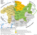
 Churraetien.png 2,500 × 2,160; 1.06 MB
-
 Davos, Grave of Willem Jan Holsboer and Alexander Spengler.JPG 1,934 × 1,451; 2.06 MB
-
 DomatEms Grabmal.jpg 3,649 × 2,689; 2.78 MB
-
 DomatEms Husaren.jpg 1,695 × 3,049; 2.06 MB
-
 Drei Bünde Karte 1768.jpg 5,184 × 3,888; 5.95 MB
-
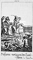
 Fähnlilupf 1572.JPG 2,046 × 1,495; 1.68 MB
-
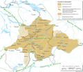
 Geschichte Graubuenden.png 2,000 × 1,873; 504 KB
-
 Grafschaft Toggenburg.png 2,000 × 1,599; 328 KB
-
 Graubündner Milizen 1809-184800007.tif 5,374 × 3,535; 54.99 MB
-
 Herrschaften Graubuenden.png 2,500 × 2,312; 1.05 MB
-
 Jäger 1805.tif 5,254 × 3,522; 53.58 MB
-
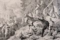
 Kampf Praettigauer Chur 1622.jpg 2,545 × 1,782; 3.41 MB
-
 Kanton Graubünden 1901.jpg 3,252 × 4,787; 2.91 MB
-
 Karte Besitz-der-Sax.png 1,000 × 1,660; 160 KB
-
 Karte Stumpf 1548 markiert.png 1,466 × 2,348; 7.85 MB
-
 Karte Stumpf 1548.png 1,466 × 2,348; 7.85 MB
-
 Karte Werdenberger.png 1,500 × 2,194; 615 KB
-
 Keulen der Verzeiflung.jpg 1,898 × 1,266; 869 KB
-
 La-Repubblica-delleTre-Legh-es.svg 926 × 726; 1.89 MB
-
 La-Repubblica-delleTre-Legh.png 2,000 × 1,866; 772 KB
-
 Map Cadi.jpg 488 × 663; 124 KB
-
 Merian Luzisteig 1653.jpg 2,120 × 2,994; 3.3 MB
-
 Raetia.jpg 2,238 × 3,399; 3.06 MB
-
 Strassengesetz GR.jpg 2,095 × 2,474; 1.38 MB
-
-
 Tschudi Rätien.JPG 2,435 × 3,330; 3.97 MB
-
 Valtellina mappa.png 750 × 449; 166 KB
-
 Zegel Gotteshausbund.jpg 216 × 226; 15 KB


_(14781451154).jpg)


