Category:Hl. Christoph (Navis), new church
Jump to navigation
Jump to search
| Object location | | View all coordinates using: OpenStreetMap |
|---|
| This category shows the protected monument with the number 110467 in Austria. (Commons, de, Wikidata) |
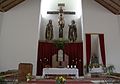
church building in Navis, Austria _02.JPG) | |||||
| Upload media | |||||
| Instance of | |||||
|---|---|---|---|---|---|
| Location | Navis, Innsbruck-Land District, Tyrol, Austria | ||||
| Street address |
| ||||
| Heritage designation | |||||
 | |||||
Media in category "Hl. Christoph (Navis), new church"
The following 10 files are in this category, out of 10 total.
-
 Hl. Christoph (Navis) 01.JPG 3,884 × 2,292; 2.03 MB
-
 Hl. Christoph (Navis) 02.JPG 3,888 × 2,592; 1.25 MB
-
 Hl. Christoph (Navis) 03.JPG 3,888 × 2,592; 1.21 MB
-
 Hl. Christoph (Navis) 04.JPG 3,668 × 2,491; 1.21 MB
-
 Hl. Christoph (Navis) 05.JPG 3,722 × 2,591; 1.35 MB
-
 Hl. Christoph (Navis) 06.JPG 2,592 × 3,888; 1.38 MB
-
 Hl. Christoph (Navis) 07.JPG 2,592 × 3,888; 3.28 MB
-
 Hl. Christoph (Navis) 08.JPG 2,239 × 2,591; 985 KB
-
 Navis 01.JPG 3,888 × 2,592; 1.69 MB
-
 Navis N.JPG 3,572 × 2,056; 4.77 MB
_01.JPG)
_03.JPG)
_04.JPG)
_05.JPG)
_06.JPG)
_07.JPG)
_08.JPG)

