Category:Hoe and Worthing
Jump to navigation
Jump to search
English: Hoe and Worthing is a civil parish in the Breckland district, in the county of Norfolk, England.
civil parish in Breckland, Norfolk, England | |||||
| Upload media | |||||
| Instance of | |||||
|---|---|---|---|---|---|
| Location | Breckland, Norfolk, East of England, England | ||||
| Area |
| ||||
| |||||
Subcategories
This category has the following 2 subcategories, out of 2 total.
H
W
Media in category "Hoe and Worthing"
The following 59 files are in this category, out of 59 total.
-
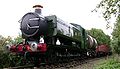 9466 at Hoe.jpg 762 × 439; 61 KB
-
 A concessionary path - geograph.org.uk - 1310183.jpg 640 × 480; 98 KB
-
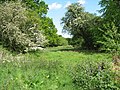 An unimproved meadow - geograph.org.uk - 1310074.jpg 640 × 480; 151 KB
-

-
 Bridge 1698 - geograph.org.uk - 2217000.jpg 800 × 531; 144 KB
-
 Bridge 1698 - Vegetation Clearance Team - geograph.org.uk - 2217447.jpg 800 × 531; 161 KB
-
 Bridge 1701 - geograph.org.uk - 2374233.jpg 800 × 531; 199 KB
-
 Bridge across disused railway line - geograph.org.uk - 607068.jpg 640 × 480; 67 KB
-
 Concessionary path through Hoe Rough - geograph.org.uk - 1310223.jpg 480 × 640; 157 KB
-
 Disused railway line - level crossing - geograph.org.uk - 607265.jpg 480 × 640; 78 KB
-
 Fire on the Line - geograph.org.uk - 2217461.jpg 800 × 531; 205 KB
-
 Footpath to Holt Road - geograph.org.uk - 2859999.jpg 4,000 × 3,000; 6.96 MB
-
 Gate on path - geograph.org.uk - 1310195.jpg 480 × 640; 155 KB
-
 Gressenhall Watermill - geograph.org.uk - 3064933.jpg 640 × 424; 289 KB
-
 Hoe Common - geograph.org.uk - 333689.jpg 640 × 480; 97 KB
-
 Hoe Common - geograph.org.uk - 333703.jpg 640 × 480; 90 KB
-
 Hoe Green - Glacial Erratic - geograph.org.uk - 2020531.jpg 800 × 531; 166 KB
-
 Hoe Green - Glacial Erratic - geograph.org.uk - 2020534.jpg 800 × 505; 167 KB
-
 Hoe Green - Glacial Erratic - geograph.org.uk - 2020538.jpg 800 × 531; 198 KB
-
 Hoe Green - Glacial Erratic - geograph.org.uk - 2020540.jpg 800 × 531; 194 KB
-
 Hoe Green - Glacial Erratic - geograph.org.uk - 2020545.jpg 800 × 531; 199 KB
-
 Hoe Road - geograph.org.uk - 333683.jpg 640 × 480; 100 KB
-
 Hoe Rough Nature Reserve - geograph.org.uk - 1310101.jpg 640 × 480; 136 KB
-
 Hoe Rough Nature Reserve - geograph.org.uk - 1310180.jpg 640 × 480; 111 KB
-

-
 Looking northeast on unnamed road - geograph.org.uk - 607314.jpg 640 × 480; 80 KB
-
 Mid Norfolk Railway - From Bridge 1698 - geograph.org.uk - 2217417.jpg 800 × 531; 140 KB
-

-

-
 Old railway crossing gates - geograph.org.uk - 607272.jpg 640 × 480; 66 KB
-
 Path following stream - geograph.org.uk - 1310140.jpg 640 × 480; 104 KB
-
 Railway Bridge - geograph.org.uk - 1219125.jpg 640 × 480; 76 KB
-
 Railway line to North Elmham - geograph.org.uk - 607269.jpg 480 × 640; 108 KB
-
 Road to Hoe - geograph.org.uk - 2216954.jpg 800 × 531; 75 KB
-
 Small Green at Hoe - Glacial Erratic - geograph.org.uk - 2020528.jpg 800 × 531; 152 KB
-
 Small overgrown pond - geograph.org.uk - 1310115.jpg 640 × 480; 108 KB
-
 Stream on the northern edge of Hoe Rough - geograph.org.uk - 1310132.jpg 640 × 480; 151 KB
-
 Tall poplars growing by stream - geograph.org.uk - 1310218.jpg 480 × 640; 117 KB
-
 The MNR northern extension.jpg 2,560 × 1,920; 613 KB
-
 The north-western edge of Hoe Rough - geograph.org.uk - 1310122.jpg 640 × 480; 116 KB
-
 The River Cam - geograph.org.uk - 3064591.jpg 640 × 424; 310 KB
-

-

-

-

-
 Weak Bridge - geograph.org.uk - 2216980.jpg 800 × 531; 135 KB
-
 Yellow meadow ants live here - geograph.org.uk - 1310251.jpg 640 × 480; 148 KB
-
 Young bracken fronds - geograph.org.uk - 1310227.jpg 640 × 480; 149 KB
-

-

-

-
 Entrance to Manor Farm - geograph.org.uk - 607175.jpg 640 × 480; 73 KB
-
 Flytipping beside disused railway track - geograph.org.uk - 607292.jpg 480 × 640; 140 KB
-
 Manor Farm - geograph.org.uk - 607177.jpg 640 × 480; 70 KB
-

-
 Pig farm near East Dereham - geograph.org.uk - 390967.jpg 640 × 480; 69 KB
-

-

-
 Two unnamed roads meet near Hoe Lodge - geograph.org.uk - 607317.jpg 640 × 480; 52 KB


