Category:Hollins Green
Jump to navigation
Jump to search
village in Warrington, Cheshire, England  | |||||
| Upload media | |||||
| Instance of | |||||
|---|---|---|---|---|---|
| Location | Rixton-with-Glazebrook, Warrington, Cheshire, North West England, England | ||||
 | |||||
English: Hollins Green is a village located on the eastern edge of Warrington, England close to the border of the City of Salford, as designated by the River Glaze. The village contains under a thousand residential properties and the most recent significant increase in this number was the construction of Marsh Brook Close off School Lane.
Media in category "Hollins Green"
The following 12 files are in this category, out of 12 total.
-
 Hollins Green - Birch Road - geograph.org.uk - 1338654.jpg 640 × 480; 193 KB
-
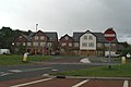
 Hollins Green - The Black Swan Pub - geograph.org.uk - 1338655.jpg 640 × 480; 175 KB
-
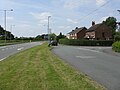 Hollins Green - West Access From A57 - geograph.org.uk - 1338653.jpg 640 × 480; 163 KB
-
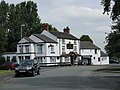
 Hollins Green - Ye Olde Red Lion Pub - geograph.org.uk - 1338650.jpg 640 × 480; 139 KB
-
 Hollins Green Panorama - geograph.org.uk - 1338652.jpg 640 × 480; 151 KB
-
-
 Manchester Road - geograph.org.uk - 27226.jpg 640 × 480; 81 KB
-
 A good day for ploughing - geograph.org.uk - 532770.jpg 640 × 355; 70 KB
-
 Curtishulme Farm, Middlewich - geograph.org.uk - 376259.jpg 640 × 442; 95 KB
-
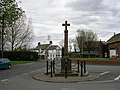 Hollins Green War Memorial - geograph.org.uk - 2731.jpg 640 × 480; 52 KB
-
 Hollinsgreen, Cheshire - geograph.org.uk - 376265.jpg 640 × 452; 106 KB
-
 Newly ploughed - geograph.org.uk - 532760.jpg 640 × 480; 133 KB


