Category:Hoofdstraat 1, Veghel
Jump to navigation
Jump to search
| Object location | | View all coordinates using: OpenStreetMap |
|---|
.JPG) | |||||
| Upload media | |||||
| Instance of | |||||
|---|---|---|---|---|---|
| Location | Veghel, Meierijstad, North Brabant, Netherlands | ||||
| Street address |
| ||||
| Located on street | |||||
| Architectural style | |||||
| Heritage designation |
| ||||
 | |||||
|
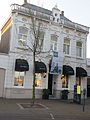
This is a category about rijksmonument number 521268
|
| Address |
|
Media in category "Hoofdstraat 1, Veghel"
The following 5 files are in this category, out of 5 total.
-
 Hoofdstraat 1a, Veghel (2).JPG 3,000 × 4,000; 3.15 MB
-
 Hoofdstraat 1a, Veghel.JPG 3,000 × 4,000; 2.76 MB
-
 T.T Herenhuis Hoofdstraat 1 Veghel (1).JPG 3,072 × 4,608; 3.2 MB
-
 T.T Herenhuis Hoofdstraat 1 Veghel (2).JPG 3,072 × 4,608; 3.14 MB
-
 Veghel-Hoofdstraat-Markt.jpg 2,988 × 2,000; 4.13 MB
.JPG)

.JPG)
