Category:Hoog Beek en Royen
Jump to navigation
Jump to search
| Object location | | View all coordinates using: OpenStreetMap |
|---|
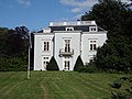
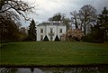
building in Zeist, Netherlands  | |||||
| Upload media | |||||
| Instance of | |||||
|---|---|---|---|---|---|
| Part of | |||||
| Location | Zeist, Utrecht, Netherlands | ||||
| Street address |
| ||||
| Located on street |
| ||||
| Heritage designation | |||||
 | |||||
|
This is a category about rijksmonumentcomplex number 510232
|
Landhuis:
|
This is a category about rijksmonument number 510233
|
Historisch park:
|
This is a category about rijksmonument number 510234
|
Speelhuisje:
|
This is a category about rijksmonument number 510235
|
Koetshuis:
|
This is a category about rijksmonument number 510236
|
| Address |
|
Subcategories
This category has only the following subcategory.
O
Media in category "Hoog Beek en Royen"
The following 34 files are in this category, out of 34 total.
-
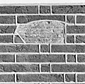 Gedenksteen speelhuisje bij Hoog Beek en Royen - Zeist - 20368988 - RCE.jpg 1,200 × 1,195; 503 KB
-

-

-

-
 Ingangspartij van het huis, vóór de restauratie - Zeist - 20221566 - RCE.jpg 1,198 × 1,200; 247 KB
-
 Interieur, begane grond, kamer - Zeist - 20368969 - RCE.jpg 945 × 1,200; 133 KB
-
 Interieur, begane grond, kamer - Zeist - 20368970 - RCE.jpg 1,200 × 950; 147 KB
-
 Interieur, begane grond, kamer, - Zeist - 20368979 - RCE.jpg 1,200 × 941; 159 KB
-
 Interieur, begane grond, kamer, boekenkast - Zeist - 20368975 - RCE.jpg 812 × 1,200; 186 KB
-
 Interieur, begane grond, kamer, detail deurpartij - Zeist - 20368978 - RCE.jpg 1,188 × 1,200; 223 KB
-
 Interieur, begane grond, kamer, detail openslaande deuren - Zeist - 20368972 - RCE.jpg 1,195 × 1,200; 258 KB
-

-
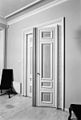 Interieur, begane grond, kamer, deurpartij - Zeist - 20368976 - RCE.jpg 812 × 1,200; 134 KB
-
 Interieur, begane grond, kamer, schouw - Zeist - 20368971 - RCE.jpg 804 × 1,200; 122 KB
-
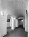 Interieur, kelder - Zeist - 20368986 - RCE.jpg 938 × 1,200; 160 KB
-
 Interieur, kelder - Zeist - 20368987 - RCE.jpg 1,200 × 956; 179 KB
-
 Interieur, verdieping, trappenhuis - Zeist - 20368981 - RCE.jpg 936 × 1,200; 162 KB
-
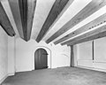
 Interieur, zolder met houten balken, - Zeist - 20368984 - RCE.jpg 1,200 × 956; 164 KB
-
 Interieur, zolder met houten balken, werkkamer - Zeist - 20368982 - RCE.jpg 941 × 1,200; 167 KB
-
 Landhuis Hoog Beek en Rooyen, gelegen aan de Driebergse weg in Zeist, RP-F-2007-361-10.jpg 5,666 × 4,490; 3.81 MB
-
 Landhuis Hoog Beek en Rooyen, gelegen aan de Driebergse weg in Zeist, RP-F-2007-361-11.jpg 6,372 × 4,714; 3.77 MB
-
 Monument-7.jpg 3,456 × 2,304; 4.89 MB
-
 Overzicht van het huis vanaf de Driebergseweg - Zeist - 20221562 - RCE.jpg 1,200 × 810; 192 KB
-

-
 Overzicht, vóór de restauratie - Zeist - 20221565 - RCE.jpg 1,200 × 958; 256 KB
-
 RM510233 Hoog Beek en Royen.JPG 4,320 × 3,240; 1.77 MB
-
 Sparrenheuvel Zeist.jpg 1,501 × 1,009; 381 KB
-
 Tekening van het huis en landschapspark - Zeist - 20221560 - RCE.jpg 1,200 × 944; 261 KB
-
 Tekening van het huis en landschapspark - Zeist - 20221561 - RCE.jpg 1,200 × 942; 279 KB
-
 Zeist Hoog Beek en Royen Achterzijde.jpg 3,538 × 2,673; 3.42 MB
-
 Zeist Hoog Beek en Royen Koetshuis.jpg 3,146 × 2,431; 3.4 MB
-
 Zeist Hoog Beek en Royen Park.JPG 3,648 × 2,736; 4.19 MB
-
 Zeist Hoog Beek en Royen Zijkant.JPG 3,648 × 2,736; 4.27 MB
-
 Zeist Netherlands (33699043).jpeg 1,024 × 677; 441 KB


.jpeg)