Category:Hoogstraat 21, Veghel
Jump to navigation
Jump to search
| Object location | | View all coordinates using: OpenStreetMap |
|---|
house in Veghel, Netherlands .JPG) | |||||
| Upload media | |||||
| Instance of | |||||
|---|---|---|---|---|---|
| Location | Veghel, Meierijstad, North Brabant, Netherlands | ||||
| Street address |
| ||||
| Located on street | |||||
| Heritage designation |
| ||||
 | |||||
|
This is a category about rijksmonument number 521269
|
| Address |
|
Media in category "Hoogstraat 21, Veghel"
The following 6 files are in this category, out of 6 total.
-
 Hoogstraat 21, Veghel.JPG 4,000 × 3,000; 3.45 MB
-
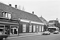 Overzicht - Veghel - 20239999 - RCE.jpg 1,200 × 788; 204 KB
-
 Rechter zijgevel - Veghel - 20240001 - RCE.jpg 1,200 × 788; 335 KB
-
 T.T Woonhuis Hoogstraat 21 Veghel (1).JPG 4,608 × 3,072; 3.45 MB
-
 T.T Woonhuis Hoogstraat 21 Veghel (2).JPG 4,608 × 3,072; 3.37 MB
-
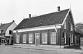 Voor- en rechter zijgevel - Veghel - 20240000 - RCE.jpg 1,200 × 780; 205 KB


.JPG)
