Category:Hoogstraat 33, Nieuwpoort
Jump to navigation
Jump to search
| Object location | | View all coordinates using: OpenStreetMap |
|---|
building in Molenwaard, Netherlands  | |||||
| Upload media | |||||
| Instance of | |||||
|---|---|---|---|---|---|
| Location | Nieuwpoort, South Holland, Netherlands | ||||
| Street address |
| ||||
| Located on street |
| ||||
| Heritage designation |
| ||||
 | |||||
|
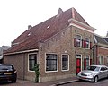
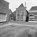
This is a category about rijksmonument number 30591
|
| Address |
|
Media in category "Hoogstraat 33, Nieuwpoort"
The following 6 files are in this category, out of 6 total.
-
 Nieuwpoort Hoogstraat 35.jpg 3,737 × 2,987; 3.77 MB
-
 RM30591 Nieuwpoort - Hoogstraat 33.jpg 1,944 × 2,592; 1.2 MB
-
 Voorgevel - Nieuwpoort - 20165819 - RCE.jpg 807 × 1,200; 167 KB
-
 Voorgevel - Nieuwpoort - 20165821 - RCE.jpg 1,195 × 1,200; 324 KB
-
 Voorgevel - Nieuwpoort - 20165828 - RCE.jpg 1,183 × 1,200; 320 KB
-
 Voorgevel met 35 - Nieuwpoort - 20165820 - RCE.jpg 1,192 × 1,200; 301 KB


