Category:Hoogstraat 7, Montfoort
Jump to navigation
Jump to search
| Object location | | View all coordinates using: OpenStreetMap |
|---|
building in Montfoort, Netherlands  | |||||
| Upload media | |||||
| Instance of | |||||
|---|---|---|---|---|---|
| Location | Montfoort, Utrecht, Netherlands | ||||
| Street address |
| ||||
| Located on street |
| ||||
| Heritage designation |
| ||||
 | |||||
|
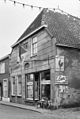
This is a category about rijksmonument number 30051
|
| Address |
|
Media in category "Hoogstraat 7, Montfoort"
The following 3 files are in this category, out of 3 total.
-
 Rijksmonument Montfoort Hoogstraat 7 In de pot.JPG 3,968 × 2,976; 2.66 MB
-
 Rijksmonument Montfoort Hoogstraat 7.JPG 2,976 × 3,968; 2.45 MB
-
 Voorgevel - Montfoort - 20160702 - RCE.jpg 805 × 1,200; 210 KB

