Category:Hopton on Sea
Jump to navigation
Jump to search
English: Hopton on Sea is a village, civil parish and seaside resort on the coast of eastern England in the county of Norfolk. It is located some 8 km south of the town of Great Yarmouth and very close to the UK's most easterly point, Lowestoft Ness.
Nederlands: Hopton on Sea is een plaats in het bestuurlijke gebied Great Yarmouth, in het Engelse graafschap Norfolk. De plaats telt 2.706 inwoners.
village and civil parish in Norfolk, United Kingdom  | |||||
| Upload media | |||||
| Instance of | |||||
|---|---|---|---|---|---|
| Location | Great Yarmouth, Norfolk, East of England, England | ||||
| Area |
| ||||
| Different from | |||||
 | |||||
Subcategories
This category has the following 3 subcategories, out of 3 total.
I
M
Media in category "Hopton on Sea"
The following 200 files are in this category, out of 302 total.
(previous page) (next page)-
 A balancing act - geograph.org.uk - 1719767.jpg 640 × 480; 144 KB
-
 A crumbling clifftop path - geograph.org.uk - 1719748.jpg 640 × 603; 113 KB
-

-
 A pair of cottages in Lowestoft Road - geograph.org.uk - 1717738.jpg 640 × 480; 116 KB
-
 A path towards Hopton Beach - geograph.org.uk - 2680595.jpg 800 × 600; 280 KB
-
 A12 Yarmouth Road - geograph.org.uk - 3371366.jpg 3,072 × 2,304; 1.37 MB
-
 Access road to saw mill by Hopton Hall - geograph.org.uk - 3284514.jpg 640 × 480; 192 KB
-
 Accommodation at Hopton Holiday Village - geograph.org.uk - 1717945.jpg 640 × 480; 113 KB
-
 Accommodation at Hopton Holiday Village - geograph.org.uk - 1717946.jpg 640 × 458; 119 KB
-
 Approaching Hopton from the A12 - geograph.org.uk - 2962116.jpg 3,264 × 2,448; 2.53 MB
-
 Approaching Hopton Holiday Village - geograph.org.uk - 4405973.jpg 2,592 × 1,944; 1.07 MB
-
 Approaching Lowestoft Road, Hopton-on-Sea - geograph.org.uk - 2968755.jpg 3,072 × 2,304; 1.26 MB
-

-
 Beach and groynes, Gorleston-on-Sea - geograph.org.uk - 4943756.jpg 640 × 480; 58 KB
-

-
 Beach, south end of Gorleston-on-Sea - geograph.org.uk - 4943753.jpg 640 × 480; 61 KB
-
 Beacon - geograph.org.uk - 4753196.jpg 1,024 × 768; 91 KB
-
 Beacon at Hopton-on-Sea - geograph.org.uk - 5823863.jpg 640 × 453; 61 KB
-
 Breaking the waves - geograph.org.uk - 1717966.jpg 640 × 464; 112 KB
-

-
 Bungalows adjoining Gorleston golf club - geograph.org.uk - 3979439.jpg 640 × 436; 144 KB
-

-
 Camelot Road, Gorleston-on-Sea - geograph.org.uk - 3367990.jpg 3,072 × 2,304; 1.23 MB
-

-
 Clifftop caravans - geograph.org.uk - 2493039.jpg 1,024 × 768; 179 KB
-
 Clifftop path in Hopton-on-Sea - geograph.org.uk - 1717952.jpg 640 × 471; 87 KB
-
 Clifftop path to League Hole - geograph.org.uk - 1719681.jpg 480 × 640; 75 KB
-
 Clifftop properties in Hopton-on-Sea - geograph.org.uk - 1717954.jpg 640 × 480; 110 KB
-
 Clifftop shelter by League Hole - geograph.org.uk - 1717889.jpg 640 × 480; 66 KB
-
 Close to the edge - geograph.org.uk - 1719725.jpg 640 × 480; 90 KB
-
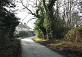
 Coast Road - geograph.org.uk - 2162332.jpg 1,024 × 743; 333 KB
-
 Coast Road - geograph.org.uk - 4944486.jpg 640 × 480; 79 KB
-
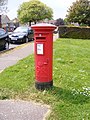
 Coast Road George V Postbox - geograph.org.uk - 2969852.jpg 3,072 × 2,304; 1.3 MB
-
 Coast Road George V Postbox - geograph.org.uk - 2969857.jpg 2,304 × 3,072; 1.62 MB
-
 Coast Road George V Postbox - geograph.org.uk - 2969859.jpg 2,304 × 3,072; 1.6 MB
-
 Coast Road George V Postbox - geograph.org.uk - 2969895.jpg 2,304 × 3,072; 1.63 MB
-
 Coast Road sign - geograph.org.uk - 2970050.jpg 3,072 × 2,304; 1.5 MB
-
 Coast Road sign - geograph.org.uk - 3368899.jpg 2,931 × 2,201; 1.93 MB
-
 Coast Road, Hopton-on-Sea - geograph.org.uk - 3368890.jpg 3,072 × 2,304; 1.32 MB
-

-
 Concrete path to the holiday park - geograph.org.uk - 1719592.jpg 640 × 480; 108 KB
-
 Cottage in Lowestoft Road - geograph.org.uk - 1717757.jpg 640 × 480; 104 KB
-
 Cottages by Homeclose Shrubbery, Hopton - geograph.org.uk - 3284575.jpg 640 × 527; 240 KB
-
 Cottages in Lowestoft Road - geograph.org.uk - 1717761.jpg 640 × 480; 102 KB
-
 Crumbling cliff - geograph.org.uk - 1719702.jpg 640 × 526; 124 KB
-

-
 Cycle path beside the A12 - geograph.org.uk - 4943799.jpg 640 × 480; 79 KB
-
 Cycleway and footpath along the A47 - geograph.org.uk - 5951203.jpg 640 × 480; 98 KB
-

-

-
 Dorking Road - geograph.org.uk - 4943811.jpg 640 × 480; 85 KB
-
-
 Dorking Road, Hopton on Sea - geograph.org.uk - 6110429.jpg 4,608 × 3,456; 3.78 MB
-
 Dorking Road, Lound - geograph.org.uk - 6110424.jpg 4,608 × 3,456; 3.99 MB
-
 Elizabeth II postbox on Links Road, Gorleston-on-Sea - geograph.org.uk - 4948934.jpg 1,823 × 2,605; 1.03 MB
-
 Entering Corton on Coast Road - geograph.org.uk - 3368900.jpg 3,072 × 2,304; 1.33 MB
-
 Entrance to Hopton Manor - geograph.org.uk - 3284550.jpg 640 × 502; 195 KB
-
 Entrance to Lakeside Manor - geograph.org.uk - 6003143.jpg 4,608 × 3,456; 3.78 MB
-
 Eroding cliff behind the revetment - geograph.org.uk - 1719567.jpg 640 × 480; 126 KB
-
 Eroding cliffs below Hopton-on-Sea - geograph.org.uk - 1719617.jpg 640 × 480; 127 KB
-
 Eroding clifftop path - geograph.org.uk - 1719694.jpg 640 × 480; 107 KB
-
 Exposed concrete - geograph.org.uk - 1719638.jpg 640 × 480; 112 KB
-
 Farm shed behind ornate security gate - geograph.org.uk - 3284511.jpg 640 × 477; 162 KB
-

-
 Field off Dorking Road - geograph.org.uk - 4943810.jpg 640 × 480; 93 KB
-
 Field off Links Road - geograph.org.uk - 3367910.jpg 3,072 × 2,304; 1.34 MB
-
 Field off Lowestoft Road - geograph.org.uk - 4943800.jpg 640 × 480; 55 KB
-
 Fields by Whitehouse Farm, Hopton - geograph.org.uk - 3284529.jpg 640 × 480; 183 KB
-
 Fields off Sidegate Road - geograph.org.uk - 3368728.jpg 3,072 × 2,304; 1.32 MB
-
 Footpath along Gorleston Beach looking south - geograph.org.uk - 3222342.jpg 3,264 × 2,448; 2.24 MB
-

-

-

-

-
 Footpath to Back Lane - geograph.org.uk - 6002462.jpg 4,608 × 3,456; 3.99 MB
-
 Footpath to Holland Road - geograph.org.uk - 6110807.jpg 4,608 × 3,456; 4.1 MB
-
 Footpath to Holland Road - geograph.org.uk - 6111757.jpg 3,000 × 4,000; 6.86 MB
-

-
 George V postbox on Coast Road, Hopton - geograph.org.uk - 4949247.jpg 1,076 × 1,844; 525 KB
-
 George VI postbox - geograph.org.uk - 1717712.jpg 436 × 640; 105 KB
-
 Golf and Bungalows - geograph.org.uk - 3246172.jpg 1,000 × 750; 128 KB
-
 Gone fishing - geograph.org.uk - 1717980.jpg 640 × 528; 83 KB
-
 Gorleston beach - south end - geograph.org.uk - 6070272.jpg 4,032 × 2,268; 3.44 MB
-
 Gorleston Golf Club - geograph.org.uk - 3367977.jpg 3,072 × 2,304; 1.4 MB
-
 Gorleston Golf Club entrance sign - geograph.org.uk - 3367976.jpg 2,304 × 3,072; 1.53 MB
-
 Gorleston golf driving range - geograph.org.uk - 3979436.jpg 640 × 424; 123 KB
-

-
 Hall Road past Oak Farm - geograph.org.uk - 3284504.jpg 640 × 480; 162 KB
-
 Hall Road past one of the Lound Lakes - geograph.org.uk - 3284488.jpg 640 × 480; 223 KB
-
 Hall Road, Hopton on Sea - geograph.org.uk - 6110431.jpg 4,608 × 3,456; 3.96 MB
-
 Hall Road, Hopton on Sea - geograph.org.uk - 6110440.jpg 4,608 × 3,456; 3.99 MB
-
 Hall Road, Hopton-on-Sea, - geograph.org.uk - 6002467.jpg 4,000 × 3,000; 3.11 MB
-
 Hall Road, Hopton-on-Sea, - geograph.org.uk - 6002848.jpg 4,000 × 3,000; 5.77 MB
-
 Hall Road, Hopton-on-Sea, - geograph.org.uk - 6002856.jpg 4,608 × 3,456; 4.43 MB
-
 Hall Road, Hopton-on-Sea, - geograph.org.uk - 6002890.jpg 4,000 × 3,000; 3.51 MB
-
 Hall Road, Hopton-on-Sea, - geograph.org.uk - 6003105.jpg 3,947 × 2,953; 4.96 MB
-
 Hall Road, Lound - geograph.org.uk - 6110449.jpg 4,608 × 3,456; 4.18 MB
-
 Hall Road, Lound - geograph.org.uk - 6110453.jpg 4,608 × 3,456; 4.06 MB
-
 Hall Road, Lound - geograph.org.uk - 6110791.jpg 4,608 × 3,456; 4.1 MB
-
 Hanging sign for 'The Turnstone', Hopton - geograph.org.uk - 5298915.jpg 2,592 × 3,456; 2.74 MB
-
 Hen Post Lane sign - geograph.org.uk - 6110420.jpg 4,000 × 3,000; 5.47 MB
-
 Hobbs Way sign - geograph.org.uk - 3369953.jpg 3,072 × 2,304; 1.66 MB
-
 Hobland Road, Gorleston-on-Sea - geograph.org.uk - 3368720.jpg 3,072 × 2,304; 1.18 MB
-
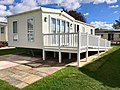 Hopton - caravan - Outdoors - ramp - patio - exterior - 2020.jpg 4,032 × 3,024; 3.26 MB
-
 Hopton Beach - geograph.org.uk - 2503811.jpg 1,600 × 1,200; 328 KB
-
 Hopton beach in 2003.jpg 640 × 480; 68 KB
-
 Hopton CoE Primary School - geograph.org.uk - 1717775.jpg 640 × 480; 92 KB
-
 Hopton Doctors Surgery - geograph.org.uk - 2969914.jpg 3,072 × 2,304; 1.27 MB
-
 Hopton Gardens in Hopton-on-Sea - geograph.org.uk - 2651646.jpg 3,648 × 2,736; 2.35 MB
-
 Hopton Holiday Park aerial image - Suffolk UK (14804735895).jpg 4,152 × 2,628; 3.7 MB
-

-

-
 Hopton in Bloom - geograph.org.uk - 2968753.jpg 3,072 × 2,304; 1.47 MB
-
 Hopton Millennium Green - geograph.org.uk - 1717779.jpg 640 × 480; 157 KB
-
 Hopton on Sea - geograph.org.uk - 2162321.jpg 1,024 × 767; 218 KB
-
-
 Hopton Post Office - geograph.org.uk - 1717706.jpg 640 × 526; 141 KB
-
 Hopton Post Office - geograph.org.uk - 2969790.jpg 3,072 × 2,304; 1.24 MB
-
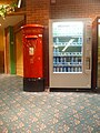
 Hopton Post Office George VI Postbox - geograph.org.uk - 2969809.jpg 2,304 × 3,072; 1.44 MB
-

-

-
 Hopton-on-Sea Coastline - geograph.org.uk - 3352671.jpg 2,816 × 2,112; 2.79 MB
-
 Hopton-on-Sea village sign - geograph.org.uk - 4292906.jpg 480 × 640; 235 KB
-
 Houses on Hall Road - geograph.org.uk - 4943807.jpg 640 × 480; 68 KB
-
 How many more years - geograph.org.uk - 1719715.jpg 640 × 480; 88 KB
-
 Injurious balls - geograph.org.uk - 2293543.jpg 760 × 570; 312 KB
-
 Inscription on the Hopton War memorial - geograph.org.uk - 5592371.jpg 3,024 × 2,268; 2.48 MB
-
 John Orde Walter War Memorial - geograph.org.uk - 5594729.jpg 2,456 × 3,925; 1.17 MB
-
 Junction of Links Road and Yallop Avenue - geograph.org.uk - 3222352.jpg 3,264 × 2,448; 1.49 MB
-
 Lakeside Manor sign - geograph.org.uk - 6003152.jpg 3,742 × 2,806; 3.68 MB
-
 Links Road Postbox - geograph.org.uk - 3367951.jpg 2,304 × 3,072; 1.64 MB
-
 Links Road Postbox - geograph.org.uk - 3367953.jpg 2,304 × 3,072; 1.63 MB
-
 Links Road Postbox - geograph.org.uk - 3367955.jpg 2,304 × 3,072; 1.52 MB
-
 Links Road sign - geograph.org.uk - 3367930.jpg 3,072 × 2,304; 1.56 MB
-
 Links Road, Gorleston-on-Sea - geograph.org.uk - 3222348.jpg 3,264 × 2,448; 2.38 MB
-
 Links Road, Gorleston-on-Sea - geograph.org.uk - 3367926.jpg 3,072 × 2,304; 1.32 MB
-
 Links Road, Gorleston-on-Sea - geograph.org.uk - 3367942.jpg 3,072 × 2,304; 1.38 MB
-
 Links Road, Gorleston-on-Sea - geograph.org.uk - 4943776.jpg 640 × 480; 63 KB
-
 Links Road, Gorleston-on-Sea - geograph.org.uk - 4948939.jpg 640 × 480; 75 KB
-
 Links Road, Gorleston-on-Sea - geograph.org.uk - 4948940.jpg 640 × 480; 75 KB
-
 Links Road, Hopton - geograph.org.uk - 2962088.jpg 3,264 × 2,448; 2.42 MB
-
 LongFullans Lane - geograph.org.uk - 2162337.jpg 768 × 1,024; 270 KB
-
 Looking towards Hobland Hall - geograph.org.uk - 263993.jpg 640 × 481; 69 KB
-
 Lound Lakes - geograph.org.uk - 3284483.jpg 640 × 480; 189 KB
-
 Lound Lakes, Lound - geograph.org.uk - 6110455.jpg 4,608 × 3,456; 4.09 MB
-
 Lound Lakes, Lound - geograph.org.uk - 6110461.jpg 4,608 × 3,456; 3.92 MB
-
 Lound Lakes, Lound - geograph.org.uk - 6110794.jpg 4,608 × 3,456; 3.96 MB
-
 Lowestoft Road - geograph.org.uk - 4753195.jpg 1,024 × 768; 217 KB
-
 Lowestoft Road - geograph.org.uk - 4943801.jpg 640 × 480; 70 KB
-
 Lowestoft Road, Hopton-on-Sea - geograph.org.uk - 1717716.jpg 640 × 480; 99 KB
-
 Lowestoft Road, Hopton-on-Sea - geograph.org.uk - 2968769.jpg 3,072 × 2,304; 1.26 MB
-
 Lowestoft Road, Hopton-on-Sea - geograph.org.uk - 2969783.jpg 3,072 × 2,304; 1.31 MB
-
 Lowestoft Road, Hopton-on-Sea - geograph.org.uk - 2969819.jpg 3,072 × 2,304; 1.38 MB
-
 Lowestoft Road, Hopton-on-Sea - geograph.org.uk - 3369950.jpg 3,072 × 2,304; 1.31 MB
-
 Lowestoft Road, Hopton-on-Sea - geograph.org.uk - 4943820.jpg 640 × 480; 57 KB
-
 Mariner's Compass, Gorleston-on-Sea - geograph.org.uk - 3367938.jpg 3,072 × 2,304; 1.36 MB
-
 Mariners Compass Sign - geograph.org.uk - 3367932.jpg 3,011 × 2,262; 1.52 MB
-
 Masons Farm - geograph.org.uk - 4943797.jpg 640 × 480; 73 KB
-
 Meadow Court, Gorleston-on-Sea - geograph.org.uk - 4943774.jpg 640 × 480; 70 KB
-
 Misty Golf - geograph.org.uk - 3246170.jpg 1,000 × 750; 163 KB
-
 Names of the fallen on the Hopton War memorial 1 - geograph.org.uk - 5592377.jpg 3,024 × 2,268; 2.76 MB
-
 Names of the fallen on the Hopton War memorial 2 - geograph.org.uk - 5592380.jpg 3,024 × 2,268; 2.59 MB
-
 Names of the fallen on the Hopton War memorial 3 - geograph.org.uk - 5592383.jpg 3,024 × 2,268; 2.33 MB
-
 New bungalows, Hopton-on-Sea - geograph.org.uk - 4943802.jpg 640 × 480; 50 KB
-
 New houses, Hopton-on-Sea - geograph.org.uk - 4943815.jpg 640 × 480; 67 KB
-
 Noel Close sign - geograph.org.uk - 2969823.jpg 3,072 × 2,304; 1.48 MB
-
 Noel Close, Hopton-on-Sea - geograph.org.uk - 2969824.jpg 3,072 × 2,304; 1.31 MB
-

-
 Norfolk Coast Path at Hopton-on-Sea - geograph.org.uk - 5946102.jpg 632 × 640; 189 KB
-
 Norfolk Coastline - geograph.org.uk - 3352778.jpg 2,816 × 2,112; 2.54 MB
-
 Norfolk Coastline - geograph.org.uk - 3352779.jpg 2,816 × 2,112; 2.59 MB
-
 Northern end of the Corton Cliffs - geograph.org.uk - 5946053.jpg 640 × 393; 66 KB
-
 Old Church Road sign - geograph.org.uk - 2969899.jpg 2,304 × 3,072; 1.6 MB
-
 Old Church Road, Hopton on Sea - geograph.org.uk - 4949249.jpg 640 × 480; 74 KB
-
 Old Church Road, Hopton-on-Sea - geograph.org.uk - 4405988.jpg 2,592 × 1,944; 1.31 MB
-
 Old Milepost - geograph.org.uk - 1803531.jpg 1,600 × 1,200; 802 KB
-
 On the sea defences south of Gorleston beach - geograph.org.uk - 6070281.jpg 4,032 × 2,268; 3.7 MB
-
 Open land near Lound Lakes - geograph.org.uk - 2980856.jpg 3,648 × 2,255; 2.49 MB
-
 Part of Gorleston golf course - geograph.org.uk - 3979433.jpg 640 × 426; 136 KB
-
 Path from beach at Gorleston-on-Sea - geograph.org.uk - 2651626.jpg 3,648 × 2,736; 2.23 MB
-
 Path leading to Hobland Road - geograph.org.uk - 6154802.jpg 1,600 × 1,065; 687 KB
-
 Path leading to Hobland Road - geograph.org.uk - 6154807.jpg 1,600 × 1,065; 919 KB
-
 Path leading to Hobland Road - geograph.org.uk - 6154810.jpg 1,600 × 1,065; 538 KB
-

-
 Perched on the clifftop - geograph.org.uk - 1717973.jpg 640 × 480; 82 KB
-
 Perched on the clifftop - geograph.org.uk - 1719753.jpg 640 × 480; 86 KB
-
 Pillbox at Gorleston-on-Sea - geograph.org.uk - 3923998.jpg 640 × 480; 72 KB
-
 Pillbox in Long Belt - geograph.org.uk - 3979109.jpg 640 × 480; 56 KB
-
 Pillbox in Long Belt - geograph.org.uk - 3979112.jpg 640 × 480; 155 KB
-
 Pine trees growing by Lound Lakes - geograph.org.uk - 3284490.jpg 480 × 640; 242 KB
-
 Pine trees on the shore of Lound Lakes - geograph.org.uk - 3284694.jpg 640 × 480; 202 KB
-
 Plaque by the entrance to Hopton Manor - geograph.org.uk - 3284544.jpg 640 × 558; 242 KB
-

-
 Potter's Holiday Resort - geograph.org.uk - 3138481.jpg 777 × 582; 159 KB
-
 Potters Hotel - geograph.org.uk - 3246179.jpg 1,000 × 750; 309 KB
-
 Reservoir off Hall Road - geograph.org.uk - 6154792.jpg 1,600 × 1,065; 699 KB
-

-

-

-


.jpg)


