Category:Houdringe
Jump to navigation
Jump to search
| Object location | | View all coordinates using: OpenStreetMap |
|---|
building in De Bilt, Netherlands  | |||||
| Upload media | |||||
| Instance of | |||||
|---|---|---|---|---|---|
| Part of | |||||
| Location | De Bilt, Utrecht, Netherlands | ||||
| Street address |
| ||||
| Located on street |
| ||||
| Owned by | |||||
| Heritage designation |
| ||||
| Inception |
| ||||
 | |||||
|
This is a category about rijksmonumentcomplex number 510396
|
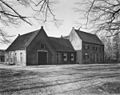
Landhuis
|
This is a category about rijksmonument number 510397
|
Historische aanleg
|
This is a category about rijksmonument number 510398
|
Brug
|
This is a category about rijksmonument number 510399
|
Speelhuisje
|
This is a category about rijksmonument number 510400
|
Tuinmuur
|
This is a category about rijksmonument number 510401
|
Klein Houdringe
|
This is a category about rijksmonument number 510402
|
De Ketting
|
This is a category about rijksmonument number 510403
|
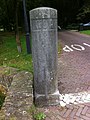
Hekpalen
|
This is a category about rijksmonument number 510404
|
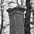
Grenspaal
|
This is a category about rijksmonument number 511404
|
| Address |
|
Subcategories
This category has only the following subcategory.
G
- Grenspalen aan de Holle Bilt (5 F)
Media in category "Houdringe"
The following 59 files are in this category, out of 59 total.
-
 Aanzicht - De Bilt - 20035039 - RCE.jpg 1,200 × 813; 302 KB
-
 Achtergevel - De Bilt - 20369498 - RCE.jpg 1,200 × 804; 182 KB
-
 Achtergevel, detail - De Bilt - 20369499 - RCE.jpg 822 × 1,200; 245 KB
-

-
 Ca. 1866 - De Bilt - 20034917 - RCE.jpg 1,200 × 944; 197 KB
-
 De Bilt - Houdringe - park - autumn 2018 (30842989647).jpg 2,560 × 1,704; 4.02 MB
-
 De Bilt - Houdringe - park - autumn 2018 (30842989857).jpg 2,560 × 1,704; 4.25 MB
-
 De Bilt - Houdringe - park - autumn 2018 (43965514940).jpg 1,704 × 2,560; 4.09 MB
-
 De Bilt - Houdringe - park - autumn 2018 (45058161854).jpg 2,560 × 1,704; 3.52 MB
-
 De Bilt - Houdringe - park - autumn 2018 (45058162284).jpg 2,560 × 1,704; 3.18 MB
-
 De Bilt - Houdringe - wood - autumn 2015 (22879575671).jpg 1,680 × 1,120; 1.18 MB
-
 De Bilt, Houdringe hist parkaanleg RM510398 (1).jpg 1,600 × 1,200; 1.54 MB
-
 De Bilt, Houdringe hist parkaanleg RM510398 (2).jpg 1,600 × 1,200; 1.33 MB
-
 De Bilt, Houdringe RM510397 (1).jpg 1,542 × 904; 973 KB
-
 De Bilt, Houdringe RM510397 (2).jpg 1,495 × 1,145; 1.18 MB
-
 Diensthuis, Oude Utrechtseweg 184 - De Bilt - 20034918 - RCE.jpg 1,200 × 818; 235 KB
-
 Exterieur - De Bilt - 20034912 - RCE.jpg 1,200 × 963; 374 KB
-
 Exterieur - De Bilt - 20034913 - RCE.jpg 1,200 × 953; 276 KB
-
 Exterieur OVERZICHT VOORZIJDE - Bilt, De - 20260758 - RCE.jpg 1,200 × 769; 229 KB
-
 Gevels - De Bilt - 20034910 - RCE.jpg 1,200 × 955; 277 KB
-
 Gevels - De Bilt - 20034911 - RCE.jpg 1,200 × 957; 321 KB
-
 Grenspaal aan de Holle Bilt - De Bilt - 20035050 - RCE.jpg 1,192 × 1,200; 299 KB
-
 Grenspaal aan de Holle Bilt - De Bilt - 20035051 - RCE.jpg 1,192 × 1,200; 251 KB
-
 Hekpaal Houdringe (links).JPG 1,936 × 2,592; 2.29 MB
-
 Hekpaal Houdringe (rechts).JPG 1,936 × 2,592; 2.4 MB
-
 Hoekstijl van de voorgevel - De Bilt - 20034915 - RCE.jpg 1,187 × 1,200; 396 KB
-
 Hoeve van het Huis over voorzijde - De Bilt - 20034921 - RCE.jpg 1,200 × 951; 361 KB
-
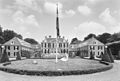
 Hoofdgebouw naar het noord-westen - De Bilt - 20034908 - RCE.jpg 1,200 × 960; 263 KB
-
 Houdringe (5).JPG 3,008 × 2,000; 1.64 MB
-
 Houdringe.jpg 1,000 × 665; 207 KB
-
 Houten pomp - De Bilt - 20035044 - RCE.jpg 1,187 × 1,200; 351 KB
-
 Houten pomp - De Bilt - 20035045 - RCE.jpg 1,190 × 1,200; 330 KB
-
 Ingang - De Bilt - 20369500 - RCE.jpg 804 × 1,200; 227 KB
-
 Interieur van de Hal - De Bilt - 20034914 - RCE.jpg 964 × 1,200; 156 KB
-
 Interieur, bel-etage,schouw - De Bilt - 20369510 - RCE.jpg 1,200 × 804; 117 KB
-
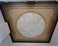
 Interieur, beschilderd plafond linkervoorkamer - De Bilt - 20369512 - RCE.jpg 1,185 × 1,200; 200 KB
-
 Interieur, beschilderd plafond linkervoorkamer - De Bilt - 20369513 - RCE.jpg 1,200 × 956; 139 KB
-

-
 Interieur, detail plafond beletage rechter voorkamer - De Bilt - 20369509 - RCE.jpg 1,200 × 1,197; 308 KB
-
 Interieur, detail schouw rechter voorkamer - De Bilt - 20369506 - RCE.jpg 1,188 × 1,200; 300 KB
-
 Interieur, detail zuilen - De Bilt - 20369504 - RCE.jpg 1,192 × 1,200; 277 KB
-
 Interieur, hal met zuilen in Bentheimer zandsteen - De Bilt - 20369502 - RCE.jpg 1,200 × 943; 140 KB
-
-

-

-
 Interieur, schouw rechter voorkamer - De Bilt - 20369505 - RCE.jpg 1,200 × 803; 140 KB
-
 Interieur, schouw uit 1779 in de grote salon - De Bilt - 20369511 - RCE.jpg 1,200 × 804; 151 KB
-
 Kinderspeelhuisje - De Bilt - 20369501 - RCE.jpg 1,200 × 804; 254 KB
-
 Overzicht naar het noorden - De Bilt - 20034907 - RCE.jpg 1,200 × 947; 230 KB
-
 Overzicht voorgevel - De Bilt - 20369493 - RCE.jpg 1,200 × 809; 198 KB
-
 Overzicht voorgevel - De Bilt - 20369495 - RCE.jpg 1,200 × 807; 176 KB
-
 Poortje met zijingang - De Bilt - 20034916 - RCE.jpg 1,187 × 1,200; 374 KB
-
 Poppenhuis - De Bilt - 20034919 - RCE.jpg 1,200 × 813; 227 KB
-
 Proefboerderij - De Bilt - 20034920 - RCE.jpg 1,200 × 825; 212 KB
-

-
 Twee grenspalen - De Bilt - 20035047 - RCE.jpg 1,194 × 1,200; 520 KB
-
 Twee grenspalen - De Bilt - 20035048 - RCE.jpg 1,194 × 1,200; 478 KB
-
 Voorgevel - De Bilt - 20369497 - RCE.jpg 1,200 × 806; 212 KB
-
 West bijgebouw naar het noord-oosten - De Bilt - 20034909 - RCE.jpg 1,200 × 957; 341 KB


.jpg)
.jpg)
.jpg)
.jpg)
.jpg)
.jpg)
.jpg)
.jpg)
.jpg)
.jpg)


.JPG)
.JPG)


.JPG)


_IN_BURGEMEESTERSKAMER,_GEMEENTEHUIS_-_Bilt,_De_-_20287797_-_RCE.jpg)
_IN_BURGEMEESTERSKAMER,_GEMEENTEHUIS,_DETAIL_-_Bilt,_De_-_20287798_-_RCE.jpg)
_IN_BURGEMEESTERSKAMER,_GEMEENTEHUIS,_DETAIL_-_Bilt,_De_-_20287799_-_RCE.jpg)


