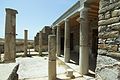
Category:House of the Masks (Delos)
Jump to navigation
Jump to search
| Object location | | View all coordinates using: OpenStreetMap |
|---|
 | |||||
| Upload media | |||||
| Instance of | |||||
|---|---|---|---|---|---|
| Location | Delos, Mykonos Municipality, Mykonos Regional Unit, South Aegean Region, Decentralized Administration of the Aegean, Greece | ||||
 | |||||
Subcategories
This category has the following 2 subcategories, out of 2 total.
Media in category "House of the Masks (Delos)"
The following 12 files are in this category, out of 12 total.
-
 Delos Haus der Masken 01.jpg 4,354 × 3,255; 8.03 MB
-
 Delos Haus der Masken 02.jpg 4,313 × 3,231; 7.88 MB
-
 Delos Haus der Masken 03.jpg 4,608 × 3,456; 8.72 MB
-
 Delos Haus der Masken 17.jpg 4,592 × 3,448; 9.83 MB
-
 House Masks Delos 102259.jpg 3,471 × 2,311; 5.39 MB
-
 House Masks Delos 102260.jpg 3,471 × 2,311; 4.9 MB
-
 House Masks Delos 102261.jpg 3,391 × 2,271; 4.78 MB
-
 House of the Masks 01.jpg 3,456 × 2,592; 3.35 MB
-
 House of the Masks 02.jpg 3,400 × 2,529; 2.32 MB
-
 House of the Masks 03.jpg 3,456 × 2,592; 2.87 MB
-
 The House of the Masks (I) (5182344093).jpg 3,648 × 2,736; 6.1 MB
-
 Theater Quarter in Delos 01.jpg 3,456 × 2,406; 2.93 MB


_(5182344093).jpg)
