Category:Houses in East Sussex
Jump to navigation
Jump to search
Ceremonial counties of England: Bedfordshire · Berkshire · Buckinghamshire · Cambridgeshire · Cheshire · Cornwall · Cumbria · Derbyshire · Devon · Dorset · Durham · East Riding of Yorkshire · East Sussex · Essex · Gloucestershire · Greater London · Greater Manchester · Hampshire · Herefordshire · Hertfordshire · Isle of Wight · Kent · Lancashire · Leicestershire · Lincolnshire · Merseyside · Norfolk · North Yorkshire · Northamptonshire · Northumberland · Nottinghamshire · Oxfordshire · Rutland · Shropshire · Somerset · South Yorkshire · Staffordshire · Suffolk · Surrey · Tyne and Wear · Warwickshire · West Midlands · West Sussex · West Yorkshire · Wiltshire · Worcestershire
City-counties: Bristol · City of London
Former historic counties: Huntingdonshire · Westmorland ·
Other former counties:
City-counties: Bristol · City of London
Former historic counties: Huntingdonshire · Westmorland ·
Other former counties:
Wikimedia category | |||||
| Upload media | |||||
| Instance of | |||||
|---|---|---|---|---|---|
| |||||
Subcategories
This category has the following 54 subcategories, out of 54 total.
*
- Bungalows in East Sussex (6 F)
A
- Aubrey House, Rottingdean (6 F)
B
- Beamsley Hall, Eastbourne (4 F)
- Beauport Park, East Sussex (5 F)
C
- Colkins Mill Free Church (4 F)
- Cousley Wood Free Church (4 F)
F
- Farleys House (2 F)
G
- Guestling Gospel Hall (5 F)
H
- Halland Mission Hall (4 F)
- Hamilton Palace, Sussex (4 F)
- Hartfield Methodist Chapel (4 F)
I
- Iden Methodist Church (7 F)
- Independent Chapel, Rye (8 F)
N
- New Gospel Hall, Vines Cross (3 F)
- Northiam Methodist Chapel (3 F)
P
- Peasmarsh Methodist Chapel (4 F)
R
- Rehoboth Chapel, Pell Green (7 F)
- Rotherfield Methodist Chapel (4 F)
- Rye Harbour Mission Hall (6 F)
S
- Sedlescombe Methodist Chapel (3 F)
T
- Three Oaks Methodist Chapel (3 F)
- Ticehurst Methodist Chapel (7 F)
U
- Uckfield Baptist Church (7 F)
V
W
- Wannock Baptist Chapel (4 F)
Z
Media in category "Houses in East Sussex"
The following 200 files are in this category, out of 330 total.
(previous page) (next page)-
 1 and 2 Church Lane, Old Town, Eastbourne (NHLE Code 1353111) (March 2010).JPG 2,200 × 1,800; 924 KB
-
 1 and 2 Church Lane, Old Town, Eastbourne (NHLE Code 1353111) (October 2012).jpg 2,000 × 1,600; 704 KB
-
 1 South Street - geograph.org.uk - 1450005.jpg 640 × 486; 84 KB
-
 10943966273 - Flickr - flintman45.jpg 5,131 × 3,367; 11.01 MB
-
 112 The Drive - geograph.org.uk - 139028.jpg 640 × 417; 145 KB
-
 12-14 The Drive - geograph.org.uk - 302349.jpg 479 × 640; 155 KB
-
 13 and 13a Bakers Road, Old Town, Eastbourne (NHLE Code 1043664) (April 2011).JPG 2,400 × 1,900; 1.12 MB
-
 13 and 13a Bakers Road, Old Town, Eastbourne (NHLE Code 1043664) (October 2012).JPG 1,900 × 2,400; 1.12 MB
-
 13 The Avenue - geograph.org.uk - 284474.jpg 460 × 640; 135 KB
-
 13-17 Norton Road - geograph.org.uk - 284750.jpg 640 × 485; 179 KB
-
 131-133, Ditchling Road, Brighton - geograph.org.uk - 4687898.jpg 640 × 480; 92 KB
-
 145-161, Eastern Road, Brighton - geograph.org.uk - 4739262.jpg 640 × 471; 71 KB
-
 146-162, Eastern Road, Brighton - geograph.org.uk - 4739270.jpg 640 × 408; 56 KB
-
 15 Bakers Road, Old Town, Eastbourne (NHLE Code 1043665) (April 2011).JPG 1,600 × 2,200; 778 KB
-
 15 Bakers Road, Old Town, Eastbourne (NHLE Code 1043665) (October 2012).jpg 1,800 × 2,400; 1.27 MB
-
 16 and 17 Portland Place, Hastings (June 2020).JPG 3,000 × 1,800; 1.7 MB
-

-
 1–12 Battle Road, Silverhill, Hastings (June 2020).JPG 2,600 × 2,000; 2.23 MB
-
 1–24 Cavendish Place, Eastbourne (IoE Code 1190211) (March 2010).JPG 2,400 × 1,600; 705 KB
-
 1–6 and 9–12 Howard Square, Eastbourne (NHLE Code 1043637) (October 2012).jpg 2,400 × 1,800; 696 KB
-
 20 Seaside, Eastbourne (NHLE Code 1043653) (May 2010).JPG 2,500 × 1,600; 911 KB
-
 20 Seaside, Eastbourne (NHLE Code 1043653) (October 2012).jpg 2,400 × 1,800; 1.19 MB
-

-
 25–33 Cavendish Place, Eastbourne (NHLE Code 1043669) (October 2012).jpg 2,200 × 1,800; 1.19 MB
-
 27–30 Wish Hill, Willingdon (NHLE Code 1093664) (April 2011).JPG 2,000 × 1,600; 1.01 MB
-
 33 The Goffs, Old Town, Eastbourne (NHLE Code 1043676) (April 2011).JPG 2,500 × 1,600; 943 KB
-
 34 Lodge Lane - geograph.org.uk - 683206.jpg 479 × 640; 73 KB
-
 39 and 40 Marine Parade, Eastbourne (NHLE Code 1043647) (May 2010).JPG 2,000 × 1,600; 647 KB
-
 3–5 Church Lane, Old Town, Eastbourne (NHLE Code 1043670) (March 2010).JPG 2,200 × 1,600; 927 KB
-
 3–5 Church Lane, Old Town, Eastbourne (NHLE Code 1043670) (October 2012).jpg 1,900 × 1,600; 970 KB
-
 6, 8 and 10 Furness Road, Eastbourne (NHLE Code 1043675) (October 2012).jpg 2,400 × 1,800; 1.27 MB
-
 67 and 69 Upper King's Drive, Willingdon (NHLE Code 1353106) (April 2011).JPG 2,400 × 1,600; 1.2 MB
-

-
 69-75, The Drive - geograph.org.uk - 98622.jpg 640 × 479; 228 KB
-
 Alexandra Villas - geograph.org.uk - 212406.jpg 479 × 640; 149 KB
-
 Alma Place, Rye - geograph.org.uk - 1423382.jpg 640 × 480; 78 KB
-
 Art Deco Houses, Shirley Road - geograph.org.uk - 276822.jpg 640 × 479; 98 KB
-
 Batts Hill House - geograph.org.uk - 743468.jpg 479 × 640; 132 KB
-
 Bay Tree Close, Heathfield - geograph.org.uk - 656097.jpg 640 × 480; 105 KB
-
 Beach front houses, Camber Sands - geograph.org.uk - 1504204.jpg 640 × 430; 105 KB
-
 Birchden Forge - geograph.org.uk - 656420.jpg 640 × 479; 169 KB
-

-
 Borough House, Borough Lane, Old Town, Eastbourne (NHLE Code 1353109) (March 2010).JPG 2,400 × 1,900; 1.05 MB
-
 Borough House, Borough Lane, Old Town, Eastbourne (NHLE Code 1353109) (October 2012).jpg 1,900 × 1,900; 1.16 MB
-
 BrightonSundial4713.JPG 2,016 × 1,512; 673 KB
-

-
-
 Brunswick Road, Eastern Side - geograph.org.uk - 385290.jpg 437 × 640; 142 KB
-
 Brunswick Road, Western Side - geograph.org.uk - 385286.jpg 640 × 479; 161 KB
-
 Brunswick Street East - geograph.org.uk - 514608.jpg 479 × 640; 136 KB
-
 Cambridge Road, Hove - geograph.org.uk - 461381.jpg 640 × 480; 116 KB
-

-
 Channel Way, Fairlight Cove - geograph.org.uk - 423769.jpg 640 × 479; 121 KB
-
 Chant Meadow (former Calvnistic Chapel), High Street, Burwash (June 2015).JPG 2,400 × 2,400; 1.33 MB
-
 Charlswood Road, Worlds End - geograph.org.uk - 844153.jpg 473 × 640; 91 KB
-
 Chatsworth Road - geograph.org.uk - 540189.jpg 640 × 479; 138 KB
-
 Clifton Road - geograph.org.uk - 592685.jpg 479 × 640; 120 KB
-
 Coastguard Cottages, Seaford Head (June 2021).JPG 3,000 × 1,800; 1.91 MB
-
 Codrington House, Hampden Place - geograph.org.uk - 211857.jpg 480 × 640; 125 KB
-
 Coggins Mill House - geograph.org.uk - 85529.jpg 640 × 480; 92 KB
-
 Coldean from nearby Field - geograph.org.uk - 706039.jpg 640 × 479; 76 KB
-
-
-
 Court House, Star Lane, Eastbourne (NHLE Code 1043655) (March 2010).JPG 2,200 × 1,800; 982 KB
-
 Cromwell Road - geograph.org.uk - 752694.jpg 479 × 640; 126 KB
-
 De Walden Court, Meads Road, Eastbourne (NHLE Code 1268504) (October 2010).JPG 2,500 × 1,900; 959 KB
-
 Dean Court Road Rottingdean - geograph.org.uk - 227955.jpg 640 × 497; 273 KB
-
 Derelict Land and Houses at Transit Road, Newhaven (March 2011).JPG 2,400 × 1,600; 888 KB
-
 Devonshire House, Bexhill-on-Sea - geograph.org.uk - 678231.jpg 640 × 480; 93 KB
-
 Dorset Gardens - geograph.org.uk - 231471.jpg 479 × 640; 197 KB
-
 Dunes Avenue, Camber - geograph.org.uk - 1427712.jpg 640 × 480; 79 KB
-
 238 Dyke Road - geograph.org.uk - 368741.jpg 640 × 511; 127 KB
-

-
 Eden Court, Ticehurst - geograph.org.uk - 327023.jpg 640 × 480; 140 KB
-
 Eliska House, South Coast Road - geograph.org.uk - 1210992.jpg 473 × 640; 67 KB
-
 Elm Grove - geograph.org.uk - 156780.jpg 640 × 479; 73 KB
-
 Georgian houses, Old Steine, BN1 - geograph.org.uk - 3009553.jpg 640 × 480; 105 KB
-
 Greystone Haugh, Meads Road, Meads, Eastbourne (NHLE Code 1353138) (October 2010).JPG 1,800 × 2,200; 911 KB
-
 Greystone Haugh, Meads Road, Meads, Eastbourne (NHLE Code 1353138) (October 2012).jpg 1,800 × 1,800; 995 KB
-
 St Clement Halton Hastings 002.jpg 406 × 189; 15 KB
-
 St Clements Halton Hastings.jpg 778 × 562; 121 KB
-
 Harrisons Lane - geograph.org.uk - 1414718.jpg 469 × 640; 65 KB
-
 Hartfield Farm House, Heathfield Road - geograph.org.uk - 323510.jpg 640 × 479; 132 KB
-
 Hartshorne House, Mermaid Street - geograph.org.uk - 300137.jpg 640 × 479; 129 KB
-
 Pink House on Hill Street - geograph.org.uk - 1259532.jpg 640 × 480; 99 KB
-
 Emmanuel Church, Vicarage Rd - geograph.org.uk - 1354449.jpg 640 × 430; 69 KB
-
 Hereford Street - geograph.org.uk - 232070.jpg 640 × 479; 137 KB
-
 House in Battle, East Sussex (1877).jpg 4,288 × 2,848; 6.04 MB
-
 House in Warwick Road, Seaford - geograph.org.uk - 863591.jpg 640 × 507; 97 KB
-
 House off A265 (Burwash Rd) - geograph.org.uk - 1247518.jpg 640 × 430; 76 KB
-

-
 House on New Lydd Road, Camber - geograph.org.uk - 326226.jpg 2,995 × 1,198; 960 KB
-
 House on the edge of Batts Wood - geograph.org.uk - 393580.jpg 640 × 428; 163 KB
-
-

-
-
 Houses at Friars Gate - geograph.org.uk - 2893725.jpg 4,000 × 3,000; 2.31 MB
-
 Houses at Richmond Road, Round Hill, Brighton.JPG 2,592 × 1,944; 1.41 MB
-
 Houses off Jackies Lane - geograph.org.uk - 1747987.jpg 640 × 428; 97 KB
-
 Houses on Brodrick Road - geograph.org.uk - 1372740.jpg 640 × 427; 92 KB
-
 Houses on Broomgrove Rd - geograph.org.uk - 1776492.jpg 640 × 430; 127 KB
-
 Houses on Caldbec Hill - geograph.org.uk - 1721161.jpg 640 × 430; 126 KB
-
 Houses on Caldbec Hill - geograph.org.uk - 1721187.jpg 640 × 349; 76 KB
-
 Houses on Carlisle Road, Eastbourne - geograph.org.uk - 4826739.jpg 1,200 × 799; 281 KB
-
 Houses on Ditton Road, Eastbourne - geograph.org.uk - 1203296.jpg 640 × 427; 78 KB
-
 Houses on Meads Street, Eastbourne - geograph.org.uk - 4828239.jpg 1,200 × 799; 310 KB
-
 Houses on Nelson Road, Hastings - geograph.org.uk - 1360950.jpg 640 × 480; 114 KB
-
 Houses on Preston Road - geograph.org.uk - 538252.jpg 444 × 640; 155 KB
-
 Houses, Montpelier Road, Brighton - geograph.org.uk - 6120466.jpg 1,024 × 684; 322 KB
-
 Houses, Netherfield - geograph.org.uk - 3438798.jpg 640 × 430; 75 KB
-

-
 Hove Park Villas - geograph.org.uk - 127779.jpg 640 × 429; 103 KB
-
 Hunter's Lodge, Hawkenbury Rd - geograph.org.uk - 1567326.jpg 640 × 430; 142 KB
-
 St Nicholas Church - geograph.org.uk - 973924.jpg 640 × 489; 99 KB
-
 Large terraced houses, St Thomas's Rd - geograph.org.uk - 1776543.jpg 640 × 430; 105 KB
-
 Little House, Friars Road - geograph.org.uk - 360798.jpg 479 × 640; 116 KB
-
 Lloyd Road - geograph.org.uk - 255634.jpg 640 × 479; 145 KB
-
 Lodge at Ocklynge Cemetery - geograph.org.uk - 2558308.jpg 640 × 480; 150 KB
-
 Lyndhurst Road - geograph.org.uk - 198871.jpg 640 × 479; 129 KB
-
 Malthouse, Cluny Street - geograph.org.uk - 255200.jpg 479 × 640; 228 KB
-
 Marlborough Place - geograph.org.uk - 231252.jpg 446 × 640; 115 KB
-
 Meads Place, Gaudick Road, Eastbourne (NHLE Code 1293819) (October 2010).JPG 2,200 × 1,800; 991 KB
-
 Medina Place - geograph.org.uk - 452179.jpg 479 × 640; 111 KB
-
 Mill Farm House - geograph.org.uk - 755034.jpg 470 × 640; 73 KB
-
 Miria, 124 Wish Hill, Willingdon (NHLE Code 1043659) (April 2011).JPG 1,600 × 1,200; 454 KB
-
 Montpelier Villas - geograph.org.uk - 211869.jpg 640 × 479; 172 KB
-
 Motcombe Farm House, Motcombe Lane, Eastbourne (NHLE Code 1190493) (April 2011).JPG 2,500 × 1,600; 1,003 KB
-
 Moulsecoomb 01.JPG 1,600 × 1,200; 552 KB
-
 My birthplace - Beals Oak near Wadhurst - geograph.org.uk - 85528.jpg 640 × 480; 112 KB
-
-

-
-

-

-
 Ocklynge Manor, Mill Road, Eastbourne (NHLE Code 1353139) (April 2011).JPG 2,550 × 1,600; 1.11 MB
-
 Old Manor House, Park Lane, Hampden Park, Eastbourne (NHLE Code 1043651) (April 2011).JPG 2,200 × 1,800; 1.23 MB
-
 Old Stone House - geograph.org.uk - 360775.jpg 640 × 479; 149 KB
-
 Outskirts of Crowborough - geograph.org.uk - 321930.jpg 640 × 428; 115 KB
-
 Oxford Grove - geograph.org.uk - 156747.jpg 640 × 479; 141 KB
-
 Palmeira Avenue, Eastern Side - geograph.org.uk - 426581.jpg 447 × 640; 131 KB
-
 Palmeira Avenue, Western Side - geograph.org.uk - 426587.jpg 479 × 640; 149 KB
-
 Pavilion Parade - geograph.org.uk - 231241.jpg 419 × 640; 133 KB
-
 Pevensey Bay Road, Eastbourne - geograph.org.uk - 216180.jpg 640 × 480; 96 KB
-
-
 Pigeon House, Warwick Road, Seaford - geograph.org.uk - 712981.jpg 640 × 507; 151 KB
-

-
 Powis Villas - geograph.org.uk - 212355.jpg 479 × 640; 125 KB
-
 Preston Park Avenue, Brighton - geograph.org.uk - 2485035.jpg 640 × 480; 97 KB
-

-
 Prospect Cottage - geograph.org.uk - 3664605.jpg 4,288 × 3,216; 5.29 MB
-
 23, Queens Park Road, Brighton - geograph.org.uk - 52085.jpg 640 × 479; 69 KB
-
 Ratton Manor Gate House, Ratton Village, Eastbourne (NHLE Code 1353141) (April 2011).JPG 2,400 × 1,800; 1.02 MB
-
 Regency House, Landsdowne Place, Hove - geograph.org.uk - 2434917.jpg 1,200 × 1,600; 637 KB
-
 Renovations, Montpelier Road - geograph.org.uk - 211818.jpg 640 × 472; 168 KB
-
 Richmond Road, Brighton.jpg 2,592 × 1,944; 579 KB
-
 Richmond Street - geograph.org.uk - 231695.jpg 640 × 484; 117 KB
-
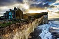
 Rooms with a view, cliff-top house nr. Seaford. - panoramio.jpg 4,384 × 3,064; 5.6 MB
-
 Rope Walk - geograph.org.uk - 446225.jpg 479 × 640; 112 KB
-
 Rural Houses - geograph.org.uk - 152989.jpg 640 × 480; 161 KB
-
 Rushlake Green village shops.JPG 3,488 × 2,616; 2.22 MB
-
 House with two front doors Rye (4909600799).jpg 3,168 × 4,552; 8.32 MB
-
 Rye (16043179433).jpg 7,360 × 4,912; 2.88 MB
-
 Salisbury Road - geograph.org.uk - 543675.jpg 640 × 495; 150 KB
-
 Sea View, Wish Hill, Willingdon (NHLE Code 1043657) (April 2011).JPG 2,400 × 1,800; 1.17 MB
-
 Seaford Banner.jpg 4,616 × 660; 1.38 MB
-

-
 Seaford MMB 03 Beach.jpg 4,616 × 2,499; 4.4 MB
-
 Seafront Houses, Camber Sands - geograph.org.uk - 877415.jpg 640 × 479; 43 KB
-
 Second Avenue, Hove - geograph.org.uk - 461387.jpg 640 × 480; 125 KB
-
 Selborne Road - geograph.org.uk - 353068.jpg 640 × 479; 136 KB
-
 Selborne Road - geograph.org.uk - 353077.jpg 450 × 640; 112 KB
-
 Semi-detached house, Broomgrove Rd - geograph.org.uk - 1776497.jpg 640 × 402; 71 KB
-
 Seven Sisters and Coastguard Cottages, Cuckmere Haven - panoramio.jpg 4,288 × 2,848; 9.32 MB
-
 Site of Former Baptist Church, Broomfield Road, Downside, Eastbourne (October 2012).JPG 1,600 × 1,400; 674 KB
-

-
 Site of Former St George's Church, Dacre Road, Downside, Eastbourne (October 2012).JPG 2,200 × 1,600; 1.05 MB
-
 South View Terrace, South Heighton (September 2011).JPG 2,400 × 1,400; 1.01 MB
-
 Southam - geograph.org.uk - 70512.jpg 640 × 479; 193 KB
-
 Station Approach - geograph.org.uk - 521817.jpg 640 × 479; 148 KB
-

-
 Station Masters House, Barcombe Mills Road, Barcombe Mills (July 2017).JPG 3,200 × 2,400; 1.17 MB
-
 Stonehouse, Beauport Park - geograph.org.uk - 344635.jpg 640 × 479; 192 KB
-
 Sutton Road, Seaford - geograph.org.uk - 863603.jpg 640 × 391; 94 KB
-
 Swyffenham, Burwash Rd - geograph.org.uk - 1247498.jpg 640 × 430; 104 KB
-
 The Beeches, Church Road - geograph.org.uk - 1096548.jpg 640 × 479; 102 KB
-
 The Cedars, Hailsham - geograph.org.uk - 111340.jpg 640 × 426; 75 KB
-
 The Coach House, Eaton Road - geograph.org.uk - 353044.jpg 479 × 640; 149 KB
-
 The Drive, Hailsham - geograph.org.uk - 202946.jpg 640 × 479; 169 KB
-
 The Elms, The Green, Rottingdean - geograph.org.uk - 227866.jpg 503 × 638; 371 KB
-
 The Hydneye, Hampden Park, Eastbourne - geograph.org.uk - 202909.jpg 640 × 479; 114 KB
-

-
 The Martlets - geograph.org.uk - 1554891.jpg 640 × 480; 51 KB
-
 The Mill House at Windmill Hill - geograph.org.uk - 290601.jpg 640 × 480; 104 KB
-

-
 The Old School House, Ivy Place - geograph.org.uk - 385361.jpg 479 × 640; 131 KB
-
 The Rectory, Church Lane, Frant - geograph.org.uk - 1272608.jpg 640 × 430; 79 KB
-
 The Village, Meads - geograph.org.uk - 612808.jpg 414 × 640; 81 KB
-
 The White Cottage, Ripe.jpg 3,934 × 3,431; 2.84 MB
-
 The White House, Whitesmith - geograph.org.uk - 383772.jpg 479 × 640; 150 KB
-
 Tisbury Road - geograph.org.uk - 353034.jpg 479 × 640; 156 KB
_(March_2010).JPG)
_(October_2012).jpg)


_(April_2011).JPG)
_(October_2012).JPG)


_(April_2011).JPG)
_(October_2012).jpg)
.JPG)

.JPG)
_(March_2010).JPG)
_(October_2012).jpg)
_(May_2010).JPG)
_(October_2012).jpg)

_(October_2012).jpg)
_(April_2011).JPG)
_(April_2011).JPG)

_(May_2010).JPG)
_(March_2010).JPG)
_(October_2012).jpg)
_(October_2012).jpg)
_(April_2011).JPG)


_(March_2010).JPG)
_(October_2012).jpg)

,_Holmes_Hill,_Golden_Cross_(Derivative_of_Geograph_Image_2770172).jpg)
,_Holmes_Hill,_Golden_Cross_(Geograph_Image_2770172).jpg)


,_High_Street,_Burwash_(June_2015).JPG)


.JPG)


_(March_2010).JPG)

_(October_2010).JPG)


_(October_2010).JPG)
_(October_2012).jpg)


.jpg)

_-_geograph.org.uk_-_1247518.jpg)


_(October_2010).JPG)


_(April_2011).JPG)

_(April_2011).JPG)


_(April_2011).JPG)
_(April_2011).JPG)


_(April_2011).JPG)


.jpg)
.jpg)

_(April_2011).JPG)


.JPG)
_(October_2012).JPG)
.JPG)
.JPG)


.JPG)
.JPG)


,_Church_Street,_Old_Town,_Eastbourne_(NHLE_Code_1043667)_(April_2011).JPG)


.JPG)