Category:Hove, East Sussex
Vai alla navigazione
Vai alla ricerca
part of the City of Brighton and Hove on the south coast of England  | |||||
| Carica un file multimediale | |||||
| Istanza di | |||||
|---|---|---|---|---|---|
| Luogo | Brighton & Hove, East Sussex, Sud Est dell'Inghilterra, Inghilterra | ||||
| Popolazione |
| ||||
| Distinto da | |||||
 | |||||
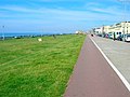
English: Hove is a town on the south coast of England, immediately to the west of its larger neighbour Brighton, with which it forms the unitary authority Brighton and Hove. It forms a single conurbation together with Brighton and some smaller towns and villages running along the coast. As part of local government reform Brighton and Hove were merged to form the borough of Brighton and Hove in 1997. In 2000 the conjoined towns officially attained city status.
Sottocategorie
Questa categoria contiene le 24 sottocategorie indicate di seguito, su un totale di 24.
B
C
D
- The Drive Prep School (1 F)
G
- Goldstone Ground (9 F)
H
- Hove Recreation Ground (6 F)
P
- Peace Statue, Hove (68 F)
R
- Regency Town House (Hove) (3 F)
S
T
- Three Cornered Copse, Hove (21 F)
W
File nella categoria "Hove, East Sussex"
Questa categoria contiene 200 file, indicati di seguito, su un totale di 593.
(pagina precedente) (pagina successiva)-
 "The Poets' Corner" public house, Hove - geograph.org.uk - 5147035.jpg 1 600 × 1 173; 517 KB
-

-

-
 1-13, Denmark Villas, Hove - geograph.org.uk - 5223021.jpg 640 × 480; 87 KB
-
 1-13, Hove Park Villas, Hove - geograph.org.uk - 5266151.jpg 640 × 479; 79 KB
-
 1-3, Vallance Gardens, Hove - geograph.org.uk - 5253791.jpg 614 × 640; 77 KB
-
 1-6, St Aubyns Gardens, Hove - geograph.org.uk - 5253772.jpg 421 × 640; 65 KB
-

-

-

-
 101-133, Conway Street, Hove - geograph.org.uk - 5228213.jpg 490 × 640; 70 KB
-
 11, Portland Road, Hove - geograph.org.uk - 5259117.jpg 640 × 620; 125 KB
-
 12, St Joseph's Close, Hove - geograph.org.uk - 5265904.jpg 640 × 464; 75 KB
-
 122-136, Holland Road, Hove - geograph.org.uk - 4715794.jpg 586 × 640; 65 KB
-
 13-16, St Catherine's Terrace, Hove - geograph.org.uk - 5253757.jpg 444 × 640; 66 KB
-
 145-155, Kingsway, Hove - geograph.org.uk - 5224527.jpg 640 × 504; 58 KB
-

-
 18-20, St Catherine's Terrace, Hove - geograph.org.uk - 5253769.jpg 599 × 640; 77 KB
-
 182, Old Shoreham Road, Hove - geograph.org.uk - 5265925.jpg 640 × 450; 48 KB
-
 30 Albany Villas - geograph.org.uk - 3795009.jpg 1 200 × 1 600; 302 KB
-
 30, Fonthill Road, Hove - geograph.org.uk - 5246384.jpg 640 × 484; 90 KB
-
 36-48, Fonthill Road, Hove - geograph.org.uk - 5266141.jpg 640 × 482; 46 KB
-
 47-53, Elm Drive, Hove - geograph.org.uk - 5246462.jpg 640 × 467; 74 KB
-
 5-11, Sackville Road, Hove - geograph.org.uk - 5288270.jpg 536 × 640; 73 KB
-
 6, St Joseph's Close, Hove - geograph.org.uk - 5265923.jpg 640 × 496; 57 KB
-
 6-18, St Aubyns, Hove - geograph.org.uk - 6074786.jpg 432 × 640; 41 KB
-
 7-8, St Aubyns Gardens, Hove - geograph.org.uk - 5253785.jpg 624 × 640; 85 KB
-

-
 82-92, Elm Drive, Hove - geograph.org.uk - 5246610.jpg 640 × 474; 96 KB
-
 9, Victoria Terrace, Kingsway, Hove - geograph.org.uk - 5290374.jpg 391 × 640; 42 KB
-
 90-114, Sackville Road, Hove - geograph.org.uk - 5263661.jpg 640 × 501; 70 KB
-
 97-101, Lorna Road, Hove - geograph.org.uk - 4715782.jpg 616 × 640; 92 KB
-

-

-
 A Railway Bridge on Sackville Road - geograph.org.uk - 3218136.jpg 1 600 × 1 063; 591 KB
-
 A Railway Bridge on Sackville Road - geograph.org.uk - 3218139.jpg 1 600 × 1 063; 659 KB
-
 A2023 - geograph.org.uk - 4732298.jpg 640 × 426; 93 KB
-
 A2023 - geograph.org.uk - 4732299.jpg 640 × 426; 78 KB
-
 Albany Mews - geograph.org.uk - 3659527.jpg 640 × 430; 79 KB
-
 Albany Villas - geograph.org.uk - 4732457.jpg 640 × 431; 56 KB
-
 Aldrington railway station, West Sussex - geograph.org.uk - 3427503.jpg 1 024 × 768; 184 KB
-
 Aldrington Station - geograph.org.uk - 5247424.jpg 461 × 640; 72 KB
-
 All Saints Church, Hove - geograph.org.uk - 2186978.jpg 1 600 × 1 200; 413 KB
-
 Alley to the sea - geograph.org.uk - 4701727.jpg 640 × 426; 61 KB
-
 Allied Preparations For D-day H38532.jpg 3 508 × 2 365; 2,18 MB
-
 Amusement park kiosk, Hove - geograph.org.uk - 5448131.jpg 1 067 × 1 600; 378 KB
-

-
 Ancient Mariner Pub - geograph.org.uk - 2908976.jpg 1 600 × 1 200; 351 KB
-
 Annual report of the Public Library Committee (IA annualreportofpu1913hove).pdf 697 × 1 187, 222 pagine; 16,71 MB
-
 Apartments on Hove Esplanade - geograph.org.uk - 3823409.jpg 1 600 × 1 200; 414 KB
-
 Apartments, Eaton Rd - geograph.org.uk - 3659546.jpg 640 × 430; 72 KB
-
 Art Deco Houses, Shirley Road - geograph.org.uk - 276822.jpg 640 × 479; 98 KB
-

-
 Aymer Rd - geograph.org.uk - 4732284.jpg 640 × 426; 70 KB
-
 B2185 - B2120 junction - geograph.org.uk - 3664787.jpg 640 × 430; 80 KB
-
-

-
 Beach huts and Zippo's Circus by the King Alfred - geograph.org.uk - 3633777.jpg 3 264 × 2 448; 3,43 MB
-
 Beach huts at Kings Lawns - geograph.org.uk - 5644730.jpg 640 × 427; 47 KB
-
 Beach huts at Kings Lawns - geograph.org.uk - 5644731.jpg 640 × 427; 69 KB
-
 Beach Huts on Hove seafront, East Sussex, UK. - panoramio.jpg 1 600 × 1 042; 215 KB
-
 Beach huts, Hove - geograph.org.uk - 5071615.jpg 1 600 × 1 169; 333 KB
-
 Beach Huts, Western Esplanade - geograph.org.uk - 2184052.jpg 640 × 480; 40 KB
-
 Biffa and the gym - geograph.org.uk - 2434977.jpg 640 × 428; 65 KB
-
 Big Wheel - Brunswick Lawns - geograph.org.uk - 3026674.jpg 1 555 × 1 600; 466 KB
-
 Bike Rack, Cromwell Road - geograph.org.uk - 2184022.jpg 480 × 640; 80 KB
-
 Bird murals, Hove - geograph.org.uk - 5241225.jpg 1 290 × 1 600; 393 KB
-
 Blatchington Court Trust, Hove - geograph.org.uk - 4303710.jpg 1 600 × 1 200; 287 KB
-
 Blatchington Road, Hove - geograph.org.uk - 5259120.jpg 640 × 480; 68 KB
-
 Bowling Green, Western Lawns - geograph.org.uk - 1625405.jpg 640 × 480; 66 KB
-
 Brighton and Hove UK ward map 1996.svg 986 × 614; 88 KB
-
 Brighton and Hove UK ward map 1999.svg 986 × 614; 88 KB
-
 Brighton WNBR 2017 - geograph.org.uk - 5433298.jpg 1 024 × 604; 140 KB
-
 Brighton ^ Hove Gymnastic Club - geograph.org.uk - 5907269.jpg 1 024 × 763; 156 KB
-

-
 Brooker Place, Hove - geograph.org.uk - 5288261.jpg 640 × 531; 47 KB
-
 Brooker Street, Hove - geograph.org.uk - 5288259.jpg 640 × 472; 56 KB
-
 Brunswick Lawns - geograph.org.uk - 3647488.jpg 640 × 430; 46 KB
-
 Brunswick Lawns - geograph.org.uk - 3647505.jpg 640 × 430; 48 KB
-
 Brunswick Lawns - geograph.org.uk - 543834.jpg 640 × 479; 99 KB
-
 Brunswick Lawns - geograph.org.uk - 603458.jpg 640 × 479; 127 KB
-
 Brunswick Lawns, Hove - geograph.org.uk - 3420715.jpg 1 600 × 1 200; 491 KB
-
 Brunswick Lawns, Hove - geograph.org.uk - 3420725.jpg 1 600 × 1 200; 529 KB
-
 Brunswick Lawns, Hove - geograph.org.uk - 5194270.jpg 640 × 480; 63 KB
-
 Brunswick Lawns, Hove - geograph.org.uk - 5290555.jpg 611 × 640; 38 KB
-
 Brunswick Street East - geograph.org.uk - 514608.jpg 479 × 640; 136 KB
-
 Byron Terrace, Byron Street, Hove - geograph.org.uk - 5263695.jpg 640 × 583; 64 KB
-
 Cambridge Grove - geograph.org.uk - 3367130.jpg 640 × 480; 108 KB
-
 Cambridge Grove - geograph.org.uk - 3664783.jpg 640 × 430; 97 KB
-
 Cambridge Road, Hove - geograph.org.uk - 461381.jpg 640 × 480; 116 KB
-
 Car Park, Brighton Station - geograph.org.uk - 538336.jpg 640 × 479; 156 KB
-
 CBabies Nursery, Palmeira Avenue, Hove - geograph.org.uk - 5581365.jpg 566 × 640; 129 KB
-
 Chimneypots of Hove - geograph.org.uk - 1725066.jpg 1 024 × 768; 118 KB
-
 Church Rd - geograph.org.uk - 3659535.jpg 640 × 430; 78 KB
-
 Church Rd - geograph.org.uk - 4732485.jpg 640 × 426; 72 KB
-
 Church Rd, B2066 - geograph.org.uk - 4735572.jpg 640 × 426; 69 KB
-
 Church Rd, Hove - geograph.org.uk - 3659530.jpg 640 × 430; 72 KB
-
 Church Rd, Hove - geograph.org.uk - 3659534.jpg 640 × 430; 63 KB
-
 Church Road - geograph.org.uk - 2184042.jpg 640 × 480; 75 KB
-
 Church Road in Hove, Sussex - geograph.org.uk - 3279893.jpg 1 024 × 768; 389 KB
-
 Church Road, Hove - geograph.org.uk - 6351865.jpg 640 × 576; 65 KB
-
 Clarendon House - geograph.org.uk - 2188219.jpg 480 × 640; 78 KB
-
 Clarendon Road, Hove - geograph.org.uk - 5263632.jpg 640 × 480; 73 KB
-
 Clarendon Villas - geograph.org.uk - 3659565.jpg 640 × 430; 82 KB
-
 Clarendon Villas, Hove - geograph.org.uk - 5229636.jpg 640 × 560; 107 KB
-
 Clouds (6264142214).jpg 1 021 × 1 024; 178 KB
-
 Coat of Arms of Hove Borough, Hove Town Hall, Norton Road, Hove (May 2020).jpg 1 000 × 1 500; 918 KB
-
 Cold Calling - geograph.org.uk - 1628162.jpg 470 × 640; 64 KB
-
 Concrete groyne - Hove beach - geograph.org.uk - 2434967.jpg 639 × 451; 113 KB
-
 Connaught Rd - geograph.org.uk - 4732323.jpg 640 × 426; 81 KB
-
 Connaught Terrace, Hove - geograph.org.uk - 5288240.jpg 640 × 586; 70 KB
-
 Constable - The Old Parish Church at Hove, 207-1888.jpg 2 500 × 1 875; 734 KB
-
-
 Conway Court Bus Depot - geograph.org.uk - 2186960.jpg 1 334 × 1 600; 320 KB
-
 Conway Place - geograph.org.uk - 2188212.jpg 640 × 480; 70 KB
-
 Conway Street - geograph.org.uk - 2188226.jpg 640 × 480; 83 KB
-
 Conway Street Steps - geograph.org.uk - 2188234.jpg 640 × 480; 95 KB
-
 Conway Street, Hove - geograph.org.uk - 5228189.jpg 640 × 511; 54 KB
-
 Corner of Seafield Road - geograph.org.uk - 2434983.jpg 640 × 503; 72 KB
-
 Cottesmore St. Mary's Catholic Primary School, Hove - geograph.org.uk - 3218134.jpg 1 600 × 1 063; 761 KB
-
 County cricket at Hove - geograph.org.uk - 3067823.jpg 1 024 × 761; 989 KB
-
 Covered Alley, Brunswick Street East - geograph.org.uk - 3833788.jpg 480 × 640; 69 KB
-

-
 Cromwell Court - geograph.org.uk - 3664817.jpg 430 × 640; 58 KB
-
 Cromwell Court, Cromwell Road, Hove - geograph.org.uk - 4851617.jpg 640 × 480; 30 KB
-
 Cromwell Rd - geograph.org.uk - 3664789.jpg 640 × 430; 93 KB
-
 Cromwell Rd - geograph.org.uk - 3664794.jpg 640 × 430; 112 KB
-
 Cromwell Road - geograph.org.uk - 752694.jpg 479 × 640; 126 KB
-
 Crossing Kingsway - geograph.org.uk - 455899.jpg 468 × 640; 106 KB
-
 Cycle Lane, Hove Seafront - geograph.org.uk - 2284589.jpg 1 600 × 1 510; 463 KB
-
 Cycle path on Hove sea front - geograph.org.uk - 2371175.jpg 640 × 480; 77 KB
-
 Cycle Path, Brunswick Lawns - geograph.org.uk - 514666.jpg 640 × 479; 131 KB
-
 Cycleway on the sea front - Hove - geograph.org.uk - 2434991.jpg 640 × 450; 41 KB
-
 Dairy, Droveway, Hove - geograph.org.uk - 2720994.jpg 1 024 × 752; 136 KB
-

-
 Dog Poop Bin, Western Lawns - geograph.org.uk - 409451.jpg 640 × 479; 163 KB
-
 Dolphin Court, Hove Street, Hove - geograph.org.uk - 5288287.jpg 640 × 527; 102 KB
-
 Driveway, Old Shoreham Road - geograph.org.uk - 276811.jpg 479 × 640; 152 KB
-
 Dyke Road Avenue, Hove - geograph.org.uk - 6445734.jpg 640 × 576; 54 KB
-
 Eaton Court - geograph.org.uk - 3659545.jpg 640 × 430; 103 KB
-
 Eaton Gardens - geograph.org.uk - 3659548.jpg 640 × 430; 89 KB
-
 Eaton Road, on the way to the cricket - geograph.org.uk - 2963304.jpg 1 024 × 762; 1,11 MB
-
 Eaton Villas - geograph.org.uk - 3659563.jpg 640 × 430; 81 KB
-

-
 Elm Drive, Hove - geograph.org.uk - 5246443.jpg 640 × 604; 111 KB
-
 Entrance to Archway Sub-station No.1 - geograph.org.uk - 444376.jpg 640 × 480; 65 KB
-
 Fire escape - St Aubyns - geograph.org.uk - 2434993.jpg 640 × 520; 75 KB
-
 Fishermen's Area, Hove Beach - geograph.org.uk - 1625381.jpg 640 × 480; 79 KB
-
 Fishermen's Area, Hove Beach - geograph.org.uk - 2184057.jpg 640 × 480; 42 KB
-
 Flats in Clarendon Road, Hove - geograph.org.uk - 3839911.jpg 1 600 × 1 519; 473 KB
-
 Flats in Hove, Formerly a Hospital - geograph.org.uk - 3218100.jpg 1 600 × 1 063; 530 KB
-
 Flats in Montgomery Street, Hove, formerly a Hospital - geograph.org.uk - 3218096.jpg 1 600 × 1 063; 583 KB
-
 Flats on King's Esplanade - Hove - geograph.org.uk - 2434986.jpg 640 × 451; 72 KB
-
 Flats overlooking Hove Seafront - geograph.org.uk - 4338555.jpg 1 600 × 1 200; 407 KB
-
 Flats, Hove St - geograph.org.uk - 4701741.jpg 640 × 426; 73 KB
-
 Flats, New Church Rd - geograph.org.uk - 4732270.jpg 640 × 426; 105 KB
-
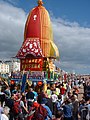 Float at a Hare Krishna parade on Hove Seafront.jpg 1 200 × 1 600; 1,34 MB
-
 Flood lights, County Cricket Ground - geograph.org.uk - 3664833.jpg 430 × 640; 54 KB
-
 Footbridge, Hove Station - geograph.org.uk - 5266161.jpg 499 × 640; 90 KB
-

-
 Former Texaco Garage, Kingsway, Hove - geograph.org.uk - 5289718.jpg 521 × 640; 60 KB
-
 Fourth Avenue - geograph.org.uk - 4732475.jpg 640 × 426; 98 KB
-
 Garden Court, Somerhill Avenue - geograph.org.uk - 153773.jpg 640 × 479; 111 KB
-
 Gates, Hove Museum - geograph.org.uk - 4732241.jpg 640 × 366; 57 KB
-
 Gates, Hove Museum - geograph.org.uk - 4732248.jpg 640 × 426; 76 KB
-
 George St - geograph.org.uk - 4732437.jpg 640 × 426; 67 KB
-
 George Street, Hove - geograph.org.uk - 5261036.jpg 1 600 × 1 332; 444 KB
-
 George Street, Hove - geograph.org.uk - 6467662.jpg 640 × 604; 58 KB
-
 GoldStone plaque.JPG 640 × 480; 117 KB
-
 Goldstone Rd - geograph.org.uk - 3659569.jpg 640 × 430; 65 KB
-
 Goldstone Retail Park - geograph.org.uk - 1657118.jpg 640 × 477; 88 KB
-
 Goldstone Road, Hove - geograph.org.uk - 5229624.jpg 640 × 555; 69 KB
-
 Goldstone Street, Hove - geograph.org.uk - 5229633.jpg 640 × 425; 54 KB
-
 Goldstone Street, Hove - geograph.org.uk - 5263637.jpg 640 × 505; 64 KB
-
 Golf with wood chips - geograph.org.uk - 2434966.jpg 639 × 437; 106 KB
-
 Gower Software Ltd, Hove - geograph.org.uk - 3163709.jpg 1 600 × 1 200; 436 KB
-
 Grasshoppers Tennis Club - geograph.org.uk - 180545.jpg 479 × 640; 133 KB
-
 Grey day on Hove beach - geograph.org.uk - 2434970.jpg 639 × 437; 69 KB
-
 Hangleton Recreation Ground, Hove (8600923155).jpg 3 638 × 2 117; 3,55 MB
-
 Hartington Villas, Hove - geograph.org.uk - 5266145.jpg 640 × 577; 72 KB
-
 Haven Lodge, Eaton Villas - geograph.org.uk - 1628209.jpg 640 × 480; 147 KB
-
 Headstone for Sir George Everest - geograph.org.uk - 3795038.jpg 1 200 × 1 600; 537 KB
-
 Healthy eating for holiday makers - geograph.org.uk - 2434972.jpg 640 × 480; 70 KB
-
 HMS Severn - geograph.org.uk - 6467592.jpg 640 × 495; 20 KB
-
 Houses on Pembroke Crescent - geograph.org.uk - 2117449.jpg 640 × 480; 88 KB
-
 Housing terrace, Stirling Place, Hove - geograph.org.uk - 5241191.jpg 1 600 × 1 060; 407 KB
-
 Housing terrace, Tisbury Road - geograph.org.uk - 5281890.jpg 1 157 × 1 600; 709 KB
-
 Hova Villas - geograph.org.uk - 3659549.jpg 640 × 430; 69 KB
-
 Hova Villas - geograph.org.uk - 4732466.jpg 640 × 426; 68 KB
-
 Hove , beach - geograph.org.uk - 6544760.jpg 1 024 × 449; 405 KB
-
 Hove , beach huts - geograph.org.uk - 6545663.jpg 1 600 × 1 131; 402 KB
-
 Hove , beach huts - geograph.org.uk - 6545668.jpg 1 024 × 687; 595 KB
-
 Hove , Langham Hotel ghost sign, Boundary Passage - geograph.org.uk - 6378258.jpg 1 335 × 1 600; 451 KB
-
 Hove , old shop sign - geograph.org.uk - 6588367.jpg 913 × 1 024; 798 KB
-
 Hove , The Old Market - geograph.org.uk - 6378267.jpg 1 024 × 682; 591 KB
-
 Hove - Courtenay Towers (geograph 7193283).jpg 1 600 × 1 429; 754 KB
-
 Hove Beach - geograph.org.uk - 5255300.jpg 640 × 480; 84 KB
-
 Hove Beach - geograph.org.uk - 6074799.jpg 640 × 480; 65 KB
-
 Hove Beach - geograph.org.uk - 6467567.jpg 640 × 480; 50 KB
-
 Hove beach on a grey day - geograph.org.uk - 2434979.jpg 640 × 441; 86 KB


.jpg)
.jpg)


.jpg)


.jpg)


