Category:Huis Sinderen, Voorst
Jump to navigation
Jump to search
| Object location | | View all coordinates using: OpenStreetMap |
|---|
 | |||||
| Upload media | |||||
| Instance of | |||||
|---|---|---|---|---|---|
| Location | Voorst, Gelderland, Netherlands | ||||
| Street address |
| ||||
| Located on street |
| ||||
| Heritage designation |
| ||||
 | |||||
|
This is a category about rijksmonument number 38046
|
| Address |
|
Media in category "Huis Sinderen, Voorst"
The following 7 files are in this category, out of 7 total.
-
 Deel zijgevel - Voorst - 20508926 - RCE.jpg 1,200 × 900; 206 KB
-
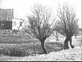
 Huis Sinderen, aanzicht - Voorst - 20246677 - RCE.jpg 1,200 × 798; 176 KB
-
 Voor- en zijgevel - Voorst - 20508925 - RCE.jpg 1,200 × 900; 186 KB
-
 Voorst, 38046.jpg 4,288 × 2,848; 6.24 MB
-
 Zij- en voorgevel - Voorst - 20508922 - RCE.jpg 1,200 × 900; 193 KB
-
 Zij- en voorgevel - Voorst - 20508924 - RCE.jpg 1,200 × 900; 135 KB
-
 Zijgevel - Voorst - 20508923 - RCE.jpg 1,200 × 900; 126 KB


