Category:Humboldt River maps
Jump to navigation
Jump to search
Media in category "Humboldt River maps"
The following 7 files are in this category, out of 7 total.
-
 Central Basin and Range ecoregion.gif 495 × 435; 17 KB
-
 Central Basin and Range ecoregion.png 310 × 273; 40 KB
-
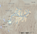 Humboldtrivermap-01.png 1,171 × 1,078; 747 KB
-
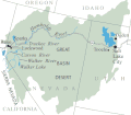
 Humboldtrivermap.jpg 1,000 × 750; 325 KB
-
 NVMap-doton-HumboldtRiver.png 165 × 215; 1 KB
-
 USA Nevada location map.svg 882 × 1,297; 76 KB
-
 Wpdms california trail3.png 300 × 200; 24 KB


