Category:Huntingdon, Cambridgeshire
Jump to navigation
Jump to search
market town and civil parish in Cambridgeshire, England, UK  | |||||
| Upload media | |||||
| Instance of | |||||
|---|---|---|---|---|---|
| Location | Huntingdonshire, Cambridgeshire, East of England, England | ||||
| Located in or next to body of water | |||||
| Population |
| ||||
| Area |
| ||||
| Different from | |||||
| official website | |||||
 | |||||
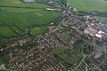
English: Huntingdon is a market town in the county of Cambridgeshire in East Anglia, England. The town was chartered by King John in 1205. It was formerly the county town of Huntingdonshire, and is currently the seat of the Huntingdonshire district council. It is known as the birthplace in 1599 of Oliver Cromwell.
Русский: Хантингдон — город в английском графстве Кембриджшир.
Subcategories
This category has the following 18 subcategories, out of 18 total.
A
B
- Brampton Racecourse (4 F)
C
G
H
- Hinchingbrooke Country Park (18 F)
- Huntingdon railway station (49 F)
- Huntingdon Viaduct (16 F)
- Huntingdon War Memorial (5 F)
P
- Portholme (13 F)
R
- RAF Graveley (6 F)
S
Media in category "Huntingdon, Cambridgeshire"
The following 200 files are in this category, out of 471 total.
(previous page) (next page)-

-
 111 High Street, Huntingdon (geograph 6935603).jpg 1,024 × 768; 198 KB
-
 136 High Street, Huntingdon (geograph 6942669).jpg 1,024 × 768; 163 KB
-
 138 High Street, Huntingdon (geograph 7383046).jpg 1,024 × 768; 186 KB
-
 142 - 143, High St - geograph.org.uk - 5256464.jpg 640 × 426; 63 KB
-
 151 High Street, Huntingdon (geograph 6943290).jpg 768 × 1,024; 234 KB
-
 152 High Street, Huntingdon (geograph 7383367).jpg 1,024 × 768; 122 KB
-
 28, High St - geograph.org.uk - 5256471.jpg 640 × 426; 82 KB
-
 36-38 High Street, Huntingdon - geograph.org.uk - 5130931.jpg 1,024 × 950; 198 KB
-

-

-
 60163 Tornado 7 Feb 2009 Huntingdon.jpg 640 × 480; 76 KB
-
 66728 Silt Road Xing 2.jpg 4,888 × 3,448; 2.32 MB
-
 66728 Silt Road Xing.jpg 3,263 × 2,255; 1.18 MB
-
 84 High Street, Huntingdon (geograph 6935683).jpg 1,024 × 768; 158 KB
-
 A1126 southbound - geograph.org.uk - 5454317.jpg 640 × 480; 39 KB
-
 A14 approaching junction with A141 - geograph.org.uk - 3463887.jpg 1,677 × 1,044; 951 KB
-
 A14 eastbound on bridge over railway - geograph.org.uk - 5082645.jpg 640 × 481; 49 KB
-
 A14 junction 23 gantry sign - geograph.org.uk - 2642004.jpg 640 × 428; 107 KB
-
 A14 loops around Huntingdon - geograph.org.uk - 2642003.jpg 640 × 428; 104 KB
-
 A14 near Huntingdon - geograph.org.uk - 3174773.jpg 640 × 429; 43 KB
-

-
 A14 south of Huntingdon - geograph.org.uk - 3463880.jpg 1,677 × 1,027; 1.01 MB
-
 A14 westbound - geograph.org.uk - 5454320.jpg 640 × 480; 45 KB
-
 A14, Junction 23 - geograph.org.uk - 3174774.jpg 640 × 408; 38 KB
-
 A14, Junction 23 overbridge - geograph.org.uk - 3174778.jpg 640 × 430; 37 KB
-

-

-
 A141 roundabout - geograph.org.uk - 5454280.jpg 640 × 480; 40 KB
-
 A141 roundabout - geograph.org.uk - 5454287.jpg 640 × 480; 52 KB
-
 A141 roundabout - geograph.org.uk - 5454297.jpg 640 × 444; 43 KB
-
 A141 southbound - geograph.org.uk - 5454285.jpg 640 × 480; 44 KB
-
 A141 southbound - geograph.org.uk - 5454288.jpg 640 × 480; 48 KB
-
 A141 westbound - geograph.org.uk - 5450240.jpg 640 × 480; 42 KB
-
 A141 westbound - geograph.org.uk - 5454279.jpg 640 × 446; 46 KB
-
 A141 westbound - geograph.org.uk - 5454282.jpg 640 × 459; 35 KB
-
-
 All Saints Church, Huntingdon - geograph.org.uk - 4126192.jpg 640 × 480; 54 KB
-
 All Saints Church, Huntingdon - geograph.org.uk - 5520679.jpg 640 × 433; 78 KB
-
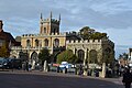
 All Saints, Market Place, Huntingdon - geograph.org.uk - 5130968.jpg 3,072 × 2,048; 1.12 MB
-

-
 Allotments off Redwongs Way - geograph.org.uk - 4734058.jpg 640 × 480; 82 KB
-
 Ambury Hill - geograph.org.uk - 5363942.jpg 640 × 426; 66 KB
-
 American Lane - geograph.org.uk - 5363933.jpg 640 × 425; 59 KB
-
 American Lane, Huntingdon - geograph.org.uk - 4484634.jpg 1,280 × 851; 340 KB
-
 Aspen Way - geograph.org.uk - 5363935.jpg 640 × 426; 62 KB
-
 ATS on Nursery Road, Huntingdon - geograph.org.uk - 6023788.jpg 1,745 × 1,137; 822 KB
-
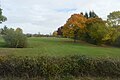
 Autumn colours on the River Great Ouse - geograph.org.uk - 5174097.jpg 4,517 × 3,387; 2.33 MB
-
 B1514 - geograph.org.uk - 5363944.jpg 640 × 426; 68 KB
-
 B1514 - geograph.org.uk - 5363957.jpg 640 × 426; 83 KB
-
 B1514 Hartford Road, Huntingdon - geograph.org.uk - 5678767.jpg 640 × 428; 123 KB
-
 B1514 Hartford Road, Huntingdon - geograph.org.uk - 5681581.jpg 640 × 428; 104 KB
-
 B1514 Main Street, Hartford, Huntingdon - geograph.org.uk - 5678777.jpg 640 × 428; 120 KB
-
 Bardon Aggregates tipper lorry on Edison Bell Way - geograph.org.uk - 4051634.jpg 3,607 × 2,289; 3.21 MB
-
 Block of flats off Mayfield Road - geograph.org.uk - 4125845.jpg 640 × 480; 64 KB
-
 Blocks of flats, Huntingdon - geograph.org.uk - 4125833.jpg 640 × 480; 73 KB
-
 Boating on the River Great Ouse - geograph.org.uk - 5773743.jpg 800 × 449; 85 KB
-
 Brampton Road (B1514) heading west - geograph.org.uk - 2994033.jpg 640 × 480; 69 KB
-
 Bridge over Alconbury Brook - geograph.org.uk - 5465442.jpg 3,264 × 2,448; 6.1 MB
-
 Bridge over the Great Ouse - geograph.org.uk - 5773749.jpg 800 × 449; 107 KB
-
 Bridleway off Parkway - geograph.org.uk - 2184365.jpg 640 × 480; 127 KB
-
 Bridleway to Washingley Farm - geograph.org.uk - 4734074.jpg 640 × 480; 100 KB
-
 Bridleway towards Green End - geograph.org.uk - 4122470.jpg 640 × 480; 96 KB
-
 Bright jogger in the rain - December 2015 - panoramio.jpg 4,000 × 1,394; 1.15 MB
-
 Brook beside Town Park, Huntingdon - geograph.org.uk - 3086989.jpg 640 × 480; 121 KB
-
 Brookside, Huntingdon (B1514) - geograph.org.uk - 3086985.jpg 640 × 480; 67 KB
-
 Brookside, Huntingdon - geograph.org.uk - 5681436.jpg 640 × 428; 118 KB
-
 Bullrushes, Hinchingbrooke Country Park - geograph.org.uk - 5898335.jpg 4,608 × 3,456; 2.89 MB
-
 Bus stop on Main Street, Huntingdon - geograph.org.uk - 5287013.jpg 640 × 480; 53 KB
-
 Bus stop on Stukeley Road, Huntingdon - geograph.org.uk - 2733826.jpg 4,000 × 3,000; 3.52 MB
-
 Bushes and brambles - geograph.org.uk - 1534210.jpg 640 × 480; 119 KB
-
 California Rd - geograph.org.uk - 5363939.jpg 640 × 426; 84 KB
-
 Cambridgeshire Constabulary Headquarters.JPG 3,264 × 2,448; 2.19 MB
-
 Car dealership on Stukeley Road - geograph.org.uk - 4122455.jpg 640 × 395; 47 KB
-
 Car dealership on Washingley Road - geograph.org.uk - 4122466.jpg 640 × 473; 51 KB
-
 Car park in Huntingdon - geograph.org.uk - 5463211.jpg 3,264 × 2,448; 3.03 MB
-
 Car Park next to A14 near station - geograph.org.uk - 2072608.jpg 640 × 480; 68 KB
-
 Castle Hill, Huntingdon - geograph.org.uk - 5131081.jpg 3,072 × 2,048; 1.17 MB
-
 Castle Hills - geograph.org.uk - 975629.jpg 640 × 427; 82 KB
-
 Castle Moat Road, Huntingdon - geograph.org.uk - 5681058.jpg 640 × 428; 95 KB
-
 Cattle on Mill Common - geograph.org.uk - 1018284.jpg 640 × 480; 240 KB
-
 Cemetery, Huntingdon - geograph.org.uk - 1878668.jpg 2,848 × 2,136; 3.12 MB
-
 Children's playground - geograph.org.uk - 2994063.jpg 640 × 480; 77 KB
-
 Church of All Saints - geograph.org.uk - 5256363.jpg 640 × 426; 86 KB
-
 Church of All Saints - geograph.org.uk - 5256372.jpg 640 × 426; 72 KB
-
 Church of All Saints - geograph.org.uk - 5256384.jpg 640 × 426; 79 KB
-
 Church of All Saints - geograph.org.uk - 5256473.jpg 640 × 426; 77 KB
-
 Church of All Saints - geograph.org.uk - 5256474.jpg 640 × 426; 71 KB
-
 Church of All Saints, Huntingdon - geograph.org.uk - 5526443.jpg 1,067 × 1,600; 631 KB
-
 Church of St Mary - geograph.org.uk - 5256461.jpg 354 × 640; 59 KB
-
 Church of St Mary - geograph.org.uk - 5256462.jpg 640 × 426; 95 KB
-
 Church of St Mary - geograph.org.uk - 5256482.jpg 337 × 640; 51 KB
-
 Church of St Mary - geograph.org.uk - 5261472.jpg 425 × 640; 70 KB
-
 Churchyard of St John the Baptist - geograph.org.uk - 5999164.jpg 6,000 × 4,000; 5.32 MB
-
 Claytons Way, Huntingdon - geograph.org.uk - 6245688.jpg 1,920 × 1,280; 1.14 MB
-
 Claytons Way, Huntingdon - geograph.org.uk - 6245689.jpg 1,892 × 1,236; 1.53 MB
-
 Close up, George VI postbox, Huntingdon Railway Station - geograph.org.uk - 5288489.jpg 1,254 × 2,520; 687 KB
-

-

-
-
 Coldhams South, Huntingdon - geograph.org.uk - 6245692.jpg 1,920 × 1,280; 1.13 MB
-
 Colebrook Rd - geograph.org.uk - 5363938.jpg 640 × 426; 55 KB
-
 Coneygear Park - geograph.org.uk - 4125732.jpg 640 × 480; 82 KB
-
 Coneygear Park - geograph.org.uk - 4734006.jpg 640 × 480; 43 KB
-
 Coneygear Park - geograph.org.uk - 5363926.jpg 640 × 426; 71 KB
-
 Coneygear Rd - geograph.org.uk - 5363925.jpg 640 × 426; 66 KB
-
 Coneygear Road - geograph.org.uk - 4125730.jpg 640 × 480; 62 KB
-
 Coneygear Road, Huntingdon - geograph.org.uk - 1878663.jpg 2,848 × 2,136; 3.12 MB
-
 Congestion on the A14 - geograph.org.uk - 5847076.jpg 1,600 × 1,062; 185 KB
-
 Constablesque Water Meadows near Huntingdon.jpg 4,176 × 2,784; 4.31 MB
-
-
 Country road - geograph.org.uk - 5557115.jpg 640 × 526; 59 KB
-
 Cowper House, High Street, Huntingdon (geograph 6943239).jpg 1,024 × 723; 146 KB
-
 Cromwell College - geograph.org.uk - 5363937.jpg 640 × 426; 60 KB
-
 Cromwell House on Ermine Street, Huntingdon - geograph.org.uk - 5173987.jpg 4,608 × 3,456; 6.04 MB
-
 Cromwell Museum - geograph.org.uk - 5256333.jpg 426 × 640; 61 KB
-
 Cromwell Museum - geograph.org.uk - 5256478.jpg 640 × 426; 78 KB
-
 Cromwell Museum - geograph.org.uk - 5256479.jpg 640 × 426; 65 KB
-
 Cromwell Walk - geograph.org.uk - 5999146.jpg 1,600 × 1,067; 291 KB
-
 Cromwells - geograph.org.uk - 5256399.jpg 640 × 426; 76 KB
-

-
-
 Derelict school in Hartford - geograph.org.uk - 6248124.jpg 1,920 × 1,280; 1.73 MB
-
 Desborough Rd - geograph.org.uk - 5363919.jpg 640 × 426; 66 KB
-
 Desborough Road - geograph.org.uk - 4733986.jpg 640 × 480; 51 KB
-
 Desborough Road - geograph.org.uk - 6162681.jpg 1,600 × 900; 314 KB
-

-
 Desborough Road, Huntingdon - geograph.org.uk - 4125722.jpg 640 × 480; 54 KB
-

-

-
 Drainage ditch to a lone tree - December 2015 - panoramio.jpg 3,000 × 4,000; 3.42 MB
-
 East Street, Huntingdon - geograph.org.uk - 6245686.jpg 1,892 × 1,238; 1.3 MB
-
 East Street, Huntingdon - geograph.org.uk - 6245687.jpg 1,872 × 1,204; 1.24 MB
-
 East Street, Huntingdon - geograph.org.uk - 6245691.jpg 1,898 × 1,248; 1.42 MB
-
 Eastbound A14, Spittals Interchange - geograph.org.uk - 3824509.jpg 640 × 427; 248 KB
-
 Electricity sub station, Lake Way - geograph.org.uk - 3585920.jpg 640 × 461; 69 KB
-
 Elphicks - geograph.org.uk - 4051686.jpg 3,648 × 2,736; 4.6 MB
-
 Entering Godmanchester - geograph.org.uk - 1020740.jpg 640 × 480; 243 KB
-
 Entering Huntingdon - geograph.org.uk - 4125681.jpg 640 × 480; 64 KB
-
 Entrance to Huntingdon Jubilee Park - geograph.org.uk - 3702452.jpg 4,320 × 3,240; 5.3 MB
-
 Entrance to Sapley Park Farms, Huntingdon - geograph.org.uk - 1878641.jpg 2,848 × 2,136; 2.95 MB
-
 Ermine Street - geograph.org.uk - 4122458.jpg 640 × 480; 76 KB
-
 Essential Supermarket - geograph.org.uk - 5999125.jpg 6,000 × 4,000; 3.43 MB
-
 Falcon Inn - geograph.org.uk - 5256475.jpg 640 × 426; 60 KB
-

-
 Foot path onto the common - geograph.org.uk - 1878769.jpg 2,848 × 2,136; 3.05 MB
-
 Football pitches - geograph.org.uk - 4734061.jpg 640 × 480; 66 KB
-
 Footbridge at Huntingdon station - geograph.org.uk - 3091365.jpg 1,024 × 768; 171 KB
-
 Footbridge. - geograph.org.uk - 2965722.jpg 850 × 638; 251 KB
-
 Footpath across Mill Common - geograph.org.uk - 1018293.jpg 640 × 480; 203 KB
-
 Footpath across Mill Common - geograph.org.uk - 1018297.jpg 640 × 480; 234 KB
-
 Footpath and Cycleway across Mill Common - geograph.org.uk - 4053710.jpg 3,648 × 2,736; 3.71 MB
-
 Former Post Office on George Street, Huntingdon - geograph.org.uk - 6156719.jpg 4,032 × 3,024; 2.49 MB
-
 Former post office, Huntingdon - geograph.org.uk - 5511240.jpg 1,600 × 938; 389 KB
-
 Garden wall East Street Huntingdon - geograph.org.uk - 948236.jpg 640 × 480; 104 KB
-
 George VI postbox, Huntingdon Railway Station - geograph.org.uk - 5288486.jpg 2,136 × 2,848; 1.35 MB
-
 Georgian house on the High Street in Huntingdon - geograph.org.uk - 5174008.jpg 4,608 × 3,456; 6 MB
-
 Go Whippet - geograph.org.uk - 4051595.jpg 3,436 × 1,647; 2.07 MB
-

-
 Godmanchester sign - geograph.org.uk - 822739.jpg 640 × 480; 106 KB
-
 Great Ouse in flood at Huntingdon Bridge - geograph.org.uk - 3279994.jpg 1,280 × 794; 129 KB
-
 Hartford Rd - geograph.org.uk - 5363956.jpg 640 × 426; 92 KB
-
 Hartford Road (B1514) - geograph.org.uk - 4125850.jpg 640 × 480; 71 KB
-

-
 Headquarters building for Magpas Helimedix - geograph.org.uk - 4053284.jpg 3,392 × 2,017; 2.44 MB
-
 Healthy thistles on Mill Common - geograph.org.uk - 4053704.jpg 3,648 × 2,736; 3.51 MB
-
 Here comes a fire engine - geograph.org.uk - 6066074.jpg 1,024 × 684; 253 KB
-
 High St - geograph.org.uk - 5256324.jpg 640 × 426; 67 KB
-
 High St - geograph.org.uk - 5256396.jpg 640 × 426; 81 KB
-
 High St - geograph.org.uk - 5256397.jpg 640 × 426; 78 KB
-
 High St - geograph.org.uk - 5256460.jpg 640 × 426; 71 KB
-
 High Street Huntingdon - geograph.org.uk - 6023789.jpg 1,892 × 1,236; 1.15 MB
-
 High Street, Huntingdon - geograph.org.uk - 5998391.jpg 6,000 × 4,000; 4.6 MB
-
 Hill mound at Hinchingbrooke Country Park - geograph.org.uk - 5898338.jpg 4,608 × 3,456; 5.97 MB
-
 Hinchingbrooke Country Park - geograph.org.uk - 5465811.jpg 3,264 × 2,448; 3.7 MB
-
 Hinchingbrooke Country Park - geograph.org.uk - 5465816.jpg 3,264 × 2,448; 4.41 MB
-
 Hinchingbrooke Country Park, Huntingdonshire - geograph.org.uk - 5898332.jpg 4,608 × 3,456; 4.7 MB
-
 Hinchingbrooke Hospital - geograph.org.uk - 5465829.jpg 3,264 × 2,448; 3.73 MB
-
 Hinchingbrooke Park Road - geograph.org.uk - 2994038.jpg 640 × 480; 81 KB
-
 House on School Lane, Hartford - geograph.org.uk - 6248126.jpg 1,920 × 1,280; 1.64 MB
-
 House on School Lane, Hartford - geograph.org.uk - 6248127.jpg 1,920 × 1,280; 1.44 MB
-
 Houses at Waters Meet, Huntingdon - geograph.org.uk - 5066857.jpg 3,072 × 1,728; 4.11 MB
-
 Burton Shop, High Street - geograph.org.uk - 729719.jpg 640 × 480; 72 KB
-
 Cycle shop advert on Ermine Street - geograph.org.uk - 1423853.jpg 480 × 640; 70 KB
-

-
 High Street, Huntingdon - geograph.org.uk - 477297.jpg 640 × 428; 100 KB
-
 Water tower at Sapley - geograph.org.uk - 467376.jpg 640 × 480; 67 KB
-
 Huntingdon Bridge - geograph.org.uk - 5256491.jpg 640 × 426; 73 KB
-
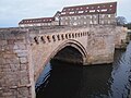 Huntingdon Bridge - geograph.org.uk - 6040554.jpg 1,600 × 1,200; 392 KB
-
 Huntingdon Bus Station - geograph.org.uk - 5888154.jpg 1,600 × 900; 236 KB
-
 Huntingdon Castle Hills - geograph.org.uk - 6157522.jpg 4,032 × 3,024; 3.85 MB
-
 Huntingdon Greyhound Stadium c.1985.png 616 × 915; 1.17 MB
-
 Huntingdon High Street - geograph.org.uk - 975634.jpg 640 × 427; 99 KB
-
 Huntingdon Law Court - geograph.org.uk - 4125897.jpg 640 × 480; 71 KB
-
 Huntingdon Law Court - geograph.org.uk - 6248857.jpg 1,848 × 1,162; 1.41 MB
-
 Huntingdon Methodist Church - geograph.org.uk - 5256466.jpg 465 × 640; 66 KB
-
 Huntingdon Methodist Church - geograph.org.uk - 5256469.jpg 640 × 426; 70 KB
-
 Huntingdon Primary School - geograph.org.uk - 5363940.jpg 640 × 426; 67 KB
-
 Huntingdon ring road - geograph.org.uk - 5681443.jpg 640 × 428; 130 KB
-
 Huntingdon shop.jpg 3,264 × 2,448; 2.51 MB

.jpg)
.jpg)
.jpg)

.jpg)
.jpg)


.jpg)


_to_Riverside_Park_and_Westside_Common,_aerial_2016_-_geograph.org.uk_-_4951683.jpg)


_heading_west_-_geograph.org.uk_-_2994033.jpg)


_-_geograph.org.uk_-_3086985.jpg)


.jpg)


_-_geograph.org.uk_-_4125850.jpg)


