Category:Hydrogeological maps of the United States
Jump to navigation
Jump to search
Media in category "Hydrogeological maps of the United States"
The following 31 files are in this category, out of 31 total.
-
-

-
 Biscayne Aquifer USGS.jpeg 538 × 419; 187 KB
-
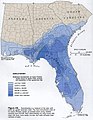
 Drastic florida.jpg 916 × 954; 193 KB
-
 Edwards and Trinity Aquifers Map.png 649 × 592; 206 KB
-
 Edwards-Trinity aquifer system v1.svg 821 × 661; 636 KB
-
 Estimated transmissivity of the Floridan aquifer sytem.png 763 × 912; 324 KB
-
 Ga coast.jpg 816 × 1,056; 105 KB
-
 Geothermal springs map US.png 887 × 387; 78 KB
-
 High plains fresh groundwater usage 2000.svg 747 × 946; 1.48 MB
-

-
-
 Keystone XL - Ogallala Aquifer.png 781 × 1,137; 625 KB
-
 Major US Aquifers by Rock Type.jpg 1,056 × 816; 636 KB
-
 Major US Aquifers by Rock Type.svg 990 × 765; 19.31 MB
-
 Map 2023-02-23 09 37 08- 0.png 754 × 902; 466 KB
-
 Missouri karst feature distribution v1.svg 820 × 734; 1.69 MB
-
 Ogallala Aquifer - Keystone XL.png 784 × 1,139; 629 KB
-
 Ogallala area freshwater ground withdrawals all aquifers.png 1,121 × 1,606; 283 KB
-
 Ogallala changes 1980-1995.svg 761 × 1,002; 1.74 MB
-
 Ogallala changes in feet 1980-1995 USGS.gif 492 × 720; 65 KB
-
 Ogallala saturated thickness 1997-sattk97-v2.svg 656 × 960; 1.36 MB
-
 Ogallala saturated thickness 1997-sattk97.svg 1,491 × 1,732; 5.64 MB
-
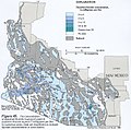
 Snake river plain aquifer H058.jpeg 883 × 529; 156 KB
-
 Southern-Arizona-fluoride-groundwater.jpeg 603 × 597; 343 KB
-
 SVRP Aquifer Map.PNG 791 × 678; 268 KB
-
 Tularosa-Basin-NM-USGS-map opaque.gif 624 × 836; 59 KB
-
 UnitedStates-GroundwaterAquifers-ShaleGasExtraction.svg 4,213 × 2,980; 13.25 MB
-
 USGS geologic map St John USVI.png 872 × 1,099; 217 KB
-
 Wakulla Springs Flow Rate G056.jpg 664 × 858; 120 KB
-
 Williams and kuniansky figure 1.png 749 × 945; 454 KB


