Category:Images by Sue Mischyshyn
Jump to navigation
Jump to search

Media in category "Images by Sue Mischyshyn"
The following 147 files are in this category, out of 147 total.
-

-
 Approaching Portnoo from SW - geograph.org.uk - 1170605.jpg 640 × 427; 57 KB
-
-
 Aranmore Island - Liebgarrow guest house - geograph.org.uk - 1166105.jpg 640 × 426; 247 KB
-
-
 Avoca - Main Street (R754) - geograph.org.uk - 1605014.jpg 640 × 427; 76 KB
-

-
-
 Beach west of R257 near Glashagh - geograph.org.uk - 1159772.jpg 640 × 426; 325 KB
-

-
-
 Belcruit - St Mary's Catholic Church - geograph.org.uk - 1171370.jpg 426 × 639; 231 KB
-

-
 Bunbeg - Magheragallon Cemetery - geograph.org.uk - 1177902.jpg 640 × 426; 311 KB
-
 Bunbeg - Magheragallon Cemetery - Ruins - geograph.org.uk - 1177901.jpg 640 × 426; 258 KB
-
 Bunbeg - R258 - geograph.org.uk - 1177841.jpg 639 × 426; 349 KB
-

-
 Bunbeg Harbour Road - House - geograph.org.uk - 1176572.jpg 640 × 426; 332 KB
-
 Bunbeg Harbour Road - New house - geograph.org.uk - 1176571.jpg 639 × 426; 275 KB
-

-
 Bunbeg Harbour Road - Road Scene - geograph.org.uk - 1176568.jpg 639 × 426; 267 KB
-
 Bunbeg Harbour Road - Road Scene - geograph.org.uk - 1176570.jpg 639 × 426; 403 KB
-

-
 Burtonport - Harbour and ferry ramp - geograph.org.uk - 1181340.jpg 639 × 426; 348 KB
-
 Capuchin Friary south of Ard's Forest - geograph.org.uk - 1183580.jpg 639 × 426; 262 KB
-
 Cattle resting near Doe Castle - geograph.org.uk - 1184951.jpg 640 × 426; 310 KB
-
-
 Crolly - Leo's Tavern - geograph.org.uk - 1174544.jpg 640 × 427; 70 KB
-
 Crolly - Leo's Tavern Sign - geograph.org.uk - 1174573.jpg 639 × 426; 370 KB
-

-
-

-

-
 Cruit Island - Golf course - geograph.org.uk - 1169017.jpg 640 × 426; 341 KB
-
-
-
-

-

-
 Cruit Island - House on east coast - geograph.org.uk - 1171287.jpg 640 × 426; 294 KB
-

-

-
 Cruit Island Golf Club sign - geograph.org.uk - 1169020.jpg 640 × 426; 459 KB
-

-
-
 Doe Castle - 4-storey tower house - geograph.org.uk - 1185010.jpg 426 × 639; 304 KB
-
 Doe Castle - Entrance gates - geograph.org.uk - 1185013.jpg 426 × 640; 429 KB
-

-

-
 Doe Castle - part of NW side of castle - geograph.org.uk - 1185025.jpg 640 × 426; 384 KB
-

-

-

-

-
 Driving to Gleniff Horseshoe Drive - geograph.org.uk - 1165470.jpg 640 × 426; 335 KB
-

-
 Dunlewy - Hillside and Lough - geograph.org.uk - 1190435.jpg 640 × 426; 283 KB
-
-

-

-

-
-
-

-

-
-

-

-

-
 Glassagh - Teac Jack's Hotel ballroom - geograph.org.uk - 1179995.jpg 639 × 426; 234 KB
-
-
-

-

-

-

-

-
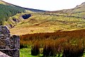
 Gleniff Horseshoe Drive - House - geograph.org.uk - 1165395.jpg 639 × 426; 406 KB
-
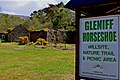 Gleniff Horseshoe Drive - Millsite - geograph.org.uk - 1165347.jpg 640 × 426; 373 KB
-

-
 Gleniff Horseshoe Drive - Waterfall - geograph.org.uk - 1165427.jpg 640 × 426; 361 KB
-
-

-

-

-

-

-
 Glenveagh National Park - Greenhouses - geograph.org.uk - 1189235.jpg 640 × 426; 414 KB
-
 Glenveagh National Park - Greenhouses - geograph.org.uk - 1189239.jpg 639 × 426; 459 KB
-
 Glenveagh National Park - Lough Beagh - geograph.org.uk - 1188714.jpg 640 × 426; 239 KB
-

-

-

-
 Hillside with stone walls near Brinlack - geograph.org.uk - 1159743.jpg 572 × 381; 316 KB
-
 Horn Head - Buildings - geograph.org.uk - 1181911.jpg 640 × 426; 347 KB
-
 Horn Head - One sheep nursing two lambs - geograph.org.uk - 1181912.jpg 640 × 426; 376 KB
-
-

-

-

-

-
 Kildare - Irish National Stud - geograph.org.uk - 1605044.jpg 640 × 427; 115 KB
-

-
 Kildare - Irish National Stud Gelding - geograph.org.uk - 1605050.jpg 640 × 427; 106 KB
-
 Kildare - Japanese Gardens - geograph.org.uk - 1605056.jpg 640 × 427; 141 KB
-
 Kildare - Japanese Gardens - geograph.org.uk - 1605057.jpg 427 × 640; 116 KB
-

-

-

-

-

-
 Kincasslagh Peninsula - Main road - geograph.org.uk - 1171554.jpg 639 × 426; 310 KB
-
 Kincasslagh Peninsula - Pier at NW end - geograph.org.uk - 1171541.jpg 639 × 426; 333 KB
-

-
-

-
 Lough Dunlewy and Mount Errigal - geograph.org.uk - 1190582.jpg 640 × 426; 215 KB
-
 Meenaclady - East of Bloody Foreland - geograph.org.uk - 1180586.jpg 639 × 426; 341 KB
-
 Meenlaragh - Hillside and pier - geograph.org.uk - 1181773.jpg 639 × 426; 338 KB
-

-
 Mullaghmore coastal road scenery - geograph.org.uk - 1165338.jpg 639 × 426; 382 KB
-

-
 Pier Head Hotel at Mullaghmore - geograph.org.uk - 1165331.jpg 639 × 426; 285 KB
-

-
 Preparing to land at Donegal - geograph.org.uk - 1159594.jpg 639 × 426; 308 KB
-
 Preparing to land at Donegal - geograph.org.uk - 1159605.jpg 639 × 426; 282 KB
-

-

-

-

-
-

-

-

-

-

-

-
 Road in Meenbannad area - geograph.org.uk - 1162087.jpg 640 × 426; 391 KB
-
-

-

-
 Sheephaven Bay NE-E from Doe Castle - geograph.org.uk - 1184989.jpg 640 × 426; 269 KB
-

-

-
-

-
 Unmarked road in Rosses Meenbannad area - geograph.org.uk - 1162051.jpg 640 × 426; 371 KB


_at_north_end_-_geograph.org.uk_-_1605009.jpg)
_-_geograph.org.uk_-_1605014.jpg)


_-_geograph.org.uk_-_1169023.jpg)


