Category:Images from Geograph Britain and Ireland with broken templates
Jump to navigation
Jump to search
These images have an incorrect {{Geograph}} or {{Also geograph}} tag which needs correction.
Media in category "Images from Geograph Britain and Ireland with broken templates"
The following 200 files are in this category, out of 1,410 total.
(previous page) (next page)-
 "Snow Globe", Market Place, Durham Lumiere - geograph.org.uk - 6323531.jpg 2,592 × 1,944; 209 KB
-
 "The Sea" - geograph.org.uk - 6318906.jpg 640 × 427; 29 KB
-
 "Three Figures" - geograph.org.uk - 6317812.jpg 678 × 1,024; 814 KB
-
 'The Family of Man' - geograph.org.uk - 6278651.jpg 640 × 480; 135 KB
-
 1 - 13 High Street - geograph.org.uk - 6322233.jpg 1,024 × 678; 724 KB
-
 113 - 115 Irsha Street - geograph.org.uk - 6353174.jpg 678 × 1,024; 510 KB
-
 486 bus on Shooters Hill - geograph.org.uk - 5287205 (cropped).jpg 387 × 290; 82 KB
-
 A bathing pond in the middle of a field - geograph.org.uk - 6353461.jpg 3,296 × 2,472; 3.47 MB
-
 A boat on the Hertford Union Canal - geograph.org.uk - 6324228.jpg 3,575 × 2,441; 1.51 MB
-
 A bungalow called Hallstones - geograph.org.uk - 6300874.jpg 6,240 × 4,160; 6.66 MB
-
 A clue on Sheepway - geograph.org.uk - 6352674.jpg 2,472 × 3,296; 3.45 MB
-

-

-
 A damp start to a new decade - geograph.org.uk - 6357326.jpg 1,024 × 768; 94 KB
-
 A familiar phrase - geograph.org.uk - 6353386.jpg 3,296 × 2,472; 3.06 MB
-
 A former dye works by the Pennine Bridleway interim route - geograph.org.uk - 6321170.jpg 4,000 × 3,000; 4.81 MB
-
 A Glory Tree near Sandringham House, Norfolk - geograph.org.uk - 6318368.jpg 4,032 × 3,024; 1.81 MB
-
 A line of hedge on the earthworks - geograph.org.uk - 6353423.jpg 3,296 × 2,472; 3.64 MB
-
 A line-up of class 158 trains at Inverness - geograph.org.uk - 6318966.jpg 1,024 × 768; 328 KB
-
 A lone cyclist, Eskermore - geograph.org.uk - 6319828.jpg 1,024 × 685; 504 KB
-
 A muddy area of the path - geograph.org.uk - 6353018.jpg 2,000 × 1,330; 3 MB
-
 A new view towards Perne Road - geograph.org.uk - 6322379.jpg 1,024 × 1,024; 1.2 MB
-
-
 A S Morris ^ Son premises in Church Stretton - geograph.org.uk - 6321956.jpg 1,240 × 1,600; 412 KB
-
 A seat for a well-deserved rest overlooking the Axe valley - geograph.org.uk - 6356412.jpg 1,600 × 1,200; 1.07 MB
-
 A small holding for sale at 104 Drumnaquoile Road - geograph.org.uk - 6318927.jpg 3,888 × 2,844; 7.87 MB
-
 A stalkers' track leading out onto the moor - geograph.org.uk - 6320608.jpg 1,024 × 576; 320 KB
-
 A stroll on the Beach - geograph.org.uk - 6322295.jpg 6,000 × 4,000; 4.14 MB
-
 A track in Bagley Wood - geograph.org.uk - 6294248.jpg 2,700 × 2,025; 846 KB
-
 A View across the Valley of Tinkler's Brook - geograph.org.uk - 6353547.jpg 5,184 × 3,456; 7.36 MB
-
 A view from Costa Coffee, Bideford High Street - geograph.org.uk - 6323623.jpg 4,560 × 3,456; 5.43 MB
-
 A view from Mepal viaduct - The Ouse washes - geograph.org.uk - 6323150.jpg 5,184 × 3,888; 3.15 MB
-
 A view of Top House Farm, Staffordshire - geograph.org.uk - 6324086.jpg 5,150 × 3,758; 5.3 MB
-
 A view to the east from Chaol-dhail sheepfold - geograph.org.uk - 6320607.jpg 1,024 × 576; 296 KB
-
 A595 towards Muncaster - geograph.org.uk - 6322884.jpg 800 × 600; 86 KB
-
 A6071, Gaitle Bridge - geograph.org.uk - 6357245.jpg 800 × 600; 114 KB
-
 A697 heading north - geograph.org.uk - 6354156.jpg 1,024 × 684; 327 KB
-
 A697 heading north - geograph.org.uk - 6354730.jpg 1,024 × 684; 237 KB
-
 A697 towards Coldstream - geograph.org.uk - 6353818.jpg 1,024 × 684; 318 KB
-
 Abbey Mill House - geograph.org.uk - 6355518.jpg 4,000 × 3,000; 2.87 MB
-
 Aber Rhigian beach - geograph.org.uk - 6319462.jpg 1,632 × 1,224; 709 KB
-
 Aberdare train at Cadoxton station - geograph.org.uk - 6318631.jpg 1,600 × 1,412; 429 KB
-

-
 Abnalls Lane - geograph.org.uk - 6278930.jpg 6,000 × 4,000; 5.65 MB
-
 Above the Whitestone Cliff - geograph.org.uk - 6355579.jpg 5,161 × 3,338; 3.27 MB
-
 Access Track leading towards Holme Fold Farm - geograph.org.uk - 6353755.jpg 5,184 × 3,456; 5.53 MB
-
 Across the fields to Skeeby - geograph.org.uk - 6354205.jpg 5,129 × 2,970; 2.19 MB
-
 Addington, St Mary - geograph.org.uk - 6357194.jpg 4,608 × 3,456; 3.96 MB
-
 Aerial view of Islip, Oxfordshire - geograph.org.uk - 3892478 (cropped).jpg 2,848 × 2,848; 4.59 MB
-
 Airbus at Heathrow Airport - geograph.org.uk - 4795657 (cropped).jpg 473 × 346; 36 KB
-
 Akeside Hill - geograph.org.uk - 6322230.jpg 683 × 1,024; 216 KB
-
 Alan Turing Statue Surrey Wikivoyage Banner.jpg 2,560 × 366; 401 KB
-
 Albert Gardens, Stepney - geograph.org.uk - 2311226 (cropped).jpg 274 × 365; 94 KB
-
 All Saints Church, Braunston - geograph.org.uk - 6317529.jpg 768 × 1,024; 171 KB
-
 All Saints, Church Street, Edmonton - Memorial.jpg 726 × 745; 274 KB
-

-
 Allachaller burn - geograph.org.uk - 6319211.jpg 6,000 × 4,000; 6.15 MB
-

-

-
 Allt Coire Uchdachan meets the Tarff - geograph.org.uk - 6320463.jpg 1,600 × 1,000; 404 KB
-
 Along Trafalgar Street - geograph.org.uk - 6285433.jpg 819 × 1,024; 951 KB
-
 Alpenglow, Aonach Beag - geograph.org.uk - 6324633.jpg 1,024 × 683; 185 KB
-
 Altnabreac station in the sunshine - geograph.org.uk - 6320662.jpg 1,024 × 576; 511 KB
-
 Ambleside , Lake Road A591 - geograph.org.uk - 6355331.jpg 6,000 × 4,000; 6.6 MB
-
 Ammunition Store - geograph.org.uk - 6278840.jpg 640 × 427; 497 KB
-
 Amroth Zoar Baptist Chapel - geograph.org.uk - 6353840.jpg 2,890 × 2,167; 2.21 MB
-
 Amroth, banner.jpg 2,576 × 368; 228 KB
-

-
 An Emblings coach on Lynch Wood Road - geograph.org.uk - 4053747 (cropped).jpg 1,610 × 1,125; 806 KB
-
 An unusual name - geograph.org.uk - 6324285.jpg 4,000 × 3,000; 4.87 MB
-
 Anne Boleyn in wood, Carshalton (cropped).jpg 317 × 422; 92 KB
-
 Another view of Blake Mere - The Mermaid's Pool - geograph.org.uk - 6324313.jpg 5,154 × 3,802; 3.91 MB
-
 Another view of the triangulation pillar on Sir William Hill - geograph.org.uk - 6355852.jpg 4,914 × 3,483; 4.06 MB
-
 Approach lights for Valley Airport - geograph.org.uk - 6321032.jpg 4,000 × 3,000; 2.51 MB
-
 Approach to Humberside Airport - geograph.org.uk - 6318246.jpg 1,024 × 678; 159 KB
-

-
 Approaching the end of the Feede Mountain track - geograph.org.uk - 6354356.jpg 3,380 × 2,185; 6.55 MB
-
 Approaching Walkden Barn Cottages - geograph.org.uk - 6353519.jpg 5,184 × 3,456; 7.2 MB
-
 Approaching Whetstone Gate Farm - geograph.org.uk - 6353538.jpg 5,184 × 3,456; 6.47 MB
-
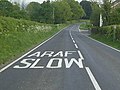 Araf-Slow on the B4302 - geograph.org.uk - 2395618 (cropped).jpg 306 × 229; 19 KB
-
 Argyle Street, outside Kelvingrove Museum - geograph.org.uk - 6323122.jpg 1,024 × 768; 162 KB
-
 Armistice Day ceremony, Omagh - geograph.org.uk - 6317943.jpg 1,024 × 768; 407 KB
-
 Aston Lock near Stone in Staffordshire - geograph.org.uk - 6319590.jpg 1,280 × 960; 1.43 MB
-
 Aston Lock near Stone in Staffordshire - geograph.org.uk - 6319591.jpg 1,440 × 960; 1.57 MB
-
 Aston Road north of Aston - geograph.org.uk - 6317659.jpg 1,920 × 1,280; 986 KB
-
 Auchinoon Hill - geograph.org.uk - 6320665.jpg 640 × 427; 244 KB
-
 Autumn Colour at the Cree - geograph.org.uk - 6357037.jpg 2,976 × 1,984; 5.36 MB
-
 Autumn colours in Croome Park - geograph.org.uk - 6318503.jpg 1,024 × 768; 315 KB
-
 Autumn colours in Victoria Park - geograph.org.uk - 6324147.jpg 3,837 × 2,879; 3.01 MB
-

-
 Autumn Day on Wandsworth Common - geograph.org.uk - 6318093.jpg 5,070 × 3,481; 3.73 MB
-
 Autumn in Barnby - geograph.org.uk - 6323535.jpg 1,024 × 768; 301 KB
-
 Autumn in Burgess Park, near Camberwell - geograph.org.uk - 6320798.jpg 1,024 × 768; 210 KB
-
 Autumn in Endcliffe Park - geograph.org.uk - 6320079.jpg 5,013 × 3,648; 7.32 MB
-
 Autumn leaves on the Tarka Trail - geograph.org.uk - 6317936.jpg 5,472 × 3,648; 5.96 MB
-
 Autumn tints by the Green Well of Scotland - geograph.org.uk - 6319576.jpg 1,600 × 1,177; 527 KB
-
 Autumn Trees at Whitcliffe Common (Ludlow) - geograph.org.uk - 6319323.jpg 3,648 × 2,736; 4.44 MB
-
 Autumn, Leigh Woods - geograph.org.uk - 6317660.jpg 2,292 × 2,873; 1.63 MB
-
 Ayr Road, Dalmellington - geograph.org.uk - 6321572.jpg 2,976 × 1,984; 2.84 MB
-

-
 B1382 Mile End Road, Little Ouse - geograph.org.uk - 6321735.jpg 4,608 × 3,456; 3.84 MB
-
 B5053 at Froghall in Staffordshire - geograph.org.uk - 6323742.jpg 960 × 1,280; 1.73 MB
-
 B724 towards Annan - geograph.org.uk - 6354621.jpg 800 × 600; 101 KB
-
 B724 towards Collin - geograph.org.uk - 6352287.jpg 800 × 600; 59 KB
-
 B724, Mouswald - geograph.org.uk - 6352291.jpg 800 × 600; 73 KB
-
 B724, Mouswald - geograph.org.uk - 6352296.jpg 800 × 600; 74 KB
-
 B8068 - geograph.org.uk - 6356497.jpg 1,024 × 576; 173 KB
-
 Badger belly up - geograph.org.uk - 6323954.jpg 3,296 × 2,472; 3.59 MB
-
 Baitings Dam - geograph.org.uk - 6356250.jpg 2,592 × 1,944; 1.55 MB
-
 Balcomie Links - geograph.org.uk - 6318366.jpg 5,184 × 3,888; 4.38 MB
-
 Baldwin's Gate Farm - geograph.org.uk - 6317454.jpg 2,641 × 1,317; 561 KB
-
 Balevullin seen from Beinn Hough - geograph.org.uk - 6354252.jpg 1,024 × 576; 234 KB
-
 Balgavies Loch - geograph.org.uk - 6352534.jpg 5,472 × 3,648; 6.69 MB
-
 Ballinamullan Road, Mullaghmore - geograph.org.uk - 6354769.jpg 1,024 × 685; 490 KB
-
 Barbershop, Banchory - geograph.org.uk - 6320919.jpg 768 × 1,024; 162 KB
-
 Barmouth Railway Bridge - geograph.org.uk - 6353905.jpg 5,120 × 3,840; 3.46 MB
-
 Barrow-in-Furness , Blake Street - geograph.org.uk - 6352646.jpg 6,000 × 4,000; 3.51 MB
-
 Barrow-in-Furness , Ironworks Road A590 - geograph.org.uk - 6352636.jpg 4,288 × 2,848; 2.62 MB
-
 Barrow-in-Furness , North Road A590 - geograph.org.uk - 6352634.jpg 6,000 × 4,000; 4.32 MB
-
 Barrow-in-Furness , Park Road A590 - geograph.org.uk - 6352612.jpg 6,000 × 4,000; 4.07 MB
-
 Bartholomew House, Edinburgh - geograph.org.uk - 6278914.jpg 4,608 × 3,456; 3.49 MB
-
 Bath Street, Southport - geograph.org.uk - 6324870.jpg 2,000 × 1,500; 2.34 MB
-
 Battle of Dunbar 1650 Re-enactment 20 - geograph.org.uk - 6324403.jpg 4,608 × 3,456; 2.54 MB
-
 BEA Vickers Viking G-AIVE 'Vestal' - geograph.org.uk - 6322286.jpg 4,320 × 3,240; 4.49 MB
-
 Beach and cliffs, Hunstanton - geograph.org.uk - 6319166.jpg 2,000 × 1,455; 2.96 MB
-
 Beach, Hunstanton - geograph.org.uk - 6319170.jpg 2,000 × 1,062; 1.7 MB
-
 Beach, Hunstanton - geograph.org.uk - 6321186.jpg 2,000 × 1,473; 2.55 MB
-
 Beaufort name sign, Raglan - geograph.org.uk - 6352289.jpg 819 × 907; 274 KB
-
 Bedlam Theatre - geograph.org.uk - 3529565 (cropped).jpg 767 × 958; 248 KB
-
 Bee Cottage Guest House - geograph.org.uk - 6355854.jpg 4,000 × 3,000; 2.85 MB
-

-
 Beehive doocot at Old Waughton - geograph.org.uk - 2747074 (cropped).jpg 1,360 × 1,360; 786 KB
-
 Belbroughton , Stourbridge Road A491 - geograph.org.uk - 6292417.jpg 6,000 × 4,000; 5.7 MB
-
 Bellymack Hill - geograph.org.uk - 6357084.jpg 2,976 × 1,984; 2.22 MB
-
 Bellymack Hill Feeding Station - geograph.org.uk - 6357225.jpg 2,592 × 1,728; 3.29 MB
-
 Ben Reoch - Summit Cairn - geograph.org.uk - 6318975.jpg 4,320 × 3,240; 4.34 MB
-
 Bench on Whitcliffe Common (Ludlow) - geograph.org.uk - 6319344.jpg 3,648 × 2,736; 5.15 MB
-
 Benchmark on buttress of St Andrew's Church - geograph.org.uk - 6278748.jpg 1,024 × 683; 292 KB
-
 Benchmarked Wall, Sea Banks - geograph.org.uk - 6322515.jpg 1,024 × 683; 189 KB
-
 Bend in the ascending Feede Mountain forest road - geograph.org.uk - 6356354.jpg 4,000 × 3,000; 7.97 MB
-
 Bend on the lane to Hilltown Cross - geograph.org.uk - 6297558.jpg 1,024 × 811; 240 KB
-

-

-
 Bilingual name sign, Great Western Crescent, Llanelli - geograph.org.uk - 6324030.jpg 1,600 × 1,145; 458 KB
-

-
 Black Ditch Lane, Flaunden - geograph.org.uk - 6317453.jpg 1,920 × 1,280; 1.71 MB
-
 Blickling Hall - geograph.org.uk - 6318285.jpg 6,919 × 4,612; 7.5 MB
-
 Blickling Hall and Lake - geograph.org.uk - 6318273.jpg 7,501 × 5,001; 7.34 MB
-
 Blickling Hall, The Parterre 2 - geograph.org.uk - 6317798.jpg 6,585 × 4,389; 7.77 MB
-
 Blickling Park, Fields used for grazing sheep - geograph.org.uk - 6317849.jpg 5,943 × 3,962; 6.79 MB
-
 Blickling Park, Seat in the Temple Walk - geograph.org.uk - 6318144.jpg 4,502 × 3,000; 4.52 MB
-
 Blickling Park, Sundial in the Secret Garden - geograph.org.uk - 6318236.jpg 5,516 × 3,676; 7.58 MB
-
 Blickling Park, Sundial in the Secret Garden - geograph.org.uk - 6318247.jpg 4,407 × 6,613; 6.3 MB
-
 Blickling Park, The Secret Garden - geograph.org.uk - 6318213.jpg 5,484 × 3,656; 7.61 MB
-
 Blickling Park, The Temple Walk - geograph.org.uk - 6318179.jpg 5,664 × 3,774; 7.76 MB
-
 Blickling Park, The Temple, Display of seasonal vegetables - geograph.org.uk - 6317832.jpg 6,162 × 4,108; 3.98 MB
-
 Blickling Park, The Temple, Lichens on one of the columns - geograph.org.uk - 6317825.jpg 3,144 × 4,715; 5.74 MB
-

-
 Blickling Road with the entrance to the Hall on the left - geograph.org.uk - 6317799.jpg 6,309 × 4,206; 7.62 MB
-
 Blickling, Pathway to Blickling Hall - geograph.org.uk - 6317804.jpg 5,795 × 3,863; 7.78 MB
-
 Blickling, St. Andrew's Church, South aisle chapel altar - geograph.org.uk - 6318387.jpg 7,436 × 4,957; 7.22 MB
-

-

-
 Blickling, St. Andrew's Church, The altar - geograph.org.uk - 6318404.jpg 6,674 × 4,448; 7.46 MB
-
 Blickling, St. Andrew's Church, The font - geograph.org.uk - 6318360.jpg 4,466 × 6,700; 6.97 MB
-
 Blickling, St. Andrew's Church, The nave from the chancel - geograph.org.uk - 6318388.jpg 7,451 × 4,967; 7.61 MB
-

-
 Blocked eastern end of Great Western Crescent, Llanelli - geograph.org.uk - 6324033.jpg 1,600 × 1,200; 354 KB
-
 Bo'ness banner 'Easter Egg Special' steam train.jpg 3,374 × 482; 1.77 MB
-
 Bogmoor Road, Shaftenhoe End - geograph.org.uk - 6356745.jpg 1,848 × 1,162; 1.4 MB
-
 Bonmarche, Folkestone - geograph.org.uk - 6354201.jpg 5,456 × 3,632; 1.83 MB
-
 Boscombe beach, from the pier - geograph.org.uk - 6355285.jpg 1,024 × 683; 216 KB
-
 Botolph's Bridge Road - geograph.org.uk - 6353841.jpg 5,456 × 3,632; 2.11 MB
-
 Boundary stone outside the old police buildings - geograph.org.uk - 6355311.jpg 3,296 × 2,472; 2.61 MB
-
 Boverton Road junction, Boverton - geograph.org.uk - 6278636.jpg 1,600 × 908; 422 KB
-
 Bowness-on-Windermere , Church Road - geograph.org.uk - 6352681.jpg 6,000 × 4,000; 5.78 MB
-
 Bowness-on-Windermere , Gulf Petrol Station - geograph.org.uk - 6352685.jpg 6,000 × 4,000; 5.1 MB
-
 Brains Cardiff Brewery - geograph.org.uk - 2981130.jpg 659 × 441; 367 KB
-
 Bransdale Ridge - geograph.org.uk - 6301042.jpg 640 × 480; 133 KB
-
 Brawith Hall - geograph.org.uk - 6321812.jpg 5,184 × 3,456; 7.7 MB
-
 Bridge Street, Knighton - geograph.org.uk - 6323183.jpg 4,896 × 3,264; 6.07 MB
-
 Bridleway gate alongside Trent Lane - geograph.org.uk - 6320995.jpg 1,280 × 960; 465 KB
-
 Bridleway off Parkgate Lane - geograph.org.uk - 6354186.jpg 3,888 × 5,184; 6.64 MB
-
 Bridleway to Stubton Gorse - geograph.org.uk - 6325153.jpg 1,024 × 768; 147 KB
-
 Bridleway, Morehay Lawn - geograph.org.uk - 6324992.jpg 1,024 × 768; 170 KB
-
 Broad Ridge between The Old Pike and Round Hill - geograph.org.uk - 6318006.jpg 5,184 × 3,456; 7.68 MB
-
 Broad Street bends into High Street, Portsmouth - geograph.org.uk - 6323779.jpg 1,024 × 768; 232 KB
-
 Brookmount Road, Omagh - geograph.org.uk - 6319682.jpg 1,024 × 685; 401 KB
-
 BT phonebox, Dolgwili Road, Carmarthen - geograph.org.uk - 6323743.jpg 1,600 × 1,471; 672 KB
-
 BT Tower - geograph.org.uk - 2791557 (cropped).jpg 1,888 × 4,092; 2.69 MB
-
 Buccaneer S MK2 Gate Guardian and Memorial - geograph.org.uk - 6323534.jpg 4,608 × 3,072; 5.43 MB
-

-
 Building Coombe Wood School - geograph.org.uk - 6354642.jpg 3,960 × 2,640; 7.61 MB
-
 Building for sale on Dark Lane, North Cerney - geograph.org.uk - 6319735.jpg 5,184 × 3,888; 4.23 MB
-
 Bungalow on The Avenue, March - geograph.org.uk - 6321176.jpg 1,892 × 1,236; 1.24 MB
-
 Burns' Cairn - geograph.org.uk - 6324402.jpg 2,976 × 1,984; 4.27 MB
-
 Burns' Cairn - geograph.org.uk - 6324404.jpg 2,976 × 1,984; 4.95 MB
-

-
-
 Bus stop on Wheldon Road, New Fryston - geograph.org.uk - 6318505.jpg 1,024 × 768; 215 KB


.jpg)


_-_geograph.org.uk_-_6356490.jpg)
_-_geograph.org.uk_-_6356555.jpg)


_-_geograph.org.uk_-_6356603.jpg)


.jpg)


.jpg)
.jpg)

.jpg)


.jpg)


.jpg)
.jpg)

.jpg)


.jpg)


_-_geograph.org.uk_-_6319323.jpg)


.jpg)


.jpg)


.jpg)


_-_geograph.org.uk_-_6319344.jpg)


_-_geograph.org.uk_-_6318373.jpg)
_-_geograph.org.uk_-_6318378.jpg)


.jpg)


.jpg)
.jpg)
