Category:Jüdischer Friedhof Unterbalbach
Jump to navigation
Jump to search
| Object location | | View all coordinates using: OpenStreetMap |
|---|
building in Lauda-Königshofen, Stuttgart Government Region, Bade-Württemberg, Germany   | |||||
| Upload media | |||||
| Instance of | |||||
|---|---|---|---|---|---|
| Location | Unterbalbach, Lauda-Königshofen, Main-Tauber-Kreis, Heilbronn-Franken, Stuttgart Government Region, Baden-Württemberg, Germany | ||||
| Heritage designation | |||||
 | |||||
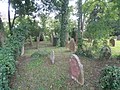
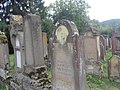
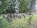
Media in category "Jüdischer Friedhof Unterbalbach"
The following 59 files are in this category, out of 59 total.
-
 2018-05-07 Der jüdische Friedhof in Unterbalbach 01.jpg 4,032 × 2,268; 3.57 MB
-
 2018-05-07 Der jüdische Friedhof in Unterbalbach 02.jpg 4,032 × 2,268; 3.4 MB
-
 2018-05-07 Der jüdische Friedhof in Unterbalbach 03.jpg 4,032 × 2,268; 3.14 MB
-
 2018-05-07 Der jüdische Friedhof in Unterbalbach 04.jpg 4,032 × 2,268; 5.13 MB
-
 2018-05-07 Der jüdische Friedhof in Unterbalbach 05.jpg 4,032 × 2,268; 5.31 MB
-
 2018-05-07 Der jüdische Friedhof in Unterbalbach 06.jpg 4,032 × 2,268; 6.03 MB
-
 2018-05-07 Der jüdische Friedhof in Unterbalbach 07.jpg 4,032 × 2,268; 5.46 MB
-

-

-
-

-
-

-

-

-
-

-
 BetOlamin LKN 01.jpg 1,188 × 1,131; 354 KB
-
 BetOlamin LKN 02.jpg 1,495 × 1,009; 411 KB
-
 BetOlamin LKN 04.jpg 1,600 × 1,026; 464 KB
-
 BetOlamin LKN 05.jpg 1,600 × 1,065; 457 KB
-
 BetOlamin LKN 06.jpg 1,200 × 1,600; 402 KB
-
 BetOlamin LKN 07.jpg 1,600 × 1,200; 404 KB
-
 BetOlamin LKN 09.jpg 1,600 × 1,200; 399 KB
-
 BetOlamin LKN 10.jpg 1,597 × 929; 402 KB
-
 BetOlamin LKN 13.jpg 1,600 × 1,200; 387 KB
-
 BetOlamin LKN 14.jpg 1,600 × 1,200; 421 KB
-
 BetOlamin LKN 15.jpg 1,600 × 1,200; 399 KB
-
 BetOlamin LKN 16.jpg 1,600 × 1,200; 396 KB
-
 BetOlamin LKN 17.jpg 1,600 × 1,200; 392 KB
-
 BetOlamin LKN 18.jpg 1,589 × 840; 369 KB
-
 BetOlamin LKN 21.jpg 1,600 × 1,200; 393 KB
-
 BetOlamin LKN 22.jpg 1,600 × 1,200; 407 KB
-
 BetOlamin LKN 23.jpg 1,600 × 1,200; 415 KB
-
 BetOlamin LKN 24.jpg 1,600 × 1,200; 409 KB
-
 BetOlamin LKN 25.jpg 1,600 × 1,200; 412 KB
-
 BetOlamin LKN 26.jpg 1,600 × 1,200; 405 KB
-
 BetOlamin LKN 27.jpg 1,600 × 1,200; 389 KB
-
 BetOlamin LKN 28.jpg 1,600 × 1,200; 396 KB
-
 BetOlamin LKN 30.jpg 1,316 × 1,011; 349 KB
-
 BetOlamin LKN 31.jpg 1,200 × 1,600; 408 KB
-
 BetOlamin LKN 32.jpg 1,600 × 1,200; 418 KB
-
 BetOlamin LKN 33.jpg 1,600 × 1,200; 411 KB
-
 BetOlamin LKN 34.jpg 1,445 × 1,105; 483 KB
-
 BetOlamin LKN 35.jpg 1,600 × 1,200; 387 KB
-
 BetOlamin LKN 36.jpg 1,600 × 1,200; 381 KB
-
 BetOlamin LKN 37.jpg 1,600 × 1,200; 428 KB
-
 BetOlamin LKN 39.jpg 1,455 × 824; 297 KB
-
 BetOlamin LKN 40.jpg 1,256 × 1,025; 416 KB
-
 BetOlamin LKN 42.jpg 1,600 × 1,200; 384 KB
-
 BetOlamin LKN 43.jpg 1,305 × 916; 354 KB
-
 BetOlamin LKN 44.jpg 1,390 × 926; 382 KB
-
 BetOlamin LKN 47.jpg 1,600 × 1,200; 402 KB
-
 BetOlamin LKN 48.jpg 1,600 × 1,200; 423 KB
-
 BetOlamin LKN 49.jpg 1,600 × 1,200; 400 KB
-
 BetOlamin LKN 50.jpg 1,600 × 1,200; 399 KB
-
 BetOlamin LKN 51.jpg 1,600 × 1,200; 419 KB
-
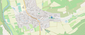 Lage Jüdischer Friedhof Unterbalbach.png 1,861 × 772; 942 KB
-
 Landappbw 447324 1820 Jüdischer Friedhof Unterbalbach.jpg 1,279 × 959; 364 KB


