Category:Jakobikirche (Sangerhausen)
Jump to navigation
Jump to search
| Object location | | View all coordinates using: OpenStreetMap |
|---|
church building in Sangerhausen, Saxony-Anhalt, Germany   | |||||
| Upload media | |||||
| Instance of | |||||
|---|---|---|---|---|---|
| Named after | |||||
| Location | Sangerhausen, Mansfeld-Südharz, Saxony-Anhalt, Germany | ||||
| Architectural style | |||||
| Heritage designation | |||||
 | |||||
This is the category of the Saxony-Anhalt Kulturdenkmal (cultural heritage monument) with the ID 09430631 (Wikidata)
|
Subcategories
This category has only the following subcategory.
I
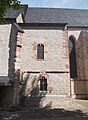
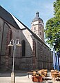
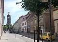
Media in category "Jakobikirche (Sangerhausen)"
The following 26 files are in this category, out of 26 total.
-
 09000-Sangerhausen-1907-Marktplatz mit Jakobikirche-Brück & Sohn Kunstverlag.jpg 1,533 × 1,000; 615 KB
-

-
 Sangerhausen - panoramio - ariannesmidt.jpg 1,300 × 1,700; 1.71 MB
-
 Sangerhausen 2012 001.jpg 2,877 × 4,344; 8.19 MB
-
 Sangerhausen 5.JPG 2,848 × 4,288; 6.26 MB
-
 Sangerhausen St. Jacobi 02.jpg 3,575 × 2,639; 1.71 MB
-
 Sangerhausen St. Jakobi.JPG 769 × 1,024; 496 KB
-
 Sangerhausen, an der Jakobikirche.jpg 5,184 × 3,456; 6.57 MB
-
 Sangerhausen, Kyselhäuser Straße Richtung Innenstadt.jpg 6,000 × 4,000; 11.06 MB
-
 Sangerhausen, Marktkirche St. Jacobi-20150730-001.jpg 4,012 × 6,057; 11.56 MB
-
 Sangerhausen, Marktkirche St. Jacobi-20150730-002.jpg 6,057 × 4,012; 11.36 MB
-
 Sangerhausen, Marktkirche St. Jacobi-20150730-003.jpg 4,011 × 6,056; 11.68 MB
-
 Sangerhausen, Marktkirche St. Jacobi-20150730-004.jpg 4,011 × 6,056; 11.16 MB
-
 Sangerhausen, Marktkirche St. Jacobi-20150730-005.jpg 4,012 × 6,057; 14.2 MB
-
 Sangerhausen, Marktkirche St. Jacobi-20150730-006.jpg 4,012 × 6,057; 13.83 MB
-
 Sangerhausen, Marktkirche St. Jacobi-20150730-007.jpg 6,057 × 4,012; 13 MB
-
 Sangerhausen, Marktkirche St. Jacobi-20150730-008.jpg 4,011 × 6,056; 10.9 MB
-
 Sangerhausen, Marktplatz, Häuserzeile und Turm der Jakobikirche.jpg 3,161 × 4,791; 3.82 MB
-
 Sangerhausen, the tower of St.Jacob church.jpg 1,701 × 2,551; 882 KB
-
 Sangerhausen, the tower of the St.Jacob church-2.jpg 1,701 × 2,551; 948 KB
-
 SGH-Jakobi1.JPG 2,597 × 3,529; 972 KB
-
 SGH-Jakobi2.JPG 3,560 × 2,670; 1.11 MB
-
 SGH-Jakobi3.JPG 2,619 × 3,565; 1.18 MB
-
 SGH-Jakobi4.JPG 2,601 × 3,596; 1.04 MB
-
 SGH-KylischeJakobi.JPG 3,547 × 2,614; 983 KB
-
 St. Jakobi Sangerhausen 2008-001.jpg 2,448 × 3,264; 4.04 MB


