Category:John Outhett
Jump to navigation
Jump to search
| Upload media | |||||
| Work period (start) |
| ||||
|---|---|---|---|---|---|
| Work period (end) |
| ||||
| Occupation | |||||
| |||||
Pages in category "John Outhett"
This category contains only the following page.
Media in category "John Outhett"
The following 21 files are in this category, out of 21 total.
-

-
 Chart of Port Mornington, and the adjacent Islands, pub. 1809.JPG 1,303 × 785; 126 KB
-

-

-
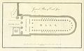 A groundplan from 1811 (copper engraving).jpg 939 × 576; 51 KB
-
 Chart of Amphila Bay (plate 10).jpg 1,327 × 966; 158 KB
-
 Chart of Amphila Bay (plate 10, page 146).jpg 6,758 × 4,914; 2.26 MB
-
 Chart of Howakil Bay, surveyed by Henry Salt esq., 1810 (plate 12, page 542).jpg 6,834 × 4,932; 2.24 MB
-
 Chart of Howakil Bay, surveyed by Henry Salt esq., 1810.jpg 1,334 × 964; 202 KB
-
 Chart of the environs of Valentia Island, pub. 1809.jpg 1,374 × 893; 120 KB
-
 Chart of the harbour of Massowa (Plate 14).jpg 909 × 1,267; 157 KB
-
 Chart of the harbour of Mosambique (plate 5).jpg 929 × 1,316; 202 KB
-
 Chart of the harbour of Mosambique (plate 5, page 25).jpg 2,569 × 3,694; 1.13 MB
-

-

-
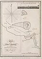 Chart of Zeyla, 1810.JPG 937 × 1,288; 166 KB
-
 General chart of the East Coast of Africa (Plate 2).jpg 1,047 × 1,489; 234 KB
-
 General chart of the East Coast of Africa (Plate 2, page 12).jpg 4,830 × 6,908; 3.11 MB
-

-
 Henry Salt - Ground plan of Carli Cave.jpg 1,672 × 1,033; 1.05 MB
-

%27_(11001436944).jpg)

%27_(11001401314).jpg)
%27_(11001228745).jpg)
.jpg)
.jpg)
.jpg)
.jpg)


.jpg)
.jpg)
.jpg)
.jpg)


.jpg)
.jpg)
.jpg)

