Category:Jozef Israëlsplein 10, The Hague
Jump to navigation
Jump to search
| Object location | | View all coordinates using: OpenStreetMap |
|---|
 | |||||
| Upload media | |||||
| Instance of | |||||
|---|---|---|---|---|---|
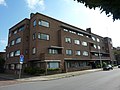
| Location | The Hague, South Holland, Netherlands | ||||
| Street address |
| ||||
| Located on street | |||||
| Heritage designation |
| ||||
 | |||||
|
This is a category about rijksmonument number 452734
|
| Address |
|
Media in category "Jozef Israëlsplein 10, The Hague"
The following 2 files are in this category, out of 2 total.
-
 Den Haag - Jozef Israelplein 10.JPG 3,648 × 2,736; 4.79 MB
-
 INTERIEUR, DEUR, GLAS IN LOODRAAM (RBK) - 's-Gravenhage - 20298804 - RCE.jpg 1,200 × 1,200; 175 KB
_-_%27s-Gravenhage_-_20298804_-_RCE.jpg)