Category:July 2009 in North Yorkshire
Jump to navigation
Jump to search
Deutsch: Bilder, die im Juli 2009 in North Yorkshire aufgenommen worden sind. Bitte beachten Sie, dass dies weder das Datum des Uploads noch das Datum des Scannens eines Fotos ist.
English: Images/pictures taken in North Yorkshire during July 2009. Note this is not the date of the upload, nor the date a photo was scanned.
Español: Fotografías o imágenes tomadas en North Yorkshire durante julio 2009. No es la fecha de subida ni escaneo, sino la fecha en que las fotografías o imágenes se crearon.
Esperanto: Bildoj faritaj en North Yorkshire en julio 2009. Tio ne estas la dato, kiam la bildoj estis alŝutitaj aŭ skanitaj.
Français : Photographies ou images prises en North Yorkshire durant juillet 2009. Ce n'est pas la date du téléchargement ou du scan.
Galego: Fotografías ou imaxes tomadas en North Yorkshire durante xullo 2009. Non é a data de subida nin escaneamento, senón a data na que se crearon as fotografías ou imaxes.
Italiano: Fotografie o immagini scattate a North Yorkshire nel luglio 2009. Nota bene: la data non si riferisce né a quella di upload né a quella in cui la foto è stata digitalizzata.
Norsk bokmål: Bilder tatt i North Yorkshire i løpet av juli 2009. Merk at dette ikke er datoen for opplasting, eller når et bilde har blitt skannet.
Norsk nynorsk: Bilete teke i North Yorkshire i løpet av juli 2009. Merk at dette ikkje er datoen for opplasting, eller når eit bilete har vorte skanna.
Русский: Изображения, сделанные в North Yorkshire в течение июль 2009 (не дата загрузки изображения).
Українська: Зображення, зроблені в North Yorkshire протягом липень 2009. Зауважте, що це не дата завантаження чи дата сканування фотографії.
| July 2008 | ← | July 2009 | → | July 2010 | |||||||
| Jan | Feb | Mar | Apr | May | Jun | Jul | Aug | Sep | Oct | Nov | Dec |
| 102 | 131 | 133 | 160 | 279 | 264 | 181 | 133 | 126 | 110 | 109 | 159 |
|---|---|---|---|---|---|---|---|---|---|---|---|
Subcategories
This category has the following 3 subcategories, out of 3 total.
Media in category "July 2009 in North Yorkshire"
The following 178 files are in this category, out of 178 total.
-
 'Sandsend' dredger - geograph.org.uk - 1404059.jpg 640 × 480; 293 KB
-
 Queens Road, Richmond - geograph.org.uk - 1411895.jpg 640 × 480; 80 KB
-
 Railway to Cliff Top - geograph.org.uk - 1398428.jpg 640 × 443; 70 KB
-
 Tram to Cliff Top - geograph.org.uk - 1398460.jpg 480 × 640; 95 KB
-
 Hag Dyke - geograph.org.uk - 1413051.jpg 640 × 426; 100 KB
-
 Railway south from Pipe Bridge - geograph.org.uk - 1419724.jpg 640 × 480; 69 KB
-

-
 A street in Robin Hood's Bay - geograph.org.uk - 1625948.jpg 640 × 428; 102 KB
-
-
 A6108 near Kirkgate Wood - geograph.org.uk - 1412082.jpg 640 × 480; 80 KB
-

-
 Approaching the Wheeldale Road - geograph.org.uk - 1393119.jpg 640 × 427; 63 KB
-
 Arable land at Inner Hills - geograph.org.uk - 1402602.jpg 640 × 480; 78 KB
-
 B1248 Towards Wharram le Street - geograph.org.uk - 1414488.jpg 640 × 480; 71 KB
-
 Barley field near Barlow - geograph.org.uk - 1403724.jpg 640 × 480; 62 KB
-
 Beach Huts - geograph.org.uk - 1398354.jpg 640 × 471; 87 KB
-

-
 Benches Looking out onto the Bay - geograph.org.uk - 1418827.jpg 640 × 427; 75 KB
-
 Blands Cliff Mural - panoramio.jpg 1,917 × 1,896; 548 KB
-
 Blands Cliff Murals - panoramio.jpg 1,719 × 1,883; 685 KB
-
 Boggle Hole Youth Hostel - geograph.org.uk - 1418778.jpg 427 × 640; 86 KB
-

-
 Bridge End Barn and the Arcow Quarry - geograph.org.uk - 1452790.jpg 640 × 480; 150 KB
-
 Bringing in the Silage, Susanna Hill - geograph.org.uk - 1418835.jpg 427 × 640; 63 KB
-
 Burdale North Wold Farm - geograph.org.uk - 1388418.jpg 640 × 480; 113 KB
-
 Burdale Quarry - geograph.org.uk - 1414447.jpg 480 × 640; 79 KB
-
 Cairn, Rutmoor Head - geograph.org.uk - 1392316.jpg 640 × 427; 53 KB
-
 Car park of the Helwith Bridge Inn - geograph.org.uk - 1445845.jpg 640 × 480; 109 KB
-
 Carperby Cross - geograph.org.uk - 1409610.jpg 640 × 399; 58 KB
-
 Castlegate, Knaresborough - geograph.org.uk - 1404057.jpg 640 × 480; 68 KB
-
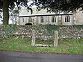
 Clapham cum Newby milestone - geograph.org.uk - 1396973.jpg 640 × 425; 128 KB
-
 Corus March 8.jpg 2,592 × 3,872; 3.97 MB
-
 Cottongrass, White Moor - geograph.org.uk - 1392239.jpg 640 × 427; 61 KB
-
 Country road from Fimber - geograph.org.uk - 1388343.jpg 640 × 480; 67 KB
-
 Crop Field beside the Cleveland Way - geograph.org.uk - 1398613.jpg 640 × 480; 94 KB
-
 Decorated Traffic Roundabout - geograph.org.uk - 1398264.jpg 640 × 480; 73 KB
-
 Deep Dale - geograph.org.uk - 1389487.jpg 640 × 480; 75 KB
-
 Dismantled Railway, Burdale - geograph.org.uk - 1414436.jpg 640 × 480; 96 KB
-

-
 Draculas Whitby-Abtei - panoramio.jpg 1,841 × 1,847; 461 KB
-
 Edward VII postbox at Little Stainforth - geograph.org.uk - 3837950.jpg 480 × 640; 155 KB
-
 Enjoying the walk - geograph.org.uk - 1404720.jpg 640 × 480; 80 KB
-
 Enter into His gates with thanksgiving - panoramio.jpg 1,780 × 1,917; 602 KB
-
 Entrance to Danebury Manor Farm - geograph.org.uk - 1385737.jpg 640 × 461; 62 KB
-
 Entrance track to Danebury Manor - geograph.org.uk - 1401323.jpg 640 × 480; 89 KB
-
 Exelby Postbox - geograph.org.uk - 1343637.jpg 480 × 640; 118 KB
-
 Fairy Dale - geograph.org.uk - 1414471.jpg 640 × 480; 89 KB
-
 Fallen Boundary Stone, White Moor - geograph.org.uk - 1392236.jpg 427 × 640; 75 KB
-
 Farm Track beside Towthorpe Plantation - geograph.org.uk - 1414481.jpg 640 × 480; 105 KB
-
 Farmland North of Towthorpe Plantation - geograph.org.uk - 1414484.jpg 640 × 480; 103 KB
-
 Farmland south of Thornton in Lonsdale - geograph.org.uk - 1502926.jpg 640 × 480; 146 KB
-
 Farmland, Wharram Percy Wold - geograph.org.uk - 1414478.jpg 640 × 480; 99 KB
-
 Fell Lane - geograph.org.uk - 1414297.jpg 640 × 385; 315 KB
-

-
 Field gate, and footpath to Bank House - geograph.org.uk - 1502797.jpg 640 × 480; 156 KB
-
 Field Near Foxrush Farm - geograph.org.uk - 1401819.jpg 640 × 427; 59 KB
-
 Field Near Manor Farm - geograph.org.uk - 1401826.jpg 427 × 640; 78 KB
-

-
 Fields and Pylons - geograph.org.uk - 1419799.jpg 640 × 480; 119 KB
-
 Fields near Downholme - geograph.org.uk - 1412041.jpg 640 × 480; 57 KB
-
 Fields near Shaws Farm - geograph.org.uk - 1418932.jpg 640 × 480; 58 KB
-
 Fields of Akebar Cotts - geograph.org.uk - 1412240.jpg 640 × 480; 51 KB
-
 Fields off Common Lane - geograph.org.uk - 1419659.jpg 640 × 480; 79 KB
-
 Fields off Hagg Bush Lane - geograph.org.uk - 1419819.jpg 640 × 480; 55 KB
-
 Fields off the A63 - geograph.org.uk - 1419671.jpg 640 × 480; 75 KB
-
 Fields on Bellerby Moor - geograph.org.uk - 1411971.jpg 640 × 480; 51 KB
-
 Fields to Angelhaw Hill - geograph.org.uk - 1409625.jpg 640 × 480; 50 KB
-
 Fields to Bolton Castle - geograph.org.uk - 1409650.jpg 640 × 480; 67 KB
-
 Fields to Boston Farm - geograph.org.uk - 1412006.jpg 640 × 339; 27 KB
-
 Fields to the River Swale - geograph.org.uk - 1412060.jpg 640 × 480; 115 KB
-
 Fields to Walburn Hall - geograph.org.uk - 1412009.jpg 640 × 352; 32 KB
-
 Fields to west of A1M - geograph.org.uk - 1393978.jpg 640 × 480; 59 KB
-
 Fields towards Drax Power Station - geograph.org.uk - 1403665.jpg 640 × 480; 60 KB
-
 Fields towards Gill Beck - geograph.org.uk - 1412036.jpg 640 × 480; 61 KB
-
 Fields towards Scarlet Wood - geograph.org.uk - 1409676.jpg 640 × 480; 72 KB
-

-
 Fields towards West Wood - geograph.org.uk - 1411699.jpg 640 × 357; 37 KB
-
 Footpath near Osgodby - geograph.org.uk - 1398625.jpg 640 × 480; 79 KB
-
 Footpath through Cornfield - geograph.org.uk - 1397419.jpg 640 × 480; 88 KB
-
 Footpath to Feizor - geograph.org.uk - 1386364.jpg 640 × 480; 97 KB
-
 Footpath towards Scarborough - geograph.org.uk - 1398652.jpg 640 × 480; 81 KB
-
 Ganton Cross - geograph.org.uk - 1401389.jpg 640 × 480; 126 KB
-
 Gateway and sheepfold on Long Lane - geograph.org.uk - 1448914.jpg 640 × 480; 148 KB
-
 General View of Lavender Farm - geograph.org.uk - 1380529.jpg 640 × 480; 272 KB
-
 Grazing land near Aske Hall Stables - geograph.org.uk - 1411872.jpg 640 × 480; 64 KB
-
 Grazing land near Barlow - geograph.org.uk - 1403682.jpg 640 × 480; 58 KB
-
 Greenhouses - Yorkshire Lavender Farm - geograph.org.uk - 1380548.jpg 640 × 480; 274 KB
-
 Gristhorpe station - geograph.org.uk - 1423616.jpg 640 × 480; 104 KB
-
 Harbour - panoramio - Immanuel Giel (1).jpg 1,688 × 1,844; 405 KB
-
 Harbour of Scarborough - panoramio.jpg 1,804 × 1,868; 572 KB
-
 Harrogaybustn 303.JPG 2,816 × 2,112; 1.48 MB
-
 Hawes Museum Car Park - geograph.org.uk - 1403703.jpg 640 × 480; 85 KB
-
 Heading for Goathland - geograph.org.uk - 1405005.jpg 480 × 640; 68 KB
-
 Hedgerow and Fields, William Dale - geograph.org.uk - 1414459.jpg 640 × 480; 73 KB
-
 Helmsley Castle gardens - geograph.org.uk - 1403824.jpg 640 × 480; 112 KB
-
 I love Fortunes kippers - geograph.org.uk - 1404085.jpg 640 × 480; 218 KB
-
 Jervaulx Park pond - geograph.org.uk - 1401438.jpg 480 × 640; 98 KB
-

-
 Lane at Thornton in Lonsdale - geograph.org.uk - 1501976.jpg 640 × 480; 143 KB
-
 Larpool Lane Cemetery Lodge - geograph.org.uk - 1396770.jpg 640 × 480; 352 KB
-
 Limestone pavement , North scar End - geograph.org.uk - 1426943.jpg 640 × 480; 81 KB
-
 Lone hawthorn - geograph.org.uk - 1386386.jpg 640 × 480; 93 KB
-
 Long Plantation - geograph.org.uk - 1401493.jpg 640 × 442; 49 KB
-
 Looking into Camp Dale - geograph.org.uk - 1423716.jpg 640 × 480; 52 KB
-
 Minor Road Towards Burdale - geograph.org.uk - 1414432.jpg 640 × 480; 69 KB
-
 Minor Road Towards Thixendale - geograph.org.uk - 1414457.jpg 640 × 480; 89 KB
-
 Newby and Grey Scars - geograph.org.uk - 1396951.jpg 640 × 425; 80 KB
-
 Newby, road junction on A65 - geograph.org.uk - 1396890.jpg 640 × 425; 91 KB
-

-
 North Cotes Road - geograph.org.uk - 1402647.jpg 640 × 480; 79 KB
-
 Northern DMU leaving Helwith Bridge - geograph.org.uk - 1448798.jpg 640 × 480; 118 KB
-
 Nunnington railway station (site), Yorkshire (geograph 3491449).jpg 1,024 × 758; 183 KB
-
 Nursery - Yorkshire Lavender Farm - geograph.org.uk - 1380551.jpg 640 × 480; 288 KB
-
 Old Mulgrave Castle - geograph.org.uk - 1626010.jpg 640 × 428; 85 KB
-

-
 RAF flypast - geograph.org.uk - 1434819.jpg 640 × 479; 52 KB
-
 Replica of the Endeavour - geograph.org.uk - 1625177.jpg 640 × 428; 76 KB
-
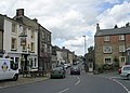
 Richmond Marketplace - geograph.org.uk - 1411892.jpg 640 × 480; 81 KB
-
 River Derwent at Sunset - geograph.org.uk - 1414396.jpg 640 × 480; 38 KB
-
 River Derwent near Aughton Clough - geograph.org.uk - 1414405.jpg 640 × 480; 35 KB
-
 Road to Exelby - geograph.org.uk - 1393991.jpg 640 × 420; 43 KB
-
 Robin Hoods Bay - geograph.org.uk - 1470431.jpg 640 × 480; 84 KB
-
 Sheepfold alongside Long Lane - geograph.org.uk - 1452690.jpg 640 × 480; 153 KB
-
 Sheepfold at the junction of Long Lane - geograph.org.uk - 1448897.jpg 640 × 480; 148 KB
-

-
 Silver Street - geograph.org.uk - 1401159.jpg 640 × 458; 209 KB
-
 Splashes of red^ - geograph.org.uk - 1388222.jpg 640 × 480; 62 KB
-
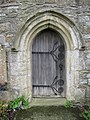 St Oswald's tower door - geograph.org.uk - 1502190.jpg 480 × 640; 180 KB
-

-
-
 St Oswald's, Thornton in Lonsdale - geograph.org.uk - 1502821.jpg 640 × 480; 121 KB
-
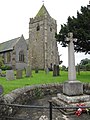
 Stocks outside St Oswald's church - geograph.org.uk - 1502857.jpg 640 × 480; 213 KB
-
 Stonewall near Carleton 04.jpg 2,560 × 1,920; 2.34 MB
-
 Stonewall near Carleton 05.jpg 2,560 × 1,920; 2.31 MB
-

-
 Temple Hirst railway station (site), Yorkshire (geograph 3491049).jpg 1,024 × 731; 135 KB
-
 The 'Castle Vaults', Knaresborough - geograph.org.uk - 1404077.jpg 640 × 480; 67 KB
-

-

-
 The 'Half Moon', Knaresborough - geograph.org.uk - 1405891.jpg 640 × 480; 85 KB
-
 The Bolton Arms, Leyburn - geograph.org.uk - 1411661.jpg 640 × 480; 66 KB
-
 The Cleveland Way on Urra Moor - geograph.org.uk - 1630170.jpg 640 × 428; 39 KB
-
 The disused quarry at Burdale - geograph.org.uk - 1388389.jpg 640 × 480; 82 KB
-
 The edge of Hasty Bank - geograph.org.uk - 1629701.jpg 640 × 428; 60 KB
-
 The edge of the Wolds - geograph.org.uk - 1400881.jpg 640 × 334; 39 KB
-
 The Grand Hotel, Scarborough - geograph.org.uk - 1401247.jpg 640 × 480; 54 KB
-
 The side of Cold Moor - geograph.org.uk - 1630045.jpg 640 × 428; 70 KB
-
 The track into Cans Dale - geograph.org.uk - 1402627.jpg 640 × 480; 134 KB
-
 The track to Hunmanby Grange - geograph.org.uk - 1402635.jpg 640 × 480; 59 KB
-
 The trig point on Round Hill - geograph.org.uk - 1630166.jpg 640 × 428; 64 KB
-
 The village shop - geograph.org.uk - 1401393.jpg 640 × 480; 81 KB
-
 Theatre - panoramio - Immanuel Giel.jpg 1,294 × 1,346; 286 KB
-
 Travelodge motel - geograph.org.uk - 1387550.jpg 640 × 466; 113 KB
-
 Trees on limestone pavement - geograph.org.uk - 1412381.jpg 640 × 425; 156 KB
-
 View along Cotton Dale - geograph.org.uk - 1402511.jpg 640 × 480; 85 KB
-
 View of Flixton Quarry - geograph.org.uk - 1401375.jpg 640 × 480; 65 KB
-
 Walkers resting at Ana Cross - geograph.org.uk - 1605675.jpg 640 × 480; 62 KB
-
 Walking in the rain near Hartoft End - geograph.org.uk - 1607024.jpg 640 × 480; 47 KB
-
 Which way^ - geograph.org.uk - 1388215.jpg 640 × 480; 79 KB
-
 Whitby Station - geograph.org.uk - 1402914.jpg 640 × 480; 346 KB
-
 Window Wall - geograph.org.uk - 1464709.jpg 480 × 640; 143 KB
-
 Wolds view - geograph.org.uk - 1388426.jpg 640 × 480; 100 KB
-
 WoldsWay and Centenary Way footpath - geograph.org.uk - 1401328.jpg 640 × 480; 77 KB
-
 Bridleway near Fairy Dale - geograph.org.uk - 1414468.jpg 640 × 480; 116 KB
-
 Burdale Pond - geograph.org.uk - 1414442.jpg 640 × 480; 86 KB
-
 Camp Dale and Raven Dale - geograph.org.uk - 1423729.jpg 640 × 480; 63 KB
-
 Campsite at Humble Bee farm - geograph.org.uk - 1423741.jpg 640 × 480; 53 KB
-
 Castle Cliff - geograph.org.uk - 1401234.jpg 640 × 432; 60 KB
-
 Centenary Way Footpath - geograph.org.uk - 1414465.jpg 640 × 480; 127 KB
-
 Cornfield Flixton Wold - geograph.org.uk - 1423749.jpg 640 × 480; 86 KB
-
 Disputed territory^ - geograph.org.uk - 1400972.jpg 480 × 640; 98 KB
-
 East over Flixton Wold - geograph.org.uk - 1423754.jpg 640 × 480; 76 KB
-
 Entrance to Folkton Wold Farm - geograph.org.uk - 1401335.jpg 640 × 480; 49 KB
-
 Farm Building, Burdale - geograph.org.uk - 1414443.jpg 640 × 480; 73 KB
-
 Farm Track on the Wolds - geograph.org.uk - 1423705.jpg 640 × 480; 78 KB
-
 Farmland, William Dale - geograph.org.uk - 1414451.jpg 640 × 480; 68 KB
-
 Field Boundary and Hedgerow - geograph.org.uk - 1401466.jpg 640 × 480; 75 KB
-
 Footpath junction - geograph.org.uk - 1401415.jpg 640 × 480; 100 KB


.jpg)


.jpg)


,_Yorkshire_(geograph_3491449).jpg)


,_Yorkshire_(geograph_3491049).jpg)


