Category:June 2007 in North Yorkshire
Jump to navigation
Jump to search
Deutsch: Bilder, die im Juni 2007 in North Yorkshire aufgenommen worden sind. Bitte beachten Sie, dass dies weder das Datum des Uploads noch das Datum des Scannens eines Fotos ist.
English: Images/pictures taken in North Yorkshire during June 2007. Note this is not the date of the upload, nor the date a photo was scanned.
Español: Fotografías o imágenes tomadas en North Yorkshire durante junio 2007. No es la fecha de subida ni escaneo, sino la fecha en que las fotografías o imágenes se crearon.
Esperanto: Bildoj faritaj en North Yorkshire en junio 2007. Tio ne estas la dato, kiam la bildoj estis alŝutitaj aŭ skanitaj.
Français : Photographies ou images prises en North Yorkshire durant juin 2007. Ce n'est pas la date du téléchargement ou du scan.
Galego: Fotografías ou imaxes tomadas en North Yorkshire durante xuño 2007. Non é a data de subida nin escaneamento, senón a data na que se crearon as fotografías ou imaxes.
Italiano: Fotografie o immagini scattate a North Yorkshire nel giugno 2007. Nota bene: la data non si riferisce né a quella di upload né a quella in cui la foto è stata digitalizzata.
Norsk bokmål: Bilder tatt i North Yorkshire i løpet av juni 2007. Merk at dette ikke er datoen for opplasting, eller når et bilde har blitt skannet.
Norsk nynorsk: Bilete teke i North Yorkshire i løpet av juni 2007. Merk at dette ikkje er datoen for opplasting, eller når eit bilete har vorte skanna.
Русский: Изображения, сделанные в North Yorkshire в течение июнь 2007 (не дата загрузки изображения).
Українська: Зображення, зроблені в North Yorkshire протягом червень 2007. Зауважте, що це не дата завантаження чи дата сканування фотографії.
| June 2006 | ← | June 2007 | → | June 2008 | |||||||
| Jan | Feb | Mar | Apr | May | Jun | Jul | Aug | Sep | Oct | Nov | Dec |
| 95 | 83 | 153 | 268 | 201 | 135 | 221 | 318 | 134 | 112 | 152 | 138 |
|---|---|---|---|---|---|---|---|---|---|---|---|
Subcategories
This category has only the following subcategory.
Y
Media in category "June 2007 in North Yorkshire"
The following 134 files are in this category, out of 134 total.
-
 Train passing the River Esk - geograph.org.uk - 478460.jpg 640 × 381; 109 KB
-
 The Kings Head, Kettlewell - geograph.org.uk - 484096.jpg 480 × 640; 110 KB
-
 A tranquil afternoon at Malham Tarn - geograph.org.uk - 469149.jpg 640 × 480; 274 KB
-

-
 All Saints Church Northallerton.jpg 640 × 427; 260 KB
-
 All Saints' Parish Church, Staveley - geograph.org.uk - 459368.jpg 640 × 480; 98 KB
-
 Applegarth Car Park - geograph.org.uk - 477228.jpg 640 × 427; 222 KB
-
 Backlane at Staithes - geograph.org.uk - 849520.jpg 480 × 640; 150 KB
-
 Blue Bell Inn, Kettlewell - geograph.org.uk - 484095.jpg 640 × 480; 103 KB
-
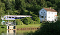
 Canal Basin, Skipton - geograph.org.uk - 1184869.jpg 640 × 480; 85 KB
-
 Canal Basin, Skipton - geograph.org.uk - 1184877.jpg 640 × 480; 97 KB
-
 Canal Basin, Skipton - geograph.org.uk - 1184880.jpg 480 × 640; 81 KB
-
 Canal Basin, Skipton - geograph.org.uk - 1184890.jpg 640 × 480; 96 KB
-
 Car Park at Gribdale - geograph.org.uk - 470086.jpg 640 × 427; 268 KB
-
 Carnegie Library - Victoria Avenue - geograph.org.uk - 472769.jpg 640 × 616; 64 KB
-
 Castle Chamber - geograph.org.uk - 457285.jpg 640 × 408; 86 KB
-
 Cayton Bay - geograph.org.uk - 469023.jpg 640 × 480; 63 KB
-
 Close up view of rusty sign - geograph.org.uk - 457650.jpg 640 × 480; 137 KB
-
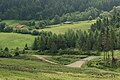
 Cocklick Hill - geograph.org.uk - 473331.jpg 640 × 480; 95 KB
-
 Communications - geograph.org.uk - 480198.jpg 640 × 480; 131 KB
-
 Cottages in Lonsdale - geograph.org.uk - 470091.jpg 640 × 427; 264 KB
-
 Cows atop Banner Hill - geograph.org.uk - 473509.jpg 640 × 480; 112 KB
-
 Downstream on the Derwent - geograph.org.uk - 482398.jpg 478 × 640; 123 KB
-
 Dry stone wall approaching Greenber Hill - geograph.org.uk - 473554.jpg 640 × 480; 132 KB
-
 East End of Errington Woods - geograph.org.uk - 469255.jpg 640 × 427; 51 KB
-
 East Side of Northallerton Town Centre - geograph.org.uk - 478818.jpg 640 × 347; 206 KB
-
 Entrance to Quaker Lane, Northallerton - geograph.org.uk - 474859.jpg 640 × 427; 231 KB
-
 Field of Barley Off Whorlton Lane - geograph.org.uk - 475674.jpg 427 × 640; 218 KB
-
 Fields North of Langbaurgh Ridge - geograph.org.uk - 475852.jpg 640 × 427; 54 KB
-
 Flood Aftermath, Priest Lane Ford. - geograph.org.uk - 471050.jpg 640 × 480; 153 KB
-
 Flood^ - geograph.org.uk - 474545.jpg 640 × 480; 72 KB
-
 Floral Roundabout - geograph.org.uk - 475102.jpg 640 × 259; 158 KB
-
 Fountains Abbey Nave - geograph.org.uk - 464332.jpg 640 × 480; 135 KB
-

-
 From the Springs Branch Canal - geograph.org.uk - 484020.jpg 480 × 640; 135 KB
-
 Furnishing Store - geograph.org.uk - 1115526.jpg 640 × 404; 79 KB
-
 Grassington - panoramio.jpg 1,632 × 1,224; 463 KB
-
 Harrogate Station. - geograph.org.uk - 474625.jpg 640 × 480; 92 KB
-
 Haymaking on hold - geograph.org.uk - 465714.jpg 640 × 427; 49 KB
-
 Ickornshaw Church - geograph.org.uk - 617575.jpg 640 × 480; 108 KB
-

-
 Lake near Settrington House - geograph.org.uk - 1407517.jpg 640 × 482; 83 KB
-
 Leeds and Liverpool Canal - geograph.org.uk - 1184952.jpg 640 × 480; 73 KB
-
 Lofthouse Post Office - geograph.org.uk - 457800.jpg 640 × 480; 106 KB
-
 Looking down Swinner Gill - geograph.org.uk - 459223.jpg 640 × 480; 90 KB
-
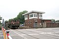 Low Gates Level Crossing and Signal Box - geograph.org.uk - 475609.jpg 640 × 427; 205 KB
-
 Marton Shops - geograph.org.uk - 477695.jpg 640 × 480; 141 KB
-
 Memorial Hall, Kirkbymoorside - geograph.org.uk - 1199215.jpg 640 × 427; 66 KB
-
 Middlesmoor(ChrisHeaton)Jun2007.jpg 640 × 480; 87 KB
-
 Moor Lane - geograph.org.uk - 473002.jpg 640 × 480; 71 KB
-
 National Park volunteers at work. - geograph.org.uk - 464041.jpg 640 × 480; 159 KB
-
 Northallerton Cattle Mart - geograph.org.uk - 476059.jpg 640 × 427; 265 KB
-
 Northallerton High Street.jpg 640 × 448; 283 KB
-
 Northallerton Railway Station - geograph.org.uk - 478189.jpg 640 × 427; 233 KB
-
 Off-Road-Prepared-Land-Rover-Discovery-200TDi.JPG 1,600 × 1,200; 403 KB
-
 Old station platform - geograph.org.uk - 466375.jpg 640 × 427; 71 KB
-
 Pasture, Near Whorlton House - geograph.org.uk - 475676.jpg 640 × 427; 234 KB
-
 Peel's Laithe - geograph.org.uk - 473243.jpg 640 × 480; 91 KB
-
 Porch House - geograph.org.uk - 475080.jpg 640 × 427; 242 KB
-
 Post Office - Cambridge Road - geograph.org.uk - 472774.jpg 640 × 511; 54 KB
-

-
 Rendezvous Hotel, Skipton - geograph.org.uk - 1184927.jpg 640 × 480; 71 KB
-

-
 River Aire south of Malham.jpg 640 × 480; 125 KB
-
 Romanby Road - geograph.org.uk - 476162.jpg 640 × 427; 210 KB
-
 Romanby Village Green - geograph.org.uk - 478133.jpg 640 × 427; 256 KB
-
 Roseberry Topping (52000368).jpeg 1,086 × 720; 182 KB
-
 Roundabout, Boroughbridge Road - geograph.org.uk - 477508.jpg 640 × 412; 269 KB
-

-
 School House - geograph.org.uk - 459098.jpg 640 × 469; 148 KB
-
 Semer Water - geograph.org.uk - 652956.jpg 640 × 480; 86 KB
-
 Sheep pasture near Cat Gill Wood - geograph.org.uk - 473446.jpg 640 × 480; 108 KB
-
 Sheep Pasture, Highcliffe Farm - geograph.org.uk - 479681.jpg 600 × 480; 71 KB
-
 Signal box at Knaresborough.jpg 1,944 × 2,592; 1.43 MB
-
 Silage harvesting at Westerdale - geograph.org.uk - 453533.jpg 640 × 374; 62 KB
-
 Skipton Castle main gate, 2007.jpg 4,048 × 3,040; 4.59 MB
-
 Spring Branch Canal - geograph.org.uk - 484016.jpg 640 × 480; 140 KB
-
 St Oswald's Church - Horton - geograph.org.uk - 465878.jpg 640 × 424; 42 KB
-
 St Paul's URC - Victoria Avenue - geograph.org.uk - 472768.jpg 555 × 640; 66 KB
-
 St Wilfrid - geograph.org.uk - 475787.jpg 640 × 480; 73 KB
-
 St Wilfrid - geograph.org.uk - 475790.jpg 640 × 480; 80 KB
-
 St Wilfrid - geograph.org.uk - 475800.jpg 640 × 480; 81 KB
-
 St Wilfrid - geograph.org.uk - 475807.jpg 480 × 640; 82 KB
-
 St Wilfrid, Duchy Road - geograph.org.uk - 475778.jpg 640 × 480; 90 KB
-
 Station Parade and Bus Station - geograph.org.uk - 472744.jpg 640 × 308; 33 KB
-
 Staveley churchyard - geograph.org.uk - 459375.jpg 480 × 640; 197 KB
-
 Swinner Gill - geograph.org.uk - 459198.jpg 640 × 480; 130 KB
-
 Swinner Gill - geograph.org.uk - 459219.jpg 640 × 480; 118 KB
-
 Swinner Gill Rock Formations - geograph.org.uk - 460324.jpg 640 × 480; 165 KB
-
 Swinner Gill Waterfall - geograph.org.uk - 459191.jpg 640 × 480; 148 KB
-
 Swinner Gill Waterfall - geograph.org.uk - 459193.jpg 640 × 480; 113 KB
-
 Teasdale Motorcycles - geograph.org.uk - 465675.jpg 640 × 427; 57 KB
-
 The "Pig Station", Northallerton - geograph.org.uk - 478157.jpg 640 × 405; 221 KB
-
 The Golden Lion, Romanby - geograph.org.uk - 478099.jpg 640 × 400; 240 KB
-
 The Lyric Cinema - geograph.org.uk - 475564.jpg 411 × 640; 271 KB
-
 The Main Car Park, Errington Woods - geograph.org.uk - 469291.jpg 640 × 427; 234 KB
-
 The Market Square, Malton, North Yorkshire (2008).jpg 640 × 480; 63 KB
-
 The Mount - geograph.org.uk - 475593.jpg 640 × 427; 255 KB
-
 The Upper River Swale - geograph.org.uk - 459228.jpg 640 × 480; 88 KB
-
 The view from Great Close Hill - geograph.org.uk - 471166.jpg 640 × 480; 82 KB
-
 The view towards Swinner Gill - geograph.org.uk - 463044.jpg 640 × 480; 80 KB
-
 Thin Stile - geograph.org.uk - 460102.jpg 480 × 640; 89 KB
-
 Upstream from Sutton Bridge - geograph.org.uk - 482399.jpg 640 × 478; 121 KB
-
 Victoria Shopping Centre. - geograph.org.uk - 474616.jpg 640 × 480; 86 KB
-
 Victoria Shopping Centre. - geograph.org.uk - 474619.jpg 640 × 480; 60 KB
-
 Victoria Shopping Centre. - geograph.org.uk - 474622.jpg 640 × 480; 84 KB
-

-

-
 Waitrose Supermarket - Station Parade - geograph.org.uk - 472690.jpg 640 × 323; 31 KB
-
 Wall - geograph.org.uk - 474868.jpg 640 × 427; 301 KB
-
 Waterfall at Swinner Gill - geograph.org.uk - 459215.jpg 480 × 640; 119 KB
-
 Wharram Percy, St Martins Church - geograph.org.uk - 659800.jpg 640 × 429; 72 KB
-
 Whitby Harbour Entrance. - geograph.org.uk - 469748.jpg 640 × 426; 184 KB
-
 Whorlton Old Church - geograph.org.uk - 475688.jpg 640 × 427; 65 KB
-

-
 A Swaledale Buttercup Meadow - geograph.org.uk - 460106.jpg 640 × 480; 116 KB
-
 Appersett scene - geograph.org.uk - 748322.jpg 640 × 480; 52 KB
-
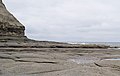
 Below Hunt Cliff - geograph.org.uk - 468683.jpg 640 × 427; 204 KB
-
 Below Hunt Cliff - geograph.org.uk - 468708.jpg 640 × 427; 211 KB
-
 Colourful Meadowland - geograph.org.uk - 459240.jpg 640 × 480; 154 KB
-
 Zetland Street - geograph.org.uk - 478815.jpg 640 × 427; 247 KB
-
 Former Providence School - geograph.org.uk - 479885.jpg 640 × 384; 55 KB
-

-

-
 Ironstone Nodules, Bird Flight Goit - geograph.org.uk - 468707.jpg 640 × 427; 232 KB
-
 North York Moors - geograph.org.uk - 659784.jpg 640 × 429; 52 KB
-
 North York Moors - geograph.org.uk - 659785.jpg 630 × 422; 104 KB
-
 Path through Colourful Meadowland - geograph.org.uk - 459238.jpg 640 × 480; 111 KB
-
 Saltburn Scar - geograph.org.uk - 469166.jpg 640 × 427; 182 KB
-
 Saltburn Scar - geograph.org.uk - 469172.jpg 640 × 427; 184 KB
-
 Scugdale Beck at Swainby - geograph.org.uk - 475645.jpg 640 × 427; 61 KB
-
 Sea Sculptured Rocks, Below Huntcliff - geograph.org.uk - 468702.jpg 640 × 427; 257 KB
-

-
 Under The Weeping Ash at Middlewood Farm - geograph.org.uk - 478479.jpg 640 × 427; 128 KB


Jun2007.jpg)


.jpeg)


.jpg)


