Category:June 2021 in Norfolk, England
Jump to navigation
Jump to search
Ceremonial counties of England: Berkshire · Buckinghamshire · Cambridgeshire · Cornwall · Cumbria · Derbyshire · Devon · Dorset · East Riding of Yorkshire · Essex · Gloucestershire · Greater London · Greater Manchester · Hampshire · Hertfordshire · Kent · Lancashire · Leicestershire · Lincolnshire · Merseyside · Norfolk · North Yorkshire · Northamptonshire · Oxfordshire · Somerset · South Yorkshire · Staffordshire · Suffolk · Surrey · Warwickshire · West Midlands · West Sussex · West Yorkshire · Wiltshire · Worcestershire
City-counties: Bristol ·
Former historic counties:
Other former counties:
City-counties: Bristol ·
Former historic counties:
Other former counties:
Deutsch: Bilder, die im Juni 2021 in Norfolk, England aufgenommen worden sind. Bitte beachten Sie, dass dies weder das Datum des Uploads noch das Datum des Scannens eines Fotos ist.
English: Images/pictures taken in Norfolk, England during June 2021. Note this is not the date of the upload, nor the date a photo was scanned.
Español: Fotografías o imágenes tomadas en Norfolk, England durante junio 2021. No es la fecha de subida ni escaneo, sino la fecha en que las fotografías o imágenes se crearon.
Esperanto: Bildoj faritaj en Norfolk, England en junio 2021. Tio ne estas la dato, kiam la bildoj estis alŝutitaj aŭ skanitaj.
Français : Photographies ou images prises en Norfolk, England durant juin 2021. Ce n'est pas la date du téléchargement ou du scan.
Galego: Fotografías ou imaxes tomadas en Norfolk, England durante xuño 2021. Non é a data de subida nin escaneamento, senón a data na que se crearon as fotografías ou imaxes.
Italiano: Fotografie o immagini scattate a Norfolk, England nel giugno 2021. Nota bene: la data non si riferisce né a quella di upload né a quella in cui la foto è stata digitalizzata.
Norsk bokmål: Bilder tatt i Norfolk, England i løpet av juni 2021. Merk at dette ikke er datoen for opplasting, eller når et bilde har blitt skannet.
Norsk nynorsk: Bilete teke i Norfolk, England i løpet av juni 2021. Merk at dette ikkje er datoen for opplasting, eller når eit bilete har vorte skanna.
Русский: Изображения, сделанные в Norfolk, England в течение июнь 2021 (не дата загрузки изображения).
Українська: Зображення, зроблені в Norfolk, England протягом червень 2021. Зауважте, що це не дата завантаження чи дата сканування фотографії.
| June 2020 | ← | June 2021 | → | June 2022 | |||||||
| Jan | Feb | Mar | Apr | May | Jun | Jul | Aug | Sep | Oct | Nov | Dec |
| 230 | 179 | 244 | 100 | 121 | 219 | 209 | 191 | 322 | 292 | 195 | 295 |
|---|---|---|---|---|---|---|---|---|---|---|---|
Subcategories
This category has the following 3 subcategories, out of 3 total.
Media in category "June 2021 in Norfolk, England"
The following 200 files are in this category, out of 216 total.
(previous page) (next page)-
 -2021-06-01 A Bantam hen and a Light Sussex hen, Trimingham, Norfolk.JPG 5,152 × 3,864; 7.23 MB
-
 -2021-06-01 Two Black hens, Trimingham, Norfolk.JPG 3,377 × 2,371; 2.18 MB
-
 -2021-06-02 Anglian Wastewater treatment plant, Thorpe Market, Norfolk.jpg 1,024 × 768; 285 KB
-
 -2021-06-02 Driveway to Sycamore House, Thorpe Market, Norfolk.jpg 1,024 × 768; 342 KB
-
 -2021-06-02 East along Topshill Road, Thorpe Market, Norfolk.jpg 1,024 × 768; 316 KB
-
 -2021-06-02 Tire pollution, Thorpe Market, Norfolk.jpg 1,024 × 768; 280 KB
-
 -2021-06-02 Topshill Road, Thorpe Market, Norfolk.jpg 1,024 × 768; 263 KB
-
 -2021-06-02 West along Topshill Road, Thorpe Market, Norfolk (1).jpg 1,024 × 768; 203 KB
-
 -2021-06-04 Common Broom (Cytisus scoparius), Mill Common, Lower Southrepps.JPG 3,864 × 5,152; 7.83 MB
-
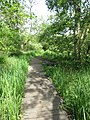
 -2021-06-04 Footpath inside Mill Common, Lower Southrepps.JPG 3,864 × 5,152; 6.79 MB
-
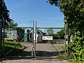
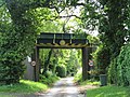 -2021-06-04 Railway bridge, Elderton Lane, Antingham, Norfolk.JPG 4,891 × 3,669; 4.53 MB
-
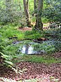 -2021-06-04 Stagnant pond inside Mill Common, Lower Southrepps.JPG 3,864 × 5,152; 6.68 MB
-
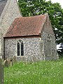
 -2021-06-05 14c Rood screen, All Saints parish church, Edingthorpe.JPG 5,152 × 3,864; 3.46 MB
-
 -2021-06-05 A medieval piscina, All Saints parish church, Edingthorpe.JPG 3,864 × 5,152; 3.37 MB
-
 -2021-06-05 A niche above the rood screen stairs, All Saints parish church, Edingthorpe.JPG 3,864 × 5,152; 3.62 MB
-
 -2021-06-05 Agricultural buildings, Edingthorpe, Norfolk.JPG 5,152 × 3,864; 5.64 MB
-
 -2021-06-05 Footpath, All Saints church, Edingthorpe, Norfolk (1).JPG 5,152 × 3,864; 6.14 MB
-
 -2021-06-05 Footpath, All Saints church, Edingthorpe, Norfolk (2).JPG 5,152 × 3,864; 4.86 MB
-
 -2021-06-05 Headstones in the churyard of All Saints church, Edingthorpe, Norfolk.JPG 5,152 × 3,864; 10.32 MB
-
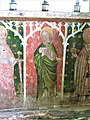
 -2021-06-05 Image of St Andrew on the rood screen, All Saints parish church, Edingthorpe.JPG 3,864 × 5,152; 4.73 MB
-

-

-
-
 -2021-06-05 Image of St Paul on the rood screen, All Saints parish church, Edingthorpe.JPG 3,864 × 5,152; 4.31 MB
-
 -2021-06-05 Image of St Peter on the rood screen, All Saints parish church, Edingthorpe.JPG 3,864 × 5,152; 4.81 MB
-
 -2021-06-05 Inscription, Val Ker bench, Edingthorpe, Norfolk.JPG 5,152 × 3,864; 7.9 MB
-
 -2021-06-05 Longshot, Val Ker bench, Edingthorpe, Norfolk.JPG 5,152 × 3,864; 8.93 MB
-
 -2021-06-05 North doorway replaced in 2000, All Saints, Edingthorpe, Norfolk.JPG 3,864 × 5,152; 4.49 MB
-
 -2021-06-05 The chancel, All Saints church, Edingthorpe, Norfolk.JPG 3,864 × 5,152; 8.69 MB
-
 -2021-06-05 The pulpit (1632), All Saints parish church, Edingthorpe.JPG 3,864 × 5,152; 3.55 MB
-
 -2021-06-05 The south facing elevation, All Saints church, Edingthorpe, Norfolk.JPG 5,152 × 3,864; 6.07 MB
-
 -2021-06-05 The south facing porch, All Saints church, Edingthorpe, Norfolk.JPG 5,152 × 3,864; 7.7 MB
-
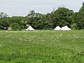 -2021-06-06 Camping in-a feild next to North Walsham and Dilham Canal, Honing, Norfolk.JPG 5,152 × 3,864; 7.18 MB
-
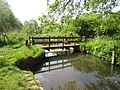
 -2021-06-06 Footbridge, North Walsham and Dilham Canal, Honing, Norfolk (1).JPG 5,152 × 3,864; 10.19 MB
-
 -2021-06-06 Footbridge, North Walsham and Dilham Canal, Honing, Norfolk (2).JPG 5,152 × 3,864; 8.42 MB
-
 -2021-06-06 Footpath alonside the North Walsham and Dilham Canal, Honing, Norfolk (1).JPG 5,152 × 3,864; 9.67 MB
-
-
 -2021-06-06 Footpath alonside the North Walsham and Dilham Canal, Honing, Norfolk (4).JPG 5,152 × 3,864; 6.07 MB
-
 -2021-06-06 Honing Lock, North Walsham and Dilham Canal, Honing, Norfolk (1).JPG 5,152 × 3,864; 10.42 MB
-
 -2021-06-06 Honing Lock, North Walsham and Dilham Canal, Honing, Norfolk (2).JPG 5,152 × 3,864; 8.83 MB
-
 -2021-06-06 Honing Lock, North Walsham and Dilham Canal, Honing, Norfolk (3).JPG 5,152 × 3,864; 8.82 MB
-
 -2021-06-06 Honing Lock, North Walsham and Dilham Canal, Honing, Norfolk (4).JPG 5,152 × 3,864; 8.63 MB
-
 -2021-06-06 Honing Lock, North Walsham and Dilham Canal, Honing, Norfolk (5).JPG 3,864 × 5,152; 8.06 MB
-
 -2021-06-06 Honing Lock, North Walsham and Dilham Canal, Honing, Norfolk (6).JPG 3,864 × 5,152; 7.98 MB
-
 -2021-06-06 Lock Road, Honing, Norfolk.JPG 4,748 × 3,192; 5.27 MB
-
 -2021-06-06 North Walsham and Dilham Canal, Honing, Norfolk (2).JPG 5,152 × 3,864; 11.38 MB
-
 -2021-06-06 Street sign, Lock Road, Honing, Norfolk.JPG 5,152 × 3,864; 8.31 MB
-
 -2021-06-06 Winding gear, Honing Lock, North Walsham and Dilham Canal, Honing, Norfolk.JPG 3,864 × 5,152; 9.22 MB
-

-

-

-
 -2021-06-07 Access ramp to Gunton Station, Thorpe Market, Norfolk (1).JPG 5,152 × 3,864; 6.61 MB
-
 -2021-06-07 Access ramp to Gunton Station, Thorpe Market, Norfolk (2).JPG 5,152 × 3,864; 6.05 MB
-

-
 -2021-06-07 Bittern Line railway bridge, Thorpe Market.JPG 5,152 × 3,864; 7.76 MB
-

-
-
 -2021-06-07 Car park, Gunton Railway Station, Norfolk.JPG 5,152 × 3,864; 7.07 MB
-
 -2021-06-07 Car park, Suffield Arms, Thorpe Market.JPG 5,152 × 3,864; 6.7 MB
-

-
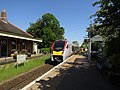
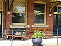
 -2021-06-07 Gunton railway station (Bittern Line), Thorpe Market, Norfolk (1).JPG 5,152 × 3,864; 6.51 MB
-
 -2021-06-07 Gunton railway station (Bittern Line), Thorpe Market, Norfolk (2).JPG 3,864 × 5,152; 7.08 MB
-
 -2021-06-07 Gunton railway station (Bittern Line), Thorpe Market, Norfolk (3).JPG 3,864 × 5,152; 6.43 MB
-
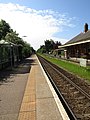
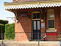
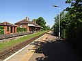 -2021-06-07 Gunton railway station, Thorpe Market, Norfolk.JPG 5,152 × 3,864; 6.07 MB
-
 -2021-06-07 Platform on Gunton railway station, Thorpe Market, Norfolk.JPG 5,152 × 3,864; 6.96 MB
-
 -2021-06-07 Post box outside the Suffield Arms, Thorpe Market, Norfolk.JPG 3,864 × 5,152; 7.81 MB
-
 -2021-06-07 Privately owned part of Gunton railway station, Thorpe Market, Norfolk (1).JPG 5,152 × 3,864; 7.23 MB
-
 -2021-06-07 Privately owned part of Gunton railway station, Thorpe Market, Norfolk (10).JPG 5,152 × 3,864; 5.55 MB
-
 -2021-06-07 Privately owned part of Gunton railway station, Thorpe Market, Norfolk (3).JPG 5,152 × 3,864; 5.93 MB
-
 -2021-06-07 Privately owned part of Gunton railway station, Thorpe Market, Norfolk (4).JPG 5,152 × 3,864; 9.17 MB
-
 -2021-06-07 Privately owned part of Gunton railway station, Thorpe Market, Norfolk (6).JPG 3,864 × 5,152; 7.33 MB
-
 -2021-06-07 Privately owned part of Gunton railway station, Thorpe Market, Norfolk (9).JPG 3,864 × 5,152; 6.98 MB
-

-

-
 -2021-06-07 Suffield Arms, Thorpe Market, Norfolk (1).JPG 5,152 × 3,864; 6.59 MB
-
 -2021-06-07 Suffield Arms, Thorpe Market, Norfolk (2).JPG 5,152 × 3,864; 6.87 MB
-
 -2021-06-08 Amazon Hub, Gunton Railway Station, Thorpe Market, Norfolk.JPG 5,152 × 3,864; 6.18 MB
-
 -2021-06-08 Garden Bench, Trimingham, Norfolk.JPG 5,152 × 3,864; 7.31 MB
-
 -2021-06-09 Breedon Concrete production plant, Laundry Loke, North Walsham.jpg 768 × 1,024; 183 KB
-
 -2021-06-09 Concrete production plant, Laundry Loke, North Walsham.jpg 1,024 × 768; 173 KB
-
 -2021-06-09 Environment Agency water gauging station, River Mun, Mundesley (1).JPG 3,864 × 5,152; 7.86 MB
-
 -2021-06-09 Environment Agency water gauging station, River Mun, Mundesley (2).JPG 5,152 × 3,864; 7.43 MB
-
 -2021-06-09 Footpaths, Holme-next-the-Sea, Norfolk.jpg 1,280 × 960; 590 KB
-
 -2021-06-09 Hand car wash, Laundry Loke, North Walsham.jpg 1,024 × 768; 242 KB
-
 -2021-06-09 Holme beach, Holme-next-the-Sea, Norfolk.jpg 1,280 × 960; 301 KB
-
 -2021-06-09 Laundry Loke, footpath, North Walsham.jpg 1,024 × 768; 324 KB
-
 -2021-06-09 Looking north along Folgate Road, North Walsham.jpg 1,024 × 768; 246 KB
-

-
 -2021-06-09 Looking west along Laundry Loke, North Walsham.jpg 1,024 × 768; 179 KB
-
 -2021-06-09 Norfolk Coast Path, Holme-next-the-Sea, Norfolk.jpg 1,280 × 960; 464 KB
-
 -2021-06-09 Northfield Road footpath, North Walsham.jpg 1,024 × 768; 319 KB
-
 -2021-06-09 Northfield Road Underpass, North Walsham (1).jpg 1,024 × 768; 222 KB
-
 -2021-06-09 Northfield Road Underpass, North Walsham (2).jpg 1,024 × 768; 166 KB
-
 -2021-06-09 Northfield Road Underpass, North Walsham.jpg 1,024 × 768; 267 KB
-
 -2021-06-09 River Mun, Mundesley.JPG 5,152 × 3,864; 6.84 MB
-
 -2021-06-09 Visitor Centre, Holme Dunes, Holme-next-the-Sea, Norfolk.jpg 1,280 × 960; 341 KB
-
 -2021-06-09 Zig-zag groynes, Holme-next-the-Sea, Norfolk.jpg 1,280 × 960; 360 KB
-
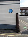
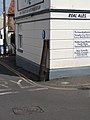
 -2021-06-14 Blue plaque, Gun Street, Sheringham, Norfolk.JPG 3,864 × 5,152; 4.05 MB
-
-
 -2021-06-14 Cannon on the corner of Gun Street, Sheringham, Norfolk (1).JPG 3,864 × 5,152; 4.96 MB
-
 -2021-06-14 Cannon on the corner of Gun Street, Sheringham, Norfolk (2).JPG 3,864 × 5,152; 4.88 MB
-
 -2021-06-14 Demolition site on the corner of High Street with Promenade, Sheringham (1).JPG 5,152 × 3,864; 5.09 MB
-
 -2021-06-14 Demolition site on the corner of High Street with Promenade, Sheringham (2).JPG 5,152 × 3,864; 5.39 MB
-
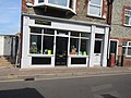
 -2021-06-14 Ellie's Ice Cream shop, High Street, Sheringham.JPG 1,577 × 2,186; 722 KB
-
 -2021-06-14 Grey Seal Coffee shop, High Street, Sheringham.JPG 5,152 × 3,864; 5.27 MB
-
 -2021-06-14 Gun Street, Sheringham, Norfolk.JPG 3,864 × 5,152; 5.1 MB
-
 -2021-06-14 Joyful West's shellfish bar, Gun Street, Sheringham, Norfolk.JPG 5,152 × 3,864; 5.31 MB
-
 -2021-06-14 Lobster public house, High Street, Sheringham.JPG 3,998 × 2,456; 1.7 MB
-
 -2021-06-15 Corvette Kingdom, Felmingham, Norfolk.jpg 1,024 × 768; 143 KB
-
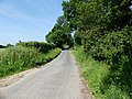
 -2021-06-15 Farm track off Goulders Lane, Felmingham.jpg 1,024 × 768; 313 KB
-
 -2021-06-15 Goulders Lane junction with North Walsham Road, Felmingham.jpg 1,024 × 768; 238 KB
-
 -2021-06-15 Looking across a grain field from Goulders Lane, Felmingham.jpg 1,024 × 768; 197 KB
-
 -2021-06-15 Looking east along Goulders Lane, Felmingham (1).jpg 1,024 × 768; 245 KB
-
 -2021-06-15 Looking east along Goulders Lane, Felmingham.jpg 1,024 × 768; 222 KB
-
 -2021-06-15 Looking west along Goulders Lane, Felmingham (1).jpg 1,024 × 768; 249 KB
-
 -2021-06-15 Looking west along Goulders Lane, Felmingham.jpg 1,024 × 768; 229 KB
-
 -2021-06-15 North along Goulders Lane, Felmingham.jpg 1,024 × 768; 306 KB
-
 -2021-06-15 North Walsham Road, Felmingham.jpg 1,024 × 768; 200 KB
-
 -2021-06-15 South entrance next to Suffield Lodge, Suffield, Norfolk.jpg 1,024 × 768; 304 KB
-

-
 -2021-06-15 Suffield Lodge, Suffield, Norfolk.jpg 1,024 × 768; 315 KB
-
 -2021-06-15 Suffield village sign, Norfolk.jpg 768 × 1,024; 299 KB
-
 -2021-06-15 West along Goulders Lane, Felmingham.jpg 1,024 × 768; 240 KB
-
 -2021-06-17 Former Primitive Methodist chapel, Chapel Road, Southrepps.JPG 5,152 × 3,864; 5.37 MB
-
 -2021-06-18 A view of Bressingham Gardens (1).jpg 4,000 × 3,000; 4.91 MB
-
 -2021-06-18 A view of Bressingham Gardens.jpg 4,000 × 3,000; 4.77 MB
-
 -2021-06-18 Caston cottage, Shirehall Plain, Holt.jpg 1,024 × 683; 191 KB
-
 -2021-06-18 Cottage on Weston Square, Holt, Norfolk.jpg 683 × 1,024; 293 KB
-
 -2021-06-18 COVID19 distance sign, Holt, Norfolk.jpg 683 × 1,024; 209 KB
-
 -2021-06-18 Fishmongers and Butchers, Bull street, Holt.jpg 1,024 × 683; 256 KB
-
 -2021-06-18 Praze cottage, Bull Street, Holt.jpg 683 × 1,024; 199 KB
-
 -2021-06-18 St John Hall, New Street, Holt.jpg 1,024 × 675; 203 KB
-
 -2021-06-18 Steam locomotive Alan Bloom, Bressingham.jpg 4,000 × 3,000; 4.68 MB
-
 -2021-06-18 Terraced Flint cottages, Albert Street, Holt.jpg 1,024 × 683; 205 KB
-
 -2021-06-18 Weston Square, Holt, Norfolk.jpg 1,024 × 683; 312 KB
-
 -2021-06-19 Eroded WWII pill box, Bawdsey Beach (1).jpg 4,000 × 3,000; 4.87 MB
-
 -2021-06-19 Eroded WWII pill box, Bawdsey Beach.jpg 4,000 × 3,000; 4.71 MB
-
 -2021-06-19 Looking north along Yarmouth Road, North Walsham.jpg 1,024 × 768; 281 KB
-
 -2021-06-19 Looking south along Yarmouth Road, North Walsham.jpg 1,024 × 768; 207 KB
-
 -2021-06-19 North Walsham Police Station, Yarmouth Road, North Walsham.jpg 1,024 × 768; 177 KB
-
 -2021-06-19 South along Yarmouth Road, North Walsham.jpg 1,024 × 768; 264 KB
-
 -2021-06-20 Former tariff booth, Cattle Market Street, Fakenham.jpg 1,024 × 683; 191 KB
-
 -2021-06-20 Town Bridge, River Wensum, Fakenham.jpg 1,024 × 683; 281 KB
-
 -2021-06-20 Wensum Lodge Hotel, Hempton Road, Fakenham.jpg 1,024 × 683; 226 KB
-
 -2021-06-22 'If Not Now When' community woodland, Suffield.jpg 1,024 × 768; 241 KB
-

-
 -2021-06-22 Entrance, 'If Not Now When' community woodland, Suffield.jpg 1,024 × 768; 367 KB
-
 -2021-06-22 Footbridge, 'If Not Now When' community woodland, Suffield.jpg 1,024 × 768; 355 KB
-
 -2021-06-22 Pergola, 'If Not Now When' community woodland, Suffield.jpg 1,024 × 768; 352 KB
-

-
 -2021-06-24 Bickling Lodge, Aylsham, Norfolk.JPG 5,152 × 3,864; 6.74 MB
-
 -2021-06-24 Bridge over the river Bure, Aylsham, Norfolk.JPG 5,152 × 3,864; 8.08 MB
-
 -2021-06-24 Kissing gate, Weavers’ Way, Aylsham (1).JPG 5,152 × 3,864; 7.8 MB
-
 -2021-06-24 Kissing gate, Weavers’ Way, Aylsham (2).JPG 3,864 × 5,152; 7.23 MB
-
 -2021-06-24 Old railway bridge, Weavers’ Way, Aylsham, Norfolk (1).JPG 5,152 × 3,864; 6.78 MB
-
 -2021-06-24 Old railway bridge, Weavers’ Way, Aylsham, Norfolk (10).JPG 5,152 × 3,864; 6.21 MB
-
 -2021-06-24 Old railway bridge, Weavers’ Way, Aylsham, Norfolk (11).JPG 5,152 × 3,864; 7.07 MB
-
 -2021-06-24 Old railway bridge, Weavers’ Way, Aylsham, Norfolk (13).JPG 5,152 × 3,864; 7.85 MB
-
 -2021-06-24 Old railway bridge, Weavers’ Way, Aylsham, Norfolk (2).JPG 5,152 × 3,864; 7.14 MB
-
 -2021-06-24 Old railway bridge, Weavers’ Way, Aylsham, Norfolk (3).JPG 3,864 × 5,152; 5.98 MB
-
 -2021-06-24 Old railway bridge, Weavers’ Way, Aylsham, Norfolk (4).JPG 5,152 × 3,864; 7.91 MB
-
 -2021-06-24 Old railway bridge, Weavers’ Way, Aylsham, Norfolk (8).JPG 5,152 × 3,864; 8.26 MB
-
 -2021-06-24 Old railway bridge, Weavers’ Way, Aylsham, Norfolk (9).JPG 5,152 × 3,864; 6.53 MB
-
 -2021-06-24 Parsley sauce, Trimingham, Norfolk.JPG 3,398 × 2,586; 1.34 MB
-
 -2021-06-24 River Bure bridge, Weavers’ Way, Aylsham, Norfolk (1).JPG 5,152 × 3,864; 9.24 MB
-
 -2021-06-24 River Bure bridge, Weavers’ Way, Aylsham, Norfolk (2).JPG 5,152 × 3,864; 8.98 MB
-
 -2021-06-24 River Bure bridge, Weavers’ Way, Aylsham, Norfolk (3).JPG 3,864 × 5,152; 7.78 MB
-
 -2021-06-24 River Bure bridge, Weavers’ Way, Aylsham, Norfolk (4).JPG 5,152 × 3,864; 8.17 MB
-
 -2021-06-24 River Bure bridge, Weavers’ Way, Aylsham, Norfolk (5).JPG 5,152 × 3,864; 8.46 MB
-
 -2021-06-24 River Bure bridge, Weavers’ Way, Aylsham, Norfolk.JPG 5,152 × 3,864; 8.3 MB
-
 -2021-06-24 skew brickwork below a railway bridge, Weavers’ Way, Aylsham, Norfolk (1).JPG 5,152 × 3,864; 6.28 MB
-
 -2021-06-24 skew brickwork below a railway bridge, Weavers’ Way, Aylsham, Norfolk (2).JPG 5,152 × 3,864; 6.11 MB
-
 -2021-06-24 Waymarker Sign, Weavers’ Way, Aylsham.JPG 2,297 × 3,138; 2.36 MB
-
 -2021-06-24 Weavers’ Way, Aylsham, Norfolk (1).JPG 5,152 × 3,864; 7.38 MB
-
 -2021-06-24 Weavers’ Way, Aylsham, Norfolk (2).JPG 3,864 × 5,152; 5.73 MB
-
 -2021-06-26 Carman’s Belt, Worstead, Norfolk.jpg 1,024 × 768; 350 KB
-
 -2021-06-26 Carman’s Lane, Worstead.jpg 1,024 × 768; 346 KB
-
 -2021-06-26 Chapel Road, Smallburgh.jpg 1,024 × 768; 275 KB
-
 -2021-06-26 Chapel Road, Worstead, Norfolk.jpg 1,024 × 768; 224 KB
-
 -2021-06-26 East along Chapel Road, Worstead.jpg 1,024 × 768; 329 KB
-
 -2021-06-26 Mill Lane, Dilham.jpg 1,024 × 768; 288 KB
-
 -2021-06-26 North along Carman’s Lane, Worstead, Norfolk.jpg 1,024 × 768; 362 KB
-
 -2021-06-26 Oak Tree, Worstead, Norfolk.jpg 768 × 1,024; 364 KB
-
 -2021-06-26 Private road, Worstead, Norfolk.jpg 1,024 × 768; 320 KB
-
 -2021-06-26 South along Carman’s Lane, Worstead, Norfolk.jpg 1,024 × 768; 360 KB
-
 -2021-06-26 Two Broody Bantam Chickens, Trimingham, Norfolk.JPG 5,152 × 3,864; 3.95 MB
-
 -2021-06-26 Uncultivated field, Worstead, Norfolk.jpg 1,024 × 768; 257 KB
-
 -2021-06-26 West along Chapel Road, Smallburgh.jpg 1,024 × 768; 297 KB
-
 -2021-06-26 Woodland path, Worstead, Norfolk.jpg 1,024 × 768; 317 KB
-
 -2021-06-27 Wood pigeon (Columba palumbus), Trimingham, Norfolk (1).JPG 5,152 × 3,864; 4.97 MB
-
 -2021-06-27 Wood pigeon (Columba palumbus), Trimingham, Norfolk (2).JPG 5,152 × 3,864; 4.9 MB
-
 -2021-06-30 Directional road sign, The Street, Knapton.jpg 1,024 × 768; 372 KB
-
 -2021-06-30 Entrance porch, Saint Margaret's, Paston, Norfolk.jpg 768 × 1,024; 325 KB
-
 -2021-06-30 Former Railway Bridge, The Street, Knapton.jpg 1,024 × 768; 244 KB
-
 -2021-06-30 Looking east along The Street, Knapton.jpg 1,024 × 768; 255 KB
-
 -2021-06-30 Looking west along The Street, Knapton.jpg 1,024 × 768; 220 KB
-
-
 -2021-06-30 Porch, south elevation, Church of Margaret's, Paston.jpg 1,024 × 768; 224 KB
-
 -2021-06-30 The lane between Knapton and Paston, Norfolk.jpg 1,024 × 768; 207 KB
-
 -2021-06-30 The north elevation and bell tower, Saint Margaret's, Paston (1).jpg 1,024 × 768; 191 KB


.jpg)
,_Mill_Common,_Lower_Southrepps.JPG)


.JPG)
.JPG)


,_All_Saints_parish_church,_Edingthorpe.JPG)


.JPG)
.JPG)
.JPG)
.JPG)
.JPG)
.JPG)
.JPG)
.JPG)
.JPG)
.JPG)
.JPG)

.JPG)


,_North_Walsham_and_Dilham_Canal,_Honing,_Norfolk_(1).JPG)
,_North_Walsham_and_Dilham_Canal,_Honing,_Norfolk_(2).JPG)

.JPG)
.JPG)


.JPG)
.JPG)


,_Thorpe_Market,_Norfolk_(1).JPG)
,_Thorpe_Market,_Norfolk_(2).JPG)
,_Thorpe_Market,_Norfolk_(3).JPG)


.JPG)
.JPG)
.JPG)
.JPG)
.JPG)
.JPG)
.JPG)
.JPG)
.JPG)
.JPG)


.JPG)
.JPG)


.jpg)
.jpg)


.JPG)
.JPG)
.JPG)
.JPG)


.jpg)

.jpg)


.jpg)


.jpg)


.JPG)
.JPG)
.JPG)
.JPG)
.JPG)
.JPG)
.JPG)
.JPG)
.JPG)
.JPG)
.JPG)

.JPG)
.JPG)
.JPG)
.JPG)
.JPG)

.JPG)
.JPG)

.JPG)
.JPG)


,_Trimingham,_Norfolk_(1).JPG)
,_Trimingham,_Norfolk_(2).JPG)


.jpg)