Category:Kaiapoi
Jump to navigation
Jump to search
town in New Zealand | |||||
| Upload media | |||||
| Instance of | |||||
|---|---|---|---|---|---|
| Location | Waimakariri District, Canterbury Region, New Zealand | ||||
| Population |
| ||||
| Area |
| ||||
| Elevation above sea level |
| ||||
 | |||||
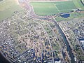
Kaiapoi is a town in the Waimakariri District of the Canterbury region, in the South Island of New Zealand. The town is located approximately 17 kilometres north of central Christchurch, close to the mouth of the Waimakariri River.
Subcategories
This category has the following 5 subcategories, out of 5 total.
Media in category "Kaiapoi"
The following 19 files are in this category, out of 19 total.
-
 At the beach near Kaiapoi (5795494297).jpg 1,414 × 2,121; 2.75 MB
-
 Cherry Vale Lane Plaque.jpg 1,080 × 1,440; 129 KB
-
 In Kaiapoi - 2010 Christchurch earthquake cracks (5795494683).jpg 1,414 × 2,121; 3.06 MB
-

-
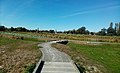
 Kaiapoi Community BMX Track within Norman Kirk Park.jpg 1,440 × 1,080; 158 KB
-
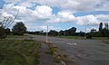 Kaiapoi East Residential Red Zone A.jpg 1,334 × 800; 126 KB
-
 Kaiapoi East Residential Red Zone B.jpg 1,334 × 800; 191 KB
-
 Kaiapoi empty red zone 008.JPG 3,264 × 2,448; 3.43 MB
-
 Kaiapoi empty red zone 009.JPG 3,264 × 2,448; 3.34 MB
-
 MV Tuhoe.jpg 2,400 × 1,595; 2.88 MB
-
 On the road homeward bound (25393511664).jpg 4,896 × 3,264; 2.76 MB
-
 Raven Street in flood, Kaiapoi, 9 May 1923 (3056917963).jpg 8,285 × 1,744; 3.27 MB
-
 Red Zone Trees 1.jpg 1,080 × 1,440; 121 KB
-
 Red Zone Trees 2.jpg 1,080 × 1,440; 172 KB
-
 Red Zone Trees 3.jpg 1,080 × 1,440; 151 KB
-
 Rhipidura fuliginosa, Pines Beach, New Zealand 01 (cropped).jpg 1,251 × 1,563; 1.37 MB
-
 Rhipidura fuliginosa, Pines Beach, New Zealand 01.jpg 3,648 × 2,389; 4.54 MB
-
 Rhipidura fuliginosa, Pines Beach, New Zealand 02.jpg 1,961 × 1,800; 1.97 MB
-
 The Honda Forest facing east towards the Beswick Stormwater Area.jpg 1,440 × 881; 198 KB
.jpg)

.jpg)


.jpg)


.jpg)


.jpg)