Category:Kaiserliches Postamt Bad Homburg
Jump to navigation
Jump to search
| Camera location | | View all coordinates using: OpenStreetMap |
|---|
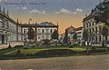
building in Bad Homburg vor der Höhe, Germany  | |||||
| Upload media | |||||
| Instance of | |||||
|---|---|---|---|---|---|
| Location | Bad Homburg vor der Höhe, Hochtaunuskreis, Darmstadt Government Region, Hesse, Germany | ||||
| Heritage designation | |||||
 | |||||
Media in category "Kaiserliches Postamt Bad Homburg"
The following 2 files are in this category, out of 2 total.
-
 Bad Homburg v. d. Höhe, Hessen - Kurhaus und Post (Zeno Ansichtskarten).jpg 2,148 × 1,379; 432 KB
-
 Bad Homburg, Louisenstraße 65.jpg 4,001 × 2,676; 1.43 MB
.jpg)