Category:Kamaraerdő
Jump to navigation
Jump to search
city part of Budapest, Hungary  | |||||
| Upload media | |||||
| Instance of | |||||
|---|---|---|---|---|---|
| Location | Budapest District XI, Budapest, Hungary | ||||
| Highest point | |||||
| Population |
| ||||
 | |||||
Media in category "Kamaraerdő"
The following 25 files are in this category, out of 25 total.
-
 41-es villamos (4000-4171) 2.jpg 3,147 × 2,219; 1.21 MB
-
 41-es villamos (4000-4171).jpg 4,608 × 2,592; 2.17 MB
-
 41-es villamos (4171-4000).jpg 4,608 × 2,592; 2.32 MB
-
 BKVT 1074 és ČKD Tatra T5C5.jpg 4,608 × 3,456; 2.88 MB
-
 BKVT 1074.jpg 4,027 × 3,034; 2.79 MB
-
 Budaörs és a Csíki-hegyek a Vadász-hegyről.jpg 3,264 × 1,620; 4.69 MB
-
 Budaörsi-medence és a Széchenyi-hegy a Vadász-hegyről.jpg 3,264 × 1,403; 4.03 MB
-
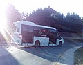 Bus line 288, Budapest.jpg 1,606 × 1,258; 263 KB
-
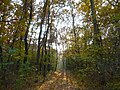
 Kamaraerdei odvas fa.jpg 750 × 2,048; 496 KB
-
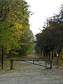
 Kamaraerdő 01.JPG 1,200 × 900; 671 KB
-
 Kamaraerdő 02.JPG 900 × 1,200; 658 KB
-
 Kamaraerdő 03.JPG 1,200 × 900; 612 KB
-
 Kamaraerdő 04.JPG 1,200 × 900; 653 KB
-
 Kamaraerdő 05.JPG 1,200 × 900; 647 KB
-
 Kamaraerdő 06.JPG 1,200 × 900; 592 KB
-
 Kamaraerdő 07.JPG 900 × 1,200; 620 KB
-
 Kamaraerdő 08.JPG 900 × 1,200; 662 KB
-
 Kamaraerdő 09.JPG 1,200 × 900; 627 KB
-
 Kamaraerdő 10.JPG 900 × 1,200; 674 KB
-
 Kamaraerdő 2009 január - panoramio.jpg 3,872 × 2,592; 4.88 MB
-
 Kinizsi Street Shopping Area and Tétényi plateau from Tűzkő Hill, 2017 Budaörs.jpg 2,272 × 1,704; 963 KB
-
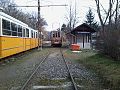 Nosztalgiakamaraerdoben.jpg 960 × 720; 155 KB
-
 Tétényi-fennsík és Kamaraerdő az Anna-hegyi kilátóból.jpg 3,264 × 1,579; 5.29 MB
-
 UV 3885.jpg 3,390 × 2,476; 1.82 MB
-
 Őrmező, Kelenföld és Albertfalva a Vadász-hegyről.jpg 2,259 × 1,091; 2.76 MB
_2.jpg)
.jpg)
.jpg)


