Category:Karlstorps kyrka
Jump to navigation
Jump to search
| Object location | | View all coordinates using: OpenStreetMap |
|---|
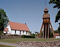
church building in Vetlanda Municipality, Jönköping County, Sweden  | |||||
| Upload media | |||||
| Instance of | |||||
|---|---|---|---|---|---|
| Location | Karlstorp, Vetlanda Municipality, Jönköping County, Sweden | ||||
| Diocese | |||||
| Has use |
| ||||
| Occupant |
| ||||
| Heritage designation |
| ||||
| Inception |
| ||||
 | |||||
|
This is a category about an ecclesiastical monument in Sweden, number 21300000004473 in the RAÄ buildings database.
|
|
This is a category about a protected building in Sweden, number 21400000442997 in the RAÄ buildings database.
|
Subcategories
This category has the following 2 subcategories, out of 2 total.
I
- Interior of Karlstorps kyrka (6 F)
K
Media in category "Karlstorps kyrka"
The following 44 files are in this category, out of 44 total.
-
 0468Karlstorps kyrka.jpg 3,859 × 2,568; 1.47 MB
-
 Karlstorp1.JPG 1,288 × 1,012; 404 KB
-
 Karlstorps kyrka - KMB - 16000200083064.jpg 396 × 600; 17 KB
-
 Karlstorps kyrka - KMB - 16000200083066.jpg 428 × 600; 14 KB
-
 Karlstorps kyrka - KMB - 16000200083077.jpg 403 × 600; 19 KB
-
 Karlstorps kyrka - KMB - 16000200083080.jpg 826 × 503; 31 KB
-
 Karlstorps kyrka - KMB - 16000200083081.jpg 469 × 600; 23 KB
-
 Karlstorps kyrka - KMB - 16000200083083.jpg 805 × 600; 49 KB
-
 Karlstorps kyrka - KMB - 16000200083085.jpg 373 × 600; 18 KB
-
 Karlstorps kyrka - KMB - 16000200083086.jpg 446 × 600; 18 KB
-
 Karlstorps kyrka - KMB - 16000200083088.jpg 776 × 600; 35 KB
-
 Karlstorps kyrka - KMB - 16000200083089.jpg 775 × 600; 21 KB
-
 Karlstorps kyrka - KMB - 16000200083090.jpg 804 × 600; 35 KB
-
 Karlstorps kyrka - KMB - 16000200083093.jpg 826 × 531; 27 KB
-
 Karlstorps kyrka - KMB - 16000200083098.jpg 826 × 496; 29 KB
-
 Karlstorps kyrka - KMB - 16000200083099.jpg 826 × 527; 27 KB
-
 Karlstorps kyrka - KMB - 16000200083102.jpg 826 × 526; 20 KB
-
 Karlstorps kyrka - KMB - 16000200083105.jpg 826 × 487; 17 KB
-
 Karlstorps kyrka - KMB - 16000200083108.jpg 826 × 536; 36 KB
-
 Karlstorps kyrka - KMB - 16000200083113.jpg 826 × 539; 38 KB
-
 Karlstorps kyrka - KMB - 16000200083115.jpg 826 × 488; 32 KB
-
 Karlstorps kyrka - KMB - 16000200083117.jpg 354 × 600; 18 KB
-
 Karlstorps kyrka - KMB - 16000200083119.jpg 826 × 507; 38 KB
-
 Karlstorps kyrka - KMB - 16000200083123.jpg 458 × 600; 31 KB
-
 Karlstorps kyrka - KMB - 16000200083124.jpg 465 × 600; 18 KB
-
 Karlstorps kyrka - KMB - 16000200083126.jpg 433 × 600; 14 KB
-
 Karlstorps kyrka - KMB - 16000200083129.jpg 775 × 600; 37 KB
-
 Karlstorps kyrka - KMB - 16000200083130.jpg 325 × 600; 14 KB
-
 Karlstorps kyrka - KMB - 16000200083133.jpg 826 × 584; 32 KB
-
 Karlstorps kyrka - KMB - 16000200083135.jpg 458 × 600; 25 KB
-
 Karlstorps kyrka - KMB - 16000200083136.jpg 431 × 600; 13 KB
-
 Karlstorps kyrka - KMB - 16000200083137.jpg 435 × 600; 19 KB
-
 Karlstorps kyrka - KMB - 16000200083138.jpg 826 × 482; 17 KB
-
 Karlstorps kyrka - KMB - 16000200083139.jpg 126 × 600; 14 KB
-
 Karlstorps kyrka - KMB - 16000200083140.jpg 784 × 600; 36 KB
-
 Karlstorps kyrka - KMB - 16000200083141.jpg 826 × 495; 18 KB
-
 Karlstorps kyrka - KMB - 16000200083143.jpg 375 × 600; 19 KB
-
 Karlstorps kyrka - KMB - 16000200083144.jpg 826 × 493; 29 KB
-
 Karlstorps kyrka - KMB - 16000200083145.jpg 401 × 600; 21 KB
-
 Karlstorps kyrka - KMB - 16000200083146.jpg 790 × 600; 55 KB
-
 Karlstorps kyrka - KMB - 16000200083147.jpg 826 × 491; 38 KB
-
 Karlstorps kyrka från luften.jpg 4,256 × 2,832; 2.76 MB
-
 Karlstorps kyrka med klockstapeln 01.JPG 1,236 × 989; 786 KB
-
 Karlstorps kyrka.jpg 3,648 × 2,736; 4.92 MB


Categories:
- Churches in the Diocese of Växjö
- Churches in Vetlanda Municipality
- Churches in Småland
- Listed churches in Vetlanda Municipality
- Stone churches in Jönköping County
- White churches in Sweden
- 13th-century architecture in Vetlanda Municipality
- Churches in Sweden built in 1252
- Destroyed in Sweden in 1760
- Built in Vetlanda Municipality in 1760
- Churches in Sweden built in 1760
- 1760s churches in Jönköping County
- Karlstorp District